File:TurquíaPalestinaSiriaIrakTransjordaniaCáucaso 1939.jpg
Jump to navigation
Jump to search

Size of this preview: 800 × 600 pixels. Other resolutions: 320 × 240 pixels | 640 × 480 pixels | 1,024 × 768 pixels | 1,280 × 960 pixels | 2,560 × 1,920 pixels | 4,000 × 3,000 pixels.
Original file (4,000 × 3,000 pixels, file size: 1.42 MB, MIME type: image/jpeg)
Captions
Captions
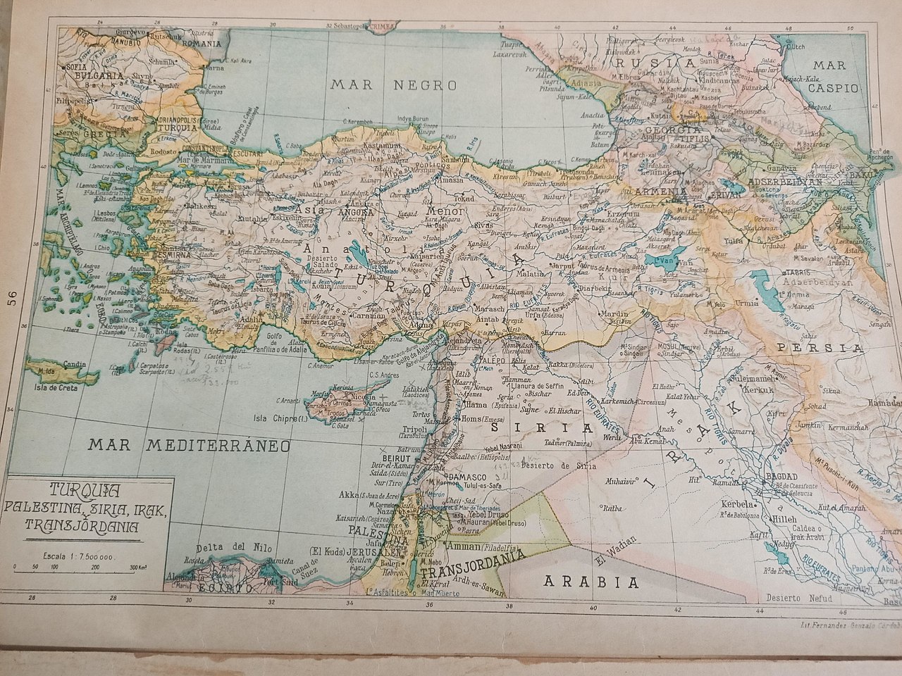
Map in Spanish of the Near East and the Caucasus in 1939 by Salvador Salinas
Summary
[edit]
| Description |
English: Map in Spanish of the Near East and the Caucasus in 1939 by Salvador Salinas |
| Date | |
| Source | Salvador Salinas. Atlas Geográfico Universal. 14th edition. Printed in 1939 |
| Author | Salvador Salinas |
Licensing
[edit]
| Description |
English: Near East and the Caucasus in 1939 |
||||
| Date | |||||
| Source |
English: Salvador Salinas. "Atlas Geográfico Universal". 14th edition. Title: Turquía, Palestina, Siria, Irak, Transjordania. |
||||
| Author | Salvador Salinas | ||||
| Permission (Reusing this file) |
|
||||
File history
Click on a date/time to view the file as it appeared at that time.
| Date/Time | Thumbnail | Dimensions | User | Comment | |
|---|---|---|---|---|---|
| current | 06:22, 7 September 2021 | | 4,000 × 3,000 (1.42 MB) | Culminatio (talk | contribs) | Uploaded a work by Salvador Salinas from Salvador Salinas. Atlas Geográfico Universal. 14th edition. Printed in 1939 with UploadWizard |
You cannot overwrite this file.
File usage on Commons
There are no pages that use this file.
File usage on other wikis
The following other wikis use this file:
- Usage on es.wikipedia.org