File:Turkey GeographicRegions.svg
Jump to navigation
Jump to search

Size of this PNG preview of this SVG file: 512 × 222 pixels. Other resolutions: 320 × 139 pixels | 640 × 278 pixels | 1,024 × 444 pixels | 1,280 × 555 pixels | 2,560 × 1,110 pixels.
Original file (SVG file, nominally 512 × 222 pixels, file size: 597 KB)
Captions
Captions
Add a one-line explanation of what this file represents
Summary
[edit]
| Description |
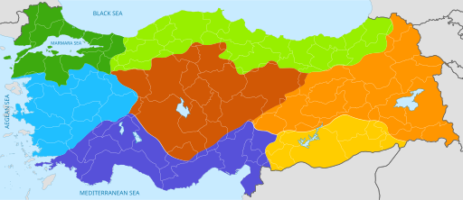
English: Color-coded geographic regions map of Turkey, with national and provincial borders superimposed. |
| Date | 14 November 2015 (original upload date) |
| Source |
Original text : Personal work. Modified version of "Turkey_region_map_with_province_borders.svg" on Wikimedia Commons.) |
| Author | Nightstallion03 (talk) (Uploads) |
Licensing
[edit]
This file is licensed under the Creative Commons Attribution 3.0 Unported license.
- You are free:
- to share – to copy, distribute and transmit the work
- to remix – to adapt the work
- Under the following conditions:
- attribution – You must give appropriate credit, provide a link to the license, and indicate if changes were made. You may do so in any reasonable manner, but not in any way that suggests the licensor endorses you or your use.
Original upload log
[edit]
The original description page was here. All following user names refer to en.wikipedia.
| Date/Time | Dimensions | User | Comment |
|---|---|---|---|
| 2015-11-14 21:11 | 512×222× (615477 bytes) | Nightstallion03 | Personal work. Color-coded geographic regions map of Turkey, with national and provincial borders superimposed. Modified version of "Turkey_region_map_with_province_borders.svg" on Wikimedia Commons. |
File history
Click on a date/time to view the file as it appeared at that time.
| Date/Time | Thumbnail | Dimensions | User | Comment | |
|---|---|---|---|---|---|
| current | 13:37, 1 February 2022 | | 512 × 222 (597 KB) | Kurmanbek (talk | contribs) | File uploaded using svgtranslate tool (https://svgtranslate.toolforge.org/). Added translation for tr. |
| 17:33, 23 April 2016 |  | 512 × 222 (601 KB) | AmaryllisGardener (talk | contribs) | Transferred from en.wikipedia |
You cannot overwrite this file.
File usage on Commons
There are no pages that use this file.
File usage on other wikis
The following other wikis use this file:
- Usage on bg.wikipedia.org
- Usage on ckb.wikipedia.org
- Usage on da.wikipedia.org
- Usage on en.wikipedia.org
- Usage on fi.wikipedia.org
- Usage on id.wikipedia.org
- Usage on ja.wikibooks.org
- Usage on la.wikipedia.org
- Usage on lv.wikipedia.org
- Usage on sq.wikipedia.org
- Usage on sr.wikipedia.org
- Usage on ta.wikipedia.org
- Usage on tr.wikipedia.org
- Usage on zh.wikipedia.org