File:Tuczna (gmina) location map.png

Original file (1,120 × 1,179 pixels, file size: 185 KB, MIME type: image/png)
Captions
Captions
Summary
[edit]_location_map.png&action=edit§ion=1)
| Description |
English: Location map |
| Date | |
| Source | Own work |
| Author | Smat |
| Description |
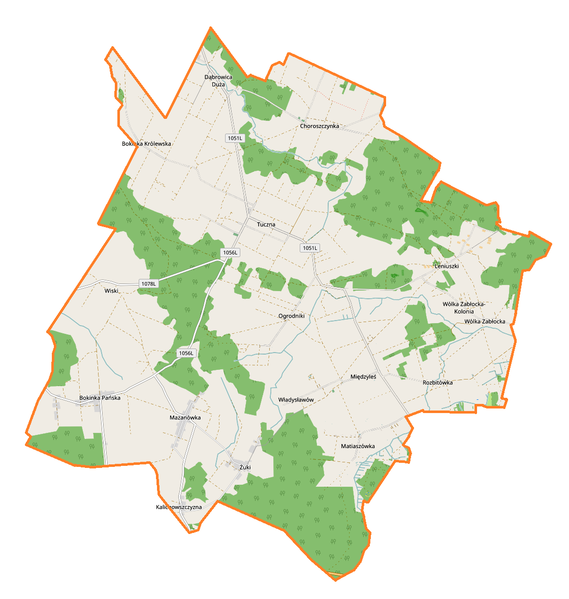
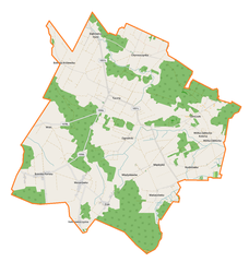
Polski: Mapa gminy Tuczna, Polska
English: Map of Tuczna (gmina), Poland |
|||||||||
| Date | ||||||||||
| Source | You may find a page on the OpenStreetMap wiki page for Tuczna (gmina) | |||||||||
| Creator |
OpenStreetMap contributors OpenStreetMap contributors |
|||||||||
| Permission (Reusing this file) |
OpenStreetMap data is available under the Open Database License (details). Map tiles are licensed under the Creative Commons Attribution-ShareAlike 2.0 license (CC-BY-SA 2.0).
This file is licensed under the Creative Commons Attribution-Share Alike 2.0 Generic license.
|
|||||||||
| Geotemporal data | ||||||||||
| Bounding box |
|
|||||||||
| Georeferencing | If inappropriate please set warp_status = skip to hide. | |||||||||
Licensing
[edit]_location_map.png&action=edit§ion=2)
| This work contains information from OpenStreetMap, which is made available under the Open Database License (ODbL).
The ODbL does not require any particular license for maps produced from ODbL data. Prior to 1 August 2020, map tiles produced by the OpenStreetMap Foundation were licensed under the CC-BY-SA-2.0 license. Maps produced by other people may be subject to other licences. |
File history
Click on a date/time to view the file as it appeared at that time.
| Date/Time | Thumbnail | Dimensions | User | Comment | |
|---|---|---|---|---|---|
| current | 10:40, 25 August 2017 | | 1,120 × 1,179 (185 KB) | Smat (talk | contribs) | User created page with UploadWizard |
You cannot overwrite this file.
File usage on Commons
There are no pages that use this file.
File usage on other wikis
The following other wikis use this file:
- Usage on pl.wikipedia.org
- Tuczna (gmina)
- Bokinka Królewska
- Bokinka Pańska
- Choroszczynka
- Dąbrowica Duża
- Kalichowszczyzna
- Leniuszki
- Matiaszówka
- Mazanówka
- Rozbitówka
- Tuczna
- Wólka Zabłocka-Kolonia
- Międzyleś (wieś w województwie lubelskim)
- Wiski (powiat bialski)
- Władysławów (powiat bialski)
- Wólka Zabłocka (powiat bialski)
- Żuki (gmina Tuczna)
- Ogrodniki (gmina Tuczna)
- Dekanat Terespol (diecezja lubelsko-chełmska)
- Sosnowy Grunt
- Wierzbiny (Bokinka Królewska)
- Ogrodniki Duże
- Ogrodniki Małe
- Gajki (Tuczna)
- Grądziki (Tuczna)
- Przycinek
- Sawiniec
- Podchoinie
- Podlesie (Wiski)
- Podpyzele
- Wołczycha
- Zabłocie (Bokinka Królewska)
- Zdanówka
- Parafia św. Anny w Międzylesiu
- Parafia św. Anny w Tucznej
- Międzyleś (osada w województwie lubelskim)
- Cerkiew św. Anny w Międzylesiu
- Błoto (Tuczna)
- Cmentarz prawosławny w Choroszczynce
- Cmentarz prawosławny w Leniuszkach
- Pod Czarnym Lasem (Mazanówka)
- Sad (Mazanówka)
- Sieliszcze (Mazanówka)
- Dubrowskie
- Dworszczyzna (Dąbrowica Duża)
- Koło Mądrego Drzewka
- Końce (Bokinka Pańska)
- Mądre Drzewko
- Pod Osowem
- Piczowska
View more global usage of this file.
_location_map.png)
_location_map.png&oldid=708061995)