File:Trzebownisko (gmina) location map.png
Original file (2,016 × 1,946 pixels, file size: 857 KB, MIME type: image/png)
Captions
Captions
Summary
[edit]_location_map.png&action=edit§ion=1)
| Description |
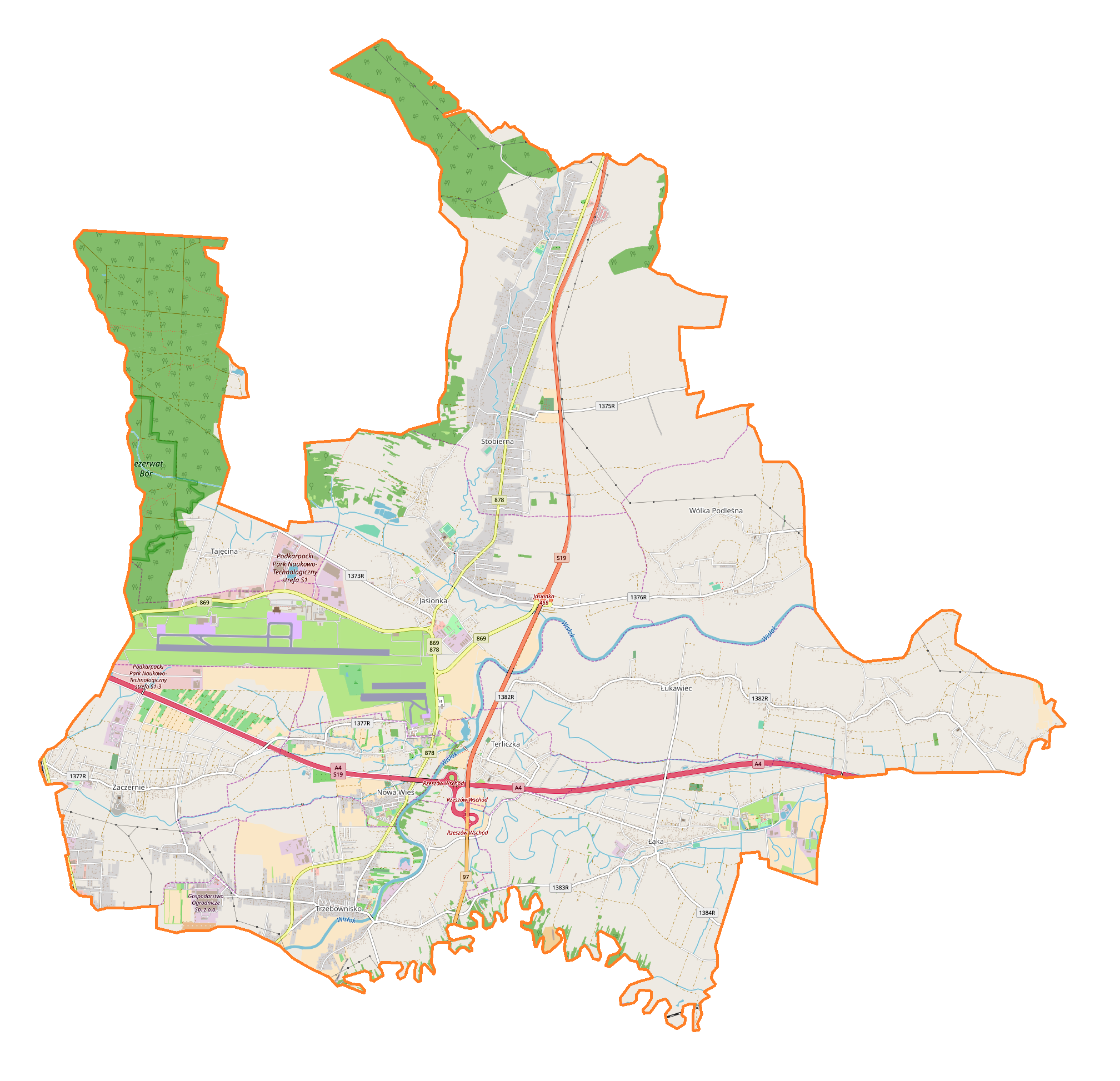
English: Location map |
| Date | |
| Source | Own work |
| Author | Smat |
| Description |
Polski: Mapa gminy Trzebownisko, Polska
English: Map of Trzebownisko (gmina), Poland |
|||||||||
| Date | ||||||||||
| Source | You may find a page on the OpenStreetMap wiki page for Trzebownisko (gmina) | |||||||||
| Creator |
OpenStreetMap contributors OpenStreetMap contributors |
|||||||||
| Permission (Reusing this file) |
OpenStreetMap data is available under the Open Database License (details). Map tiles are licensed under the Creative Commons Attribution-ShareAlike 2.0 license (CC-BY-SA 2.0).
This file is licensed under the Creative Commons Attribution-Share Alike 2.0 Generic license.
|
|||||||||
| Geotemporal data | ||||||||||
| Bounding box |
|
|||||||||
| Georeferencing | If inappropriate please set warp_status = skip to hide. | |||||||||
Licensing
[edit]_location_map.png&action=edit§ion=2)
| This work contains information from OpenStreetMap, which is made available under the Open Database License (ODbL).
The ODbL does not require any particular license for maps produced from ODbL data. Prior to 1 August 2020, map tiles produced by the OpenStreetMap Foundation were licensed under the CC-BY-SA-2.0 license. Maps produced by other people may be subject to other licences. |
File history
Click on a date/time to view the file as it appeared at that time.
| Date/Time | Thumbnail | Dimensions | User | Comment | |
|---|---|---|---|---|---|
| current | 13:41, 25 August 2018 | | 2,016 × 1,946 (857 KB) | Smat (talk | contribs) | User created page with UploadWizard |
You cannot overwrite this file.
File usage on Commons
There are no pages that use this file.
File usage on other wikis
The following other wikis use this file:
- Usage on pl.wikipedia.org
- Jasionka (powiat rzeszowski)
- Port lotniczy Rzeszów-Jasionka
- Tajęcina
- Terliczka
- Trzebownisko
- Wólka Podleśna
- Zaczernie
- Łąka (województwo podkarpackie)
- Łukawiec (powiat rzeszowski)
- Stobierna (powiat rzeszowski)
- Nowa Wieś (powiat rzeszowski)
- Parafia św. Wojciecha i Niepokalanego Poczęcia Najświętszej Maryi Panny w Trzebownisku
- Parafia Matki Bożej Fatimskiej w Terliczce
- Zaczernie (stacja kolejowa)
- Parafia św. Jadwigi Królowej w Wólce Podleśnej
- Parafia Narodzenia Najświętszej Maryi Panny w Zaczerniu
- Lotnisko Rzeszów
- Parafia św. Stanisława Kostki w Jasionce
- Parafia św. Onufrego w Łące
- Parafia Dobrego Pasterza w Nowej Wsi
- Parafia Niepokalanego Serca Najświętszej Maryi Panny w Stobiernej
- Parafia Miłosierdzia Bożego w Łukawcu
- Parafia Świętych Apostołów Piotra i Pawła w Łukawcu
- Kościół św. Jadwigi Królowej w Wólce Podleśnej
- Moduł:Mapa/dane/Trzebownisko (gmina)
- Podkarpackie Centrum Nauki Łukasiewicz
- Jasionka Lotnisko
- Usage on pl.wikibooks.org
_location_map.png&oldid=704811479)