File:Tropical Storm Rina (MODIS 2017-11-08).jpg

Original file (2,736 × 2,704 pixels, file size: 1.13 MB, MIME type: image/jpeg)
Captions
Captions
Summary
[edit].jpg&action=edit§ion=1)
| Description |
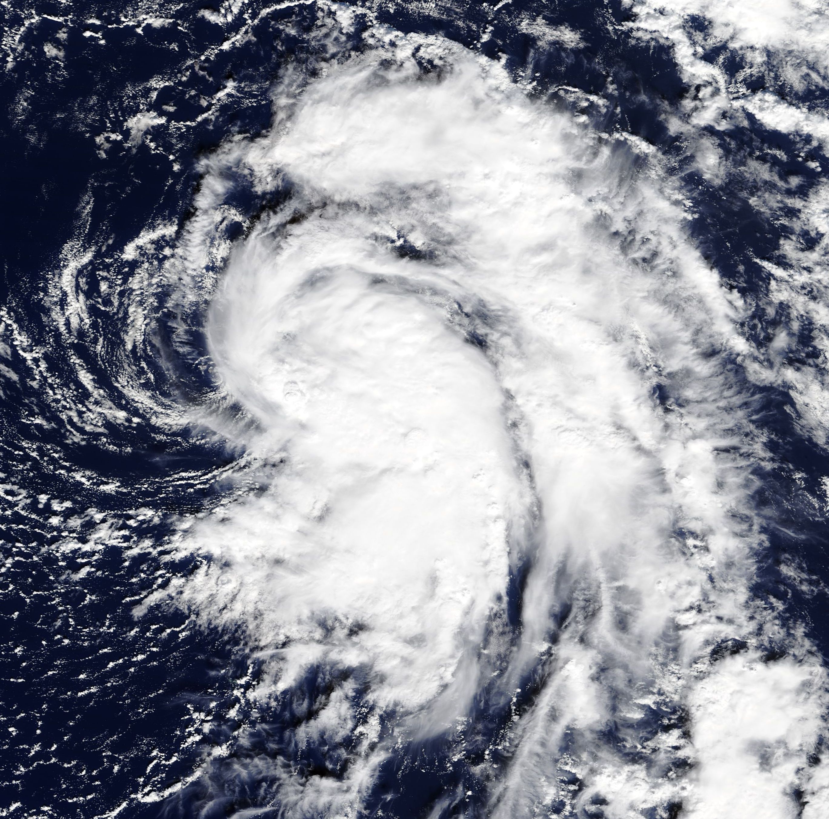
English: Tropical Depression 19 strengthened into a tropical storm and was renamed Rina at 10 p.m. EST on November 6, 2017.
The Moderate Resolution Imaging Spectroradiometer (MODIS) aboard NASA’s Terra satellite acquired a true-color image of Tropical Storm Rina on that same day. The image showed that Rina's overall cloud pattern increased in coverage in the eastern quadrant of the storm. By 4 a.m. EST (5 a.m. AST) on Tuesday, November 7 the center of Tropical Storm Rina was located near 31.4 degrees north latitude and 49.8 degrees west longitude. That's about 1,370 miles (2,200 km) west-southwest of the Azores islands. Rina was moving toward the north near 12 mph (19 km/h). This general motion accompanied by an increase in forward speed is expected through today. A turn toward north-northeast is forecast to occur by Wednesday night, November 8. Maximum sustained winds are near 40 mph (65 km/h) with higher gusts. Some strengthening is forecast during the next 48 hours. The estimated minimum central pressure of 1009 millibars is based on recent reports from a nearby buoy. The National Hurricane Center (NHC) expects Rina to continue to accelerate toward the north today and then toward the north-northeast on Wednesday. By 48 hours, Rina is expected to get caught up in the mid-latitude westerlies and accelerate even more toward the northeast over the cold waters of the north Atlantic. |
||
| Date | Taken on 6 November 2017 | ||
| Source |
Tropical Storm Rina (direct link)
|
||
| Author | Jeff Schmaltz, MODIS Land Rapid Response Team, NASA GSFC |
| This media is a product of the Terra mission Credit and attribution belongs to the mission team, if not already specified in the "author" row |
Licensing
[edit].jpg&action=edit§ion=2)
| This file is in the public domain in the United States because it was solely created by NASA. NASA copyright policy states that "NASA material is not protected by copyright unless noted". (See Template:PD-USGov, NASA copyright policy page or JPL Image Use Policy.) | ||
 |
Warnings:
|
File history
Click on a date/time to view the file as it appeared at that time.
| Date/Time | Thumbnail | Dimensions | User | Comment | |
|---|---|---|---|---|---|
| current | 17:23, 16 February 2024 | | 2,736 × 2,704 (1.13 MB) | OptimusPrimeBot (talk | contribs) | #Spacemedia - Upload of http://modis.gsfc.nasa.gov/gallery/images/image11082017_250m.jpg via Commons:Spacemedia |
You cannot overwrite this file.
File usage on Commons
There are no pages that use this file.
.jpg&oldid=852524539)