File:Tropical Storm Maria (MODIS 2024-08-13).jpg
Original file (5,294 × 4,270 pixels, file size: 2.99 MB, MIME type: image/jpeg)
Captions
Captions
Summary
[edit].jpg&action=edit§ion=1)
| Description |
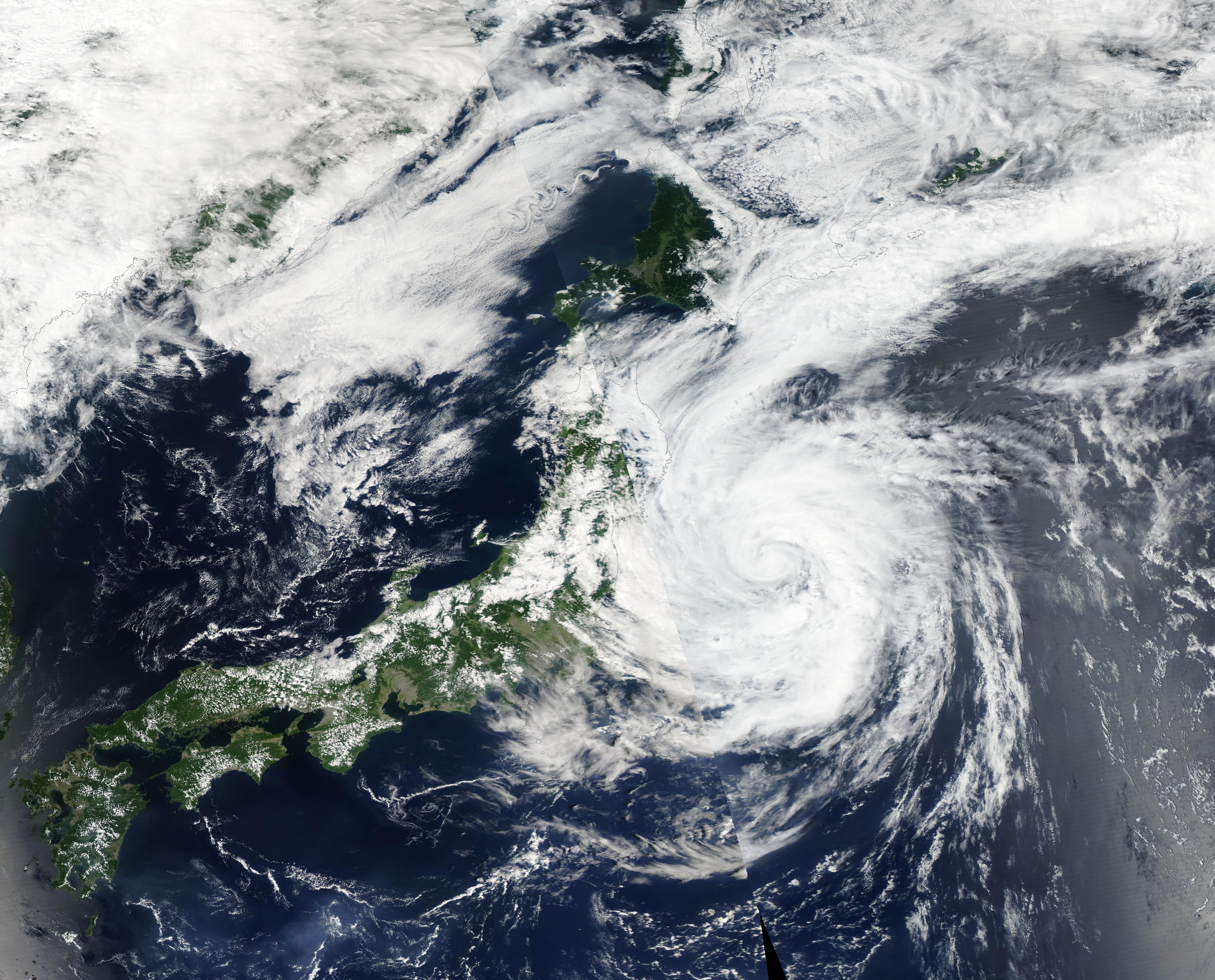
English: Tropical Cyclone Maria was intensifying as it headed towards Japan on August 11, 2024, when the Moderate Resolution Imaging Spectroradiometer (MODIS) acquired this true-color image of the storm. At the time the image was acquired, Maria’s maximum sustained winds were about 60 mph (96.5 km/h), and it was tracking northwest towards Honshu Island.
Tropical Cyclone Maria made landfall about 2330 UTC on August 11 (8:30 a.m. Japan Standard Time on August 12) near Ofunato City, Iwate prefecture. It was carrying maximum sustained winds near 65 mph (104.6 km/h), bringing it to “Severe Tropical Cyclone” status at landfall. Maria was also carrying extreme rainfall. The Japan Times reported that rainfall reached 481.5 millimeters (19 inches) in Kuji in 48 hours and 319 millimeters (12.6 inches) in the town of Otsuchi in Iwate, record highs for the areas. Flooding was reported in Iwate prefecture. Maria formed over the northern Philippine Sea on August 7 and moved steadily towards Honshu Island as it strengthened. After landfall, Maria quickly weakened as it crossed Iwate and Akita Prefectures. The Joint Typhoon Warning Center issued its last advisory on Maria at 2100 UTC (5:00 p.m. EDT) on August 12. At that time, Maria had crossed Honshu Island and was spinning over the Sea of Japan (East Sea) as a Tropical Depression. It was located about 129 miles (207 km) west-northwest of Misawa, Japan and was tracking north northwestward. Maximum sustained winds were close to 28 miles per hour (45 km/h). Maria was moving into less favorable conditions, with increasing wind shear and decreasing sea surface temperatures. It was forecast to dissipate within 24 hours. |
||
| Date | Taken on 11 August 2024 | ||
| Source |
Tropical Storm Maria (direct link)
|
||
| Author | MODIS Land Rapid Response Team, NASA GSFC |
| This media is a product of the Aqua mission Credit and attribution belongs to the mission team, if not already specified in the "author" row |
Licensing
[edit].jpg&action=edit§ion=2)
| This file is in the public domain in the United States because it was solely created by NASA. NASA copyright policy states that "NASA material is not protected by copyright unless noted". (See Template:PD-USGov, NASA copyright policy page or JPL Image Use Policy.) | ||
 |
Warnings:
|
File history
Click on a date/time to view the file as it appeared at that time.
| Date/Time | Thumbnail | Dimensions | User | Comment | |
|---|---|---|---|---|---|
| current | 05:05, 13 August 2024 | | 5,294 × 4,270 (2.99 MB) | OptimusPrimeBot (talk | contribs) | #Spacemedia - Upload of http://modis.gsfc.nasa.gov/gallery/images/image08132024_500m.jpg via Commons:Spacemedia |
You cannot overwrite this file.
File usage on Commons
There are no pages that use this file.
.jpg&oldid=909380174)