File:Tropical Storm Choi-wan (MODIS 2021-06-02).jpg

Original file (7,989 × 6,629 pixels, file size: 4.77 MB, MIME type: image/jpeg)
Captions
Captions
Summary
[edit].jpg&action=edit§ion=1)
| Description |
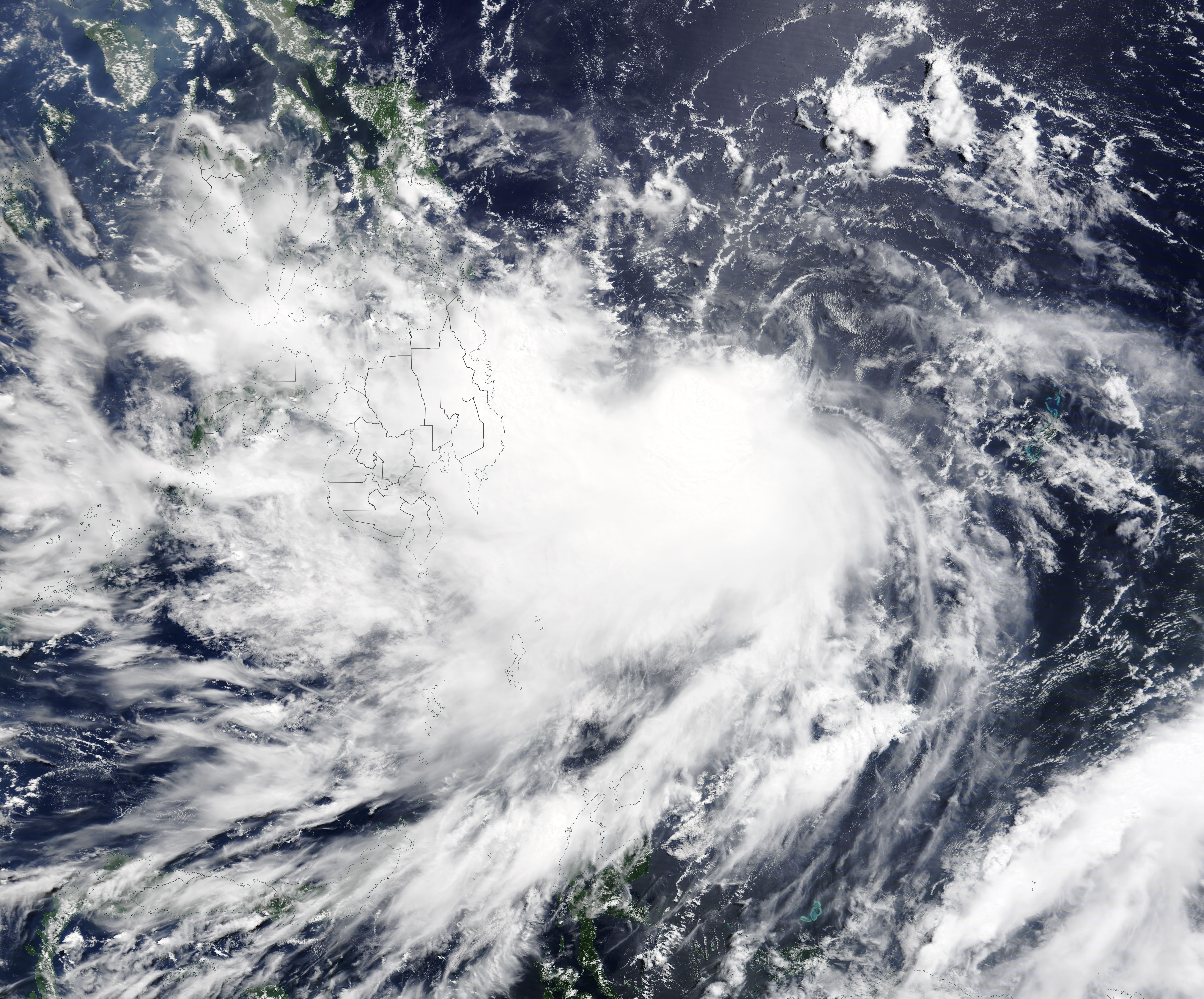
English: On May 31, 2021, the Moderate Resolution Imaging Spectroradiometer (MODIS) on board NASA’s Terra satellite acquired a true-color image of newly-formed Tropical Storm Choi-Wan (Dante) as it spun north-westward over the Philippine Sea heading towards landfall in the Philippines. At the time the image was acquired, Choi-Wan was an intensifying system with a cloud-filled center of circulation.
According to the Global Disaster Alert and Coordination System (GDACS), Tropical Storm Choi-Wan reached peak strength on May 31 when it sported one-minute maximum sustained winds of 94 km/h (58 mph). It has weakened as it moved into the Philippines, with the Joint Typhoon Warning Center (JTWC) reporting maximum sustained winds of 55.5 km/h (34.5 mph) at 0300 UTC on June 2 (11:00 p.m. EDT June 1). At that time, Tropical Depression Choi-Wan (Dante) was located about 158 miles (254 km) southeast of Manila, Philippines and was moving west-northwestward. Maximum significant wave height was reported at 14 feet (4.3 meters). On June 1, Tropical Depression Choi-Wan made landfall over the municipality of Sulat, Eastern Samar on the island of Samar in the Eastern Visayas region of the Philippines. About 4.5 hours later, Choi-Wan struck the municipality of Cataingan, Masbate Island, which sits near the center of the Philippine archipelago. By the morning of June 2, the storm was heading towards the island of Romblon. The track of the storm brings it across the island of Luzon, Philippines, close to the city of Manila late on June 2 before moving out of the Philippines. |
||
| Date | Taken on 31 May 2021 | ||
| Source |
Tropical Storm Choi-wan (direct link)
|
||
| Author | MODIS Land Rapid Response Team, NASA GSFC |
| This media is a product of the Terra mission Credit and attribution belongs to the mission team, if not already specified in the "author" row |
Licensing
[edit].jpg&action=edit§ion=2)
| This file is in the public domain in the United States because it was solely created by NASA. NASA copyright policy states that "NASA material is not protected by copyright unless noted". (See Template:PD-USGov, NASA copyright policy page or JPL Image Use Policy.) | ||
 |
Warnings:
|
File history
Click on a date/time to view the file as it appeared at that time.
| Date/Time | Thumbnail | Dimensions | User | Comment | |
|---|---|---|---|---|---|
| current | 17:44, 30 January 2024 | | 7,989 × 6,629 (4.77 MB) | OptimusPrimeBot (talk | contribs) | #Spacemedia - Upload of http://modis.gsfc.nasa.gov/gallery/images/image06022021_250m.jpg via Commons:Spacemedia |
You cannot overwrite this file.
File usage on Commons
There are no pages that use this file.
.jpg&oldid=909384373)