File:Tropical Storm Celia Struggles to Strengthen (MODIS 2022-06-25).jpg

Original file (7,102 × 5,869 pixels, file size: 3.16 MB, MIME type: image/jpeg)
Captions
Captions
Summary
[edit].jpg&action=edit§ion=1)
| Description |
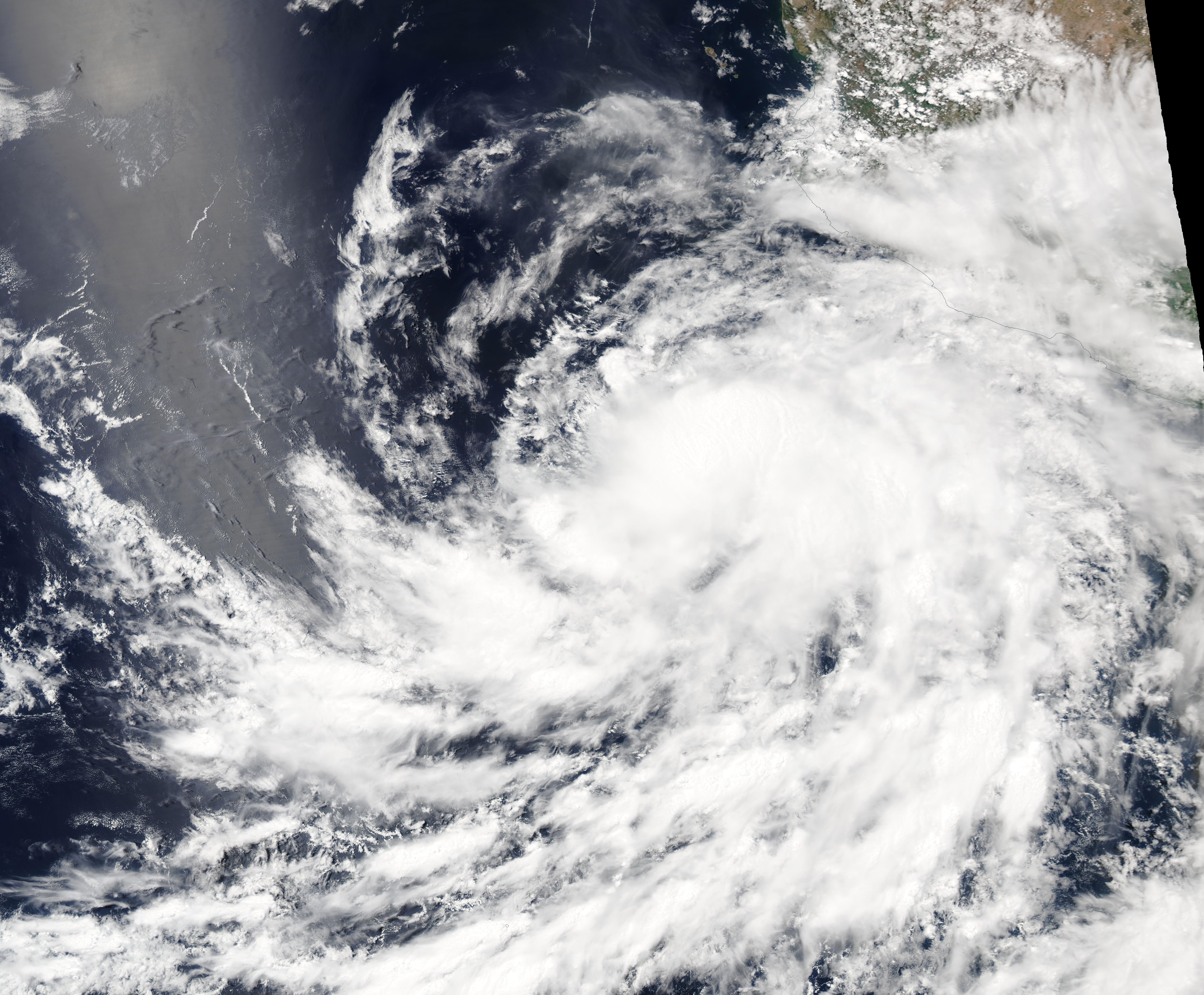
English: After more than a week of struggling to gain strength over the eastern Pacific Ocean, Tropical Storm Celia continued to fight for intensification on June 23, 2022. The Moderate Resolution Imaging Spectroradiometer (MODIS) on board NASA’s Aqua satellite acquired a true-color image of Cecelia on that same day. At that time, the storm showed ragged circulation spiraling into a cloud-filled center as it spun west of the Mexican coast.
At 11:00 a.m. EDT (1500 UTC) on June 23, the National Hurricane Center (NHC) advised that Tropical Storm Celia was located about 235 mi (380 km) south-southwest of Manzanillo, Mexico and about 380 miles (615 km) east-southeast of Socorro Island. It was sporting maximum sustained winds of 50 mph (85 km/h) and was traveling northwestward at 13 mph (20 km/h). The NHC advisory stated “Celia is a bit of a conundrum.” And explained that, “The strong east-northeasterly shear which was affecting the system over the past couple of days has lessened and turned out of the north, but the cyclone may have ingested so much dry air during that time that it's now struggling to produce much convection near its center. That said, new convection has recently been developing just to the east of the center…The big question for intensity is whether the dry air near the core can be mixed out and allow deep convection to organize near the center.” Despite the conundrum, Celia was expected to intensify to hurricane strength over the next several days. The storm was able to muster some strength by 11:00 p.m. EDT on June 24 (0300 UTC June 25) when wind speeds were reported at 65 mph (100 km/h). At that time, the NHC located Tropical Storm Celia at 310 miles (500 km) southwest of Cabo Corrientes, Mexico and about 115 mi (185 km) southeast of Socorro Island. It continued to move south-southwest. Celia appears to continue to be a conundrum, as models differ on the storm’s ability to reach hurricane strength. A compromise of the possibilities indicates that Tropical Storm Celia is likely to strengthen only slightly over the next 12-24 hours and then gradually begin to weaken. It is expected that the storm will also begin to track westward, taking it further away from land. |
||
| Date | Taken on 23 June 2022 | ||
| Source |
Tropical Storm Celia Struggles to Strengthen (direct link)
|
||
| Author | MODIS Land Rapid Response Team, NASA GSFC |
| This media is a product of the Aqua mission Credit and attribution belongs to the mission team, if not already specified in the "author" row |
Licensing
[edit].jpg&action=edit§ion=2)
| This file is in the public domain in the United States because it was solely created by NASA. NASA copyright policy states that "NASA material is not protected by copyright unless noted". (See Template:PD-USGov, NASA copyright policy page or JPL Image Use Policy.) | ||
 |
Warnings:
|
File history
Click on a date/time to view the file as it appeared at that time.
| Date/Time | Thumbnail | Dimensions | User | Comment | |
|---|---|---|---|---|---|
| current | 21:59, 9 January 2024 | | 7,102 × 5,869 (3.16 MB) | OptimusPrimeBot (talk | contribs) | #Spacemedia - Upload of http://modis.gsfc.nasa.gov/gallery/images/image06252022_250m.jpg via Commons:Spacemedia |
You cannot overwrite this file.
File usage on Commons
There are no pages that use this file.
.jpg&oldid=840285542)