File:Trondheim map 1898.jpg
Jump to navigation
Jump to search

Size of this preview: 735 × 600 pixels. Other resolutions: 294 × 240 pixels | 588 × 480 pixels | 941 × 768 pixels | 1,255 × 1,024 pixels | 2,548 × 2,080 pixels.
Original file (2,548 × 2,080 pixels, file size: 4.66 MB, MIME type: image/jpeg)
Captions
Captions
Add a one-line explanation of what this file represents
Summary
[edit]
Licensing
[edit]
|
This work is in the public domain in its country of origin and other countries and areas where the copyright term is the author's life plus 70 years or fewer. | |
| This file has been identified as being free of known restrictions under copyright law, including all related and neighboring rights. | |
File history
Click on a date/time to view the file as it appeared at that time.
| Date/Time | Thumbnail | Dimensions | User | Comment | |
|---|---|---|---|---|---|
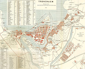
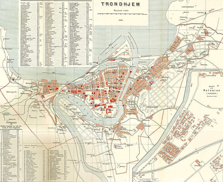
| current | 09:23, 3 June 2008 | | 2,548 × 2,080 (4.66 MB) | Mahlum (talk | contribs) | {{Information |Description={{en|1=Trondheim city map, 1898}} {{no|1=Kart over Trondheim, 1898}} |Source=Amund Helland: ''Norges Land og Folk. Søndre Trondhjems Amt'' |Author=Lithografisk Anstalt |Date=1898 |Permission= |other_versions= }} {{ImageUpload| |
You cannot overwrite this file.
File usage on Commons
The following page uses this file:
File usage on other wikis
The following other wikis use this file:
- Usage on ast.wikipedia.org
- Usage on ca.wikipedia.org
- Usage on cs.wikipedia.org
- Usage on da.wikipedia.org
- Usage on el.wikipedia.org
- Usage on en.wikipedia.org
- Usage on es.wikipedia.org
- Usage on no.wikipedia.org
- Usage on pl.wikipedia.org
- Usage on sl.wikipedia.org
- Usage on sv.wikipedia.org