File:Trobriand 1806 map fig0803.jpg
Jump to navigation
Jump to search
No higher resolution available.
Trobriand_1806_map_fig0803.jpg (643 × 555 pixels, file size: 66 KB, MIME type: image/jpeg)
Captions
Captions
Add a one-line explanation of what this file represents
Summary
[edit]
| Description |
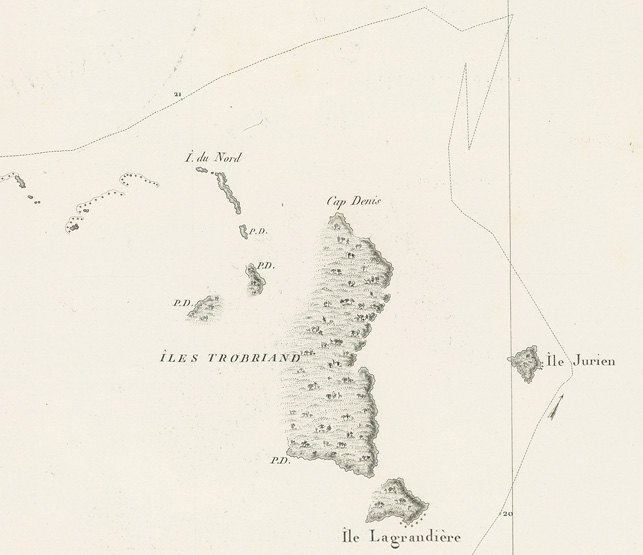
English: first map of the Trobriand Islands, Papua New Guinea, part of Carte des Archipels des iles Salomon, de la Louisiade et de la Nouv.le Bretagne; situes a l’est de la Nouvelle Guinee |
| Date | between 1806 and 1807 |
| Source | http://press-files.anu.edu.au/downloads/press/p344583/html/ch08.xhtml?referer=1826&page=14 |
| Author | C. F. Beautemps-Beaupré |
Licensing
[edit]
|
This work is in the public domain in its country of origin and other countries and areas where the copyright term is the author's life plus 70 years or fewer. This work is in the public domain in the United States because it was published (or registered with the U.S. Copyright Office) before January 1, 1929. | |
| This file has been identified as being free of known restrictions under copyright law, including all related and neighboring rights. | |
File history
Click on a date/time to view the file as it appeared at that time.
| Date/Time | Thumbnail | Dimensions | User | Comment | |
|---|---|---|---|---|---|
| current | 10:26, 6 October 2016 | | 643 × 555 (66 KB) | Ratzer (talk | contribs) | User created page with UploadWizard |
You cannot overwrite this file.
File usage on Commons
There are no pages that use this file.