File:Trinity Peak Boise National Forest.jpg
From Wikimedia Commons, the free media repository
Jump to navigation
Jump to search
Size of this preview: 800 × 501 pixels. Other resolutions: 320 × 200 pixels | 640 × 400 pixels | 1,024 × 641 pixels | 1,280 × 801 pixels | 2,560 × 1,602 pixels | 6,144 × 3,844 pixels.
Original file (6,144 × 3,844 pixels, file size: 4.04 MB, MIME type: image/jpeg)
File information
Structured data
Captions
Summary
[edit]DescriptionTrinity Peak Boise National Forest.jpg |
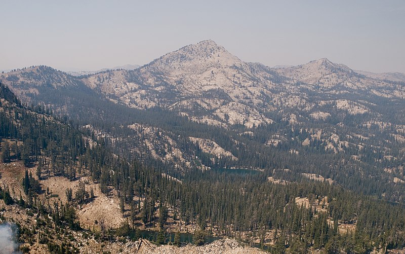
English: Trinity Peak and the Rainbow Lakes area of Boise National Forest Idaho with the Elk Complex Fire in the lower left corner. |
Date | |
Source | Boise National Forest |
Author | U.S. Forest Service |
Camera location | 43° 35′ 23.28″ N, 115° 23′ 41.33″ W | View this and other nearby images on: OpenStreetMap | 43.589799; -115.394813 |
---|
Licensing
[edit]Public domainPublic domainfalsefalse |
This image is a work of the Forest Service of the United States Department of Agriculture. As a work of the U.S. federal government, the image is in the public domain.
|
File history
Click on a date/time to view the file as it appeared at that time.
Date/Time | Thumbnail | Dimensions | User | Comment | |
---|---|---|---|---|---|
current | 21:52, 29 December 2014 | 6,144 × 3,844 (4.04 MB) | Fredlyfish4 (talk | contribs) | User created page with UploadWizard |
You cannot overwrite this file.
File usage on Commons
There are no pages that use this file.
File usage on other wikis
The following other wikis use this file:
- Usage on arz.wikipedia.org
- Usage on ca.wikipedia.org
- Usage on ceb.wikipedia.org
- Usage on en.wikipedia.org
- Usage on lld.wikipedia.org
- Usage on ur.wikipedia.org
- Usage on www.wikidata.org
Metadata
This file contains additional information such as Exif metadata which may have been added by the digital camera, scanner, or software program used to create or digitize it. If the file has been modified from its original state, some details such as the timestamp may not fully reflect those of the original file. The timestamp is only as accurate as the clock in the camera, and it may be completely wrong.
Image title |
|
---|---|
Camera manufacturer | OLYMPUS IMAGING CORP. |
Camera model | E-3 |
Author | Kari Greer |
Exposure time | 1/640 sec (0.0015625) |
F-number | f/5.6 |
ISO speed rating | 100 |
Date and time of data generation | 13:28, 20 August 2013 |
Lens focal length | 17 mm |
Latitude | 43° 35′ 23.28″ N |
Longitude | 115° 23′ 41.33″ W |
Altitude | 2,722.6 meters above sea level |
Copyright holder |
|
Short title |
|
Orientation | Normal |
Software used | Adobe Photoshop CS4 Macintosh |
File change date and time | 09:38, 21 August 2013 |
Exposure Program | Shutter priority |
Exif version | 2.21 |
Date and time of digitizing | 13:28, 20 August 2013 |
APEX shutter speed | 9.321928 |
APEX aperture | 4.970854 |
APEX exposure bias | 0 |
Maximum land aperture | 2.97265625 APEX (f/2.8) |
Metering mode | Pattern |
Light source | Flash |
Flash | Flash did not fire, compulsory flash firing |
DateTimeOriginal subseconds | 00 |
DateTimeDigitized subseconds | 00 |
File source | Digital still camera |
Custom image processing | Normal process |
Exposure mode | Auto exposure |
White balance | Manual white balance |
Digital zoom ratio | 1 |
Scene capture type | Standard |
Scene control | None |
Contrast | Normal |
Saturation | High saturation |
Sharpness | Hard |
Measurement mode | 2-dimensional measurement |
Geodetic survey data used | WGS-84 |
GPS tag version | 2.2.0.0 |
Rating (out of 5) | 4 |
Keywords |
|