File:Trias 240ma 1.png
Original file (1,600 × 800 pixels, file size: 129 KB, MIME type: image/png)
Captions
Captions
Summary
[edit]
| Description |
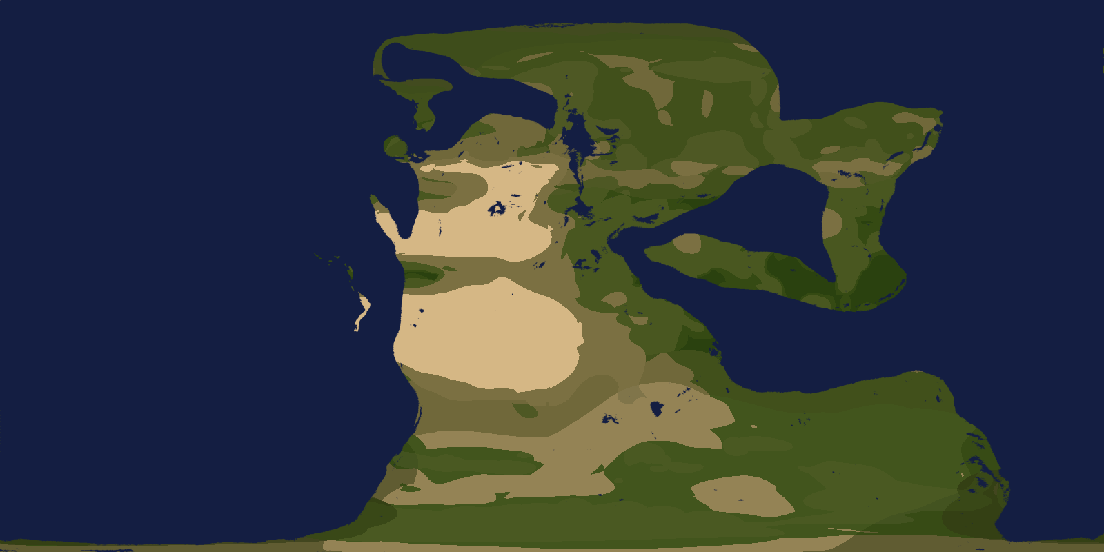
English: Triassic 240 Ma |
| Date | |
| Source | Own work |
| Author | Merikanto |
Simulated with exoplasim. Map created with Koppenpasta and krita.
https://github.com/hersfeldtn/koppenpasta
users scaking factor 25, that produces 1600x800 map
Data for hillshade is 6 minutes paleodem
@dataset{scotese_christopher_r_2018_5460860,
author       = {Scotese, Christopher R and
                Wright, Nicky M},
title        = {{PALEOMAP Paleodigital Elevation Models (PaleoDEMS)
                 for the Phanerozoic}},
month        = aug,
year         = 2018,
publisher    = {Zenodo},
doi          = {10.5281/zenodo.5460860},
url          = {https://doi.org/10.5281/zenodo.5460860}
}
Mask creation script (for Krita)
- process dem file to mask
- and flatten sea
install_packages=0
if(install_packages==1)
{
	install.packages("raster")
	install.packages("ncdf4")
	install.packages("rgdal")
	install.packages("png")
}
library(raster)
library(ncdf4)
library(rgdal)
library(png)
file1="./trias240_60.nc"
file2="dem.nc"
file3="dem.tif"
outmask1="out_mask.png"
ur1<-raster(file1)
ur1[ur1[]<1] <- 0
- image(ur1)
- plot(ur1)
lonr1 <- init(ur1, 'x')
latr1 <- init(ur1, 'y')
crs(ur1)<-"+proj=longlat +datum=WGS84 +no_defs +ellps=WGS84 +towgs84=0,0,0"
writeRaster(ur1, file2, overwrite=TRUE, format="CDF", varname="Band1", varunit="m",
longname="Band1", xname="lon", yname="lat")
writeRaster(ur1, file3, overwrite=TRUE, format="GTiff", varname="Band1", varunit="m",
longname="Band1", xname="lon", yname="lat")
crs(lonr1)<-"+proj=longlat +datum=WGS84 +no_defs +ellps=WGS84 +towgs84=0,0,0"
crs(latr1)<-"+proj=longlat +datum=WGS84 +no_defs +ellps=WGS84 +towgs84=0,0,0"
writeRaster(lonr1, "lons.nc", overwrite=TRUE, format="CDF", varname="Band1", varunit="deg",
longname="Band1", xname="lon", yname="lat")
writeRaster(latr1, "lats.nc", overwrite=TRUE, format="CDF", varname="Band1", varunit="deg",
longname="Band1", xname="lon", yname="lat")
r=ur1
dims<-dim(r)
dims
r[r[]<1] <- 0
r[r[]>0] <- 1
image(r)
- stop(-1)
print (dims[1])
print (dims[2])
rows=dims[2]
cols=dims[1]
- stop(-1)
mask0<-r
mask1<-mask0[]
mask2<-matrix(mask1, ncol=cols, nrow=rows )
mask3<-t(mask2)
r <- writePNG(mask3, outmask1)
plot(r)
- png('mask.png', height=nrow(r), width=ncol(r))
- plot(r, maxpixels=ncell(r))
- image(r, axes = FALSE, labels=FALSE)
- dev.off()
Exoplasim script to run this (run in ubuntu etc)
- Ecoplasim planet running code
- exoplasim example
- in ra
- convert to T21, input netcdf
- load one lon, lat, z grid
- or Tarasov glac1d grid
- 08.01.2022 0000.0005
-
- MPI NOTE: if you use more than
- one processor, you cannot in most cases run MPI in root
- in ubuntu you must install
-
- pip3 install exoplasim[netCDF4]
- not
- "sudo pip3 install exoplasim[netCDF4]"
import numpy as np
import matplotlib.pyplot as plt
from scipy.interpolate import interp2d
import netCDF4
import exoplasim as exo
NLAT=0
NLON=0


def writeSRA(name,kcode,field,NLAT,NLON):
   label=name+'_surf_%04d.sra'%kcode
   header=[kcode,0,20170927,0,NLON,NLAT,0,0]
   fmap = field.reshape((int(NLAT*NLON/8),8))
   sheader =
   for h in header:
       sheader+=" %11d"%h

   lines=[]
   i=0
   while i<NLAT*NLON/8:
       l=
       for n in fmap[i,:]:
           l+=' %9.3f'%n
       lines.append(l)
       i+=1
text=sheader+'\n'+'\n'.join(lines)+'\n'
   f=open(label,'w')
   f.write(text)
   f.close()
   print (label)
def writeSRA2(label,kcode,field,NLAT,NLON):
   #label=name+'_surf_%04d.sra'%kcode
   header=[kcode,0,20170927,0,NLON,NLAT,0,0]
   fmap = field.reshape((int(NLAT*NLON/8),8))
   sheader =
   for h in header:
       sheader+=" %11d"%h

   lines=[]
   i=0
   while i<NLAT*NLON/8:
       l=
       for n in fmap[i,:]:
           l+=' %9.3f'%n
       lines.append(l)
       i+=1
text=sheader+'\n'+'\n'.join(lines)+'\n'
   f=open(label,'w')
   f.write(text)
   f.close()
   print (label)
def savenetcdf_single_frommem(outfilename1, outvarname1, xoutvalue1,xoutlats1,xoutlons1):
	nlat1=len(xoutlats1)
	nlon1=len(xoutlons1)
	#indata_set1=indata1
	print(outfilename1)
	ncout1 = netCDF4.Dataset(outfilename1, 'w', format='NETCDF4')
	outlat1 = ncout1.createDimension('lat', nlat1)
	outlon1 = ncout1.createDimension('lon', nlon1)
	outlats1 = ncout1.createVariable('lat', 'f4', ('lat',))
	outlons1 = ncout1.createVariable('lon', 'f4', ('lon',))
	outvalue1 = ncout1.createVariable(outvarname1, 'f4', ('lat', 'lon',))
	outvalue1.units = 'Unknown'
	outlats1[:] = xoutlats1
	outlons1[:] = xoutlons1
	outvalue1[:, :] =xoutvalue1[:]
	ncout1.close()
	return 0
def loadnetcdf_single_tomem(infilename1, invarname1):
	global cache_lons1
	global cache_lats1
	print(infilename1)
	inc1 = netCDF4.Dataset(infilename1)
	inlatname1="lat"
	inlonname1="lon"
	inlats1=inc1[inlatname1][:]
	inlons1=inc1[inlonname1][:]
	cache_lons1=inlons1
	cache_lats1=inlats1
	indata1_set1 = inc1[invarname1][:]
	dim1=indata1_set1.shape
	nlat1=dim1[0]
	nlon1=dim1[1]
	inc1.close()
	return (indata1_set1)
def create_sras(topo):
	global NLAT
	global NLON
	topo2=np.copy(topo)
	masko=np.copy(topo)
	topo2[topo2 < 1] = 0
	masko[masko < 1] = 0
	masko[masko > 0] = 1
	grid=np.flipud(masko)
	name="Example"
	writeSRA(name,129,topo,NLAT,NLON)
	writeSRA(name,172,grid,NLAT,NLON)
	writeSRA2("topo.sra",129,topo2,NLAT,NLON)
	writeSRA2("landmask.sra",172,grid,NLAT,NLON)
	return(0)
def convert_to_t21(infilename1, outfilename1):
	global NLAT
	global NLON
	indimx=361
	indimy=181
	#indimx=360
	#indimy=360
	## t21 64x32
	shapex=64
	shapey=32
	NLAT=shapex
	NLON=shapey
	nc = netCDF4.Dataset(infilename1)
	inlats=nc['lat'][:]
	inlons=nc['lon'][:]
	#print(inlats)
	#print(inlons)
	latlen=len(inlats)
	lonlen=len(inlons)


	#print(lonlen, latlen)
	indimx=lonlen
	indimy=latlen
	dem=nc['z']
	#dem=np.flipud(dem000)
	dem2=np.copy(dem)
	#dem2[dem2 < 0] = 0
	#plt.imshow(dem,cmap='gist_earth')
	#plt.imshow(dem2,cmap='gist_earth')
	#plt.show()
	#quit(0)
	lts=[85.7606, 80.2688, 74.7445, 69.2130, 63.6786, 58.1430, 52.6065, 47.0696,
	41.5325,35.9951, 30.4576, 24.9199, 19.3822, 13.8445, 8.3067, 2.7689,
	-2.7689, -8.3067, -13.8445, -19.3822, -24.9199, -30.4576, -35.9951, -41.5325,
	-47.0696, -52.6065, -58.1430, -63.6786, -69.2130, -74.7445, -80.2688, -85.7606]
	##
	lns=[0, 5.6250, 11.2500, 16.8750, 22.5000, 28.1250, 33.7500 ,39.3750,
	45.0000, 50.6250, 56.2500, 61.8750, 67.5000, 73.1250, 78.7500, 84.3750,
	90.0000, 95.6250, 101.2500, 106.8750, 112.5000, 118.1250, 123.7500, 129.3750,
	135.0000, 140.6250, 146.2500, 151.8750, 157.5000, 163.1250, 168.7500, 174.3750,
	180.0000, 185.6250, 191.2500, 196.8750, 202.5000, 208.1250, 213.7500, 219.3750,
	225.0000, 230.6250, 236.2500, 241.8750, 247.5000, 253.1250, 258.7500, 264.3750,
	270.0000, 275.6250, 281.2500, 286.8750, 292.5000, 298.1250, 303.7500, 309.3750,
	315.0000, 320.6250, 326.2500, 331.8750, 337.5000, 343.1250, 348.7500, 354.3750]


	ly2=len(lts)
	lx2=len(lns)
	shapex=lx2
	shapey=ly2
	#print("sheip")
	#print(shapex, shapey)


	lons, lats = np.meshgrid(lns,lts)
	#print (lts)
	#print (lns)
	new_W, new_H = (shapey,shapex)
	xrange = lambda x: np.linspace(0, 360, x)
	f2 = interp2d(xrange(indimx), xrange(indimy), dem2, kind="linear")
	#f2 = interp2d(range(indimx), range(indimy), dem2, kind="cubic")
	demo = f2(xrange(shapex), xrange(shapey))
	#plt.imshow(demo)
	#plt.show()
	#quit(0)
	f3 = interp2d(xrange(indimx), xrange(indimy), dem2, kind="linear")
	#masko = f3(xrange(shapex), xrange(shapey))
	#topo=np.flipud(demo)
	topo=np.copy(demo)
	#grid=np.fliplr(masko)
	#def savenetcdf_single_frommem(outfilename1, outvarname1, xoutvalue1,xoutlats1,xoutlons1):
	savenetcdf_single_frommem(outfilename1, "z", topo,lts,lns)
	return(topo,lons,lats)
def load_glac1d_dem(indatafile, outdatafile, a_yr):
	# load dem from Tarsaov GLAC1d anno domini 2021
	global NLAT
	global NLON
	yr=a_yr
	lok=int(abs(yr/100-260))
	# tarasov ice 26k
	nc = netCDF4.Dataset(indatafile1)
	#print(nc)
	eisbase=nc['ICEM']
	inlats=nc['YLATGLOBP5'][:]
	inlons=nc['XLONGLOB1'][:]
	dem=nc['HDCB'][lok]
	#dem=np.flipud(dem000)
	#print (dem)
	#print (np.shape(dem))
	#plt.imshow(dem,cmap='gist_earth')


	savenetcdf_single_frommem(outdatafile, "z",dem,inlats,inlons)
	return(0)
- maybe nok
def convert_to_t42(infilename1, outfilename1):
	## ONLY attempi! to create T42!
	global NLAT
	global NLON
	indimx=361
	indimy=181


	## t42 64x32
	#shapex=64
	#shapey=32
	shapex=128
	shapey=64
	#shapey=63


	NLAT=shapex
	NLON=shapey
	nc = netCDF4.Dataset(infilename1)
	inlats=nc['lat'][:]
	inlons=nc['lon'][:]
	latlen=len(inlats)
	lonlen=len(inlons)
	indimx=lonlen
	indimy=latlen
	dem=nc['z']
	#dem=np.flipud(dem000)
	dem2=np.copy(dem)
	## test t21


	tdx=360.0/shapex
	#tdy=180.0/shapey
	tdy=(90.0-85.706)/2
	minix=0.0
	maksix=360-tdx
	maksiy=90-tdy
	miniy=-90+tdy


	#print(90-tdy)
	#
	#print(miniy)
	#print(maksiy)
	#quit(-1)
	#lns=np.linspace(minix, maksix, num=shapex)
	#lts=np.linspace(maksiy, miniy, num=shapey)
	## jn WARNING 90!
	lts=[87.8638, 85.0965 ,82.3129, 79.5256, 76.7369 ,73.9475 ,71.1578, 68.3678, #ok
	65.5776, 62.7874,  59.9970 ,57.2066,  54.4162,  51.6257,  48.8352, 46.0447,
	43.2542, 40.4636,  37.6731 ,34.8825,  32.0919,  29.3014,  26.5108, 23.7202,
	20.9296, 18.1390,  15.3484 ,12.5578,  9.7671,   6.9765,   4.1859, 1.3953,
	-1.3953, -4.1859, -6.9765, -9.7671,  -12.5578,  -15.3484, -18.1390, -20.9296,
	-23.7202,-26.5108, -29.3014 ,-32.0919, -34.8825, -37.6731, -40.4636,-43.2542,
	-46.0447,-48.8352, -51.6257, -54.4162, -57.2066, -59.9970, -62.7874, -65.5776,
	-68.3678,-71.1578 ,-73.9475, -76.7369 ,-79.5256, -82.3129, -85.0965, -87.8638]
	lns=[0.0000 ,2.8125, 5.6250, 8.4375, 11.2500, 14.0625 ,16.8750 ,19.6875,
	22.5000,25.3125, 28.1250, 30.9375 ,33.7500,36.5625 ,39.3750, 42.1875,
	45.0000,47.8125, 50.6250, 53.4375, 56.2500, 59.0625 ,61.8750, 64.6875,
	67.5000, 70.3125, 73.1250, 75.9375, 78.7500, 81.5625, 84.3750, 87.1875,
	90.0000, 92.8125, 95.6250 ,98.4375 ,101.2500, 104.0625, 106.8750, 109.6875,
	112.5000, 115.3125, 118.1250, 120.9375,123.7500 ,126.5625 ,129.3750, 132.1875,
	135.0000, 137.8125, 140.6250 ,143.4375, 146.2500 ,149.0625, 151.8750 ,154.6875,
	157.5000, 160.3125, 163.1250, 165.9375, 168.7500, 171.5625 ,174.3750, 177.1875,
	180.0000, 182.8125, 185.6250 ,188.4375, 191.2500, 194.0625, 196.8750, 199.6875,
	202.5000, 205.3125, 208.1250, 210.9375, 213.7500 ,216.5625, 219.3750 ,222.1875,
	225.0000, 227.8125, 230.6250 ,233.4375, 236.2500, 239.0625, 241.8750, 244.6875,
	247.5000, 250.3125, 253.1250, 255.9375, 258.7500, 261.5625, 264.3750, 267.1875,
	270.0000, 272.8125, 275.6250, 278.4375, 281.2500 ,284.0625 ,286.8750, 289.6875,
	292.5000, 295.3125, 298.1250, 300.9375, 303.7500 ,306.5625, 309.3750, 312.1875,
	315.0000, 317.8125, 320.6250, 323.4375, 326.2500, 329.0625 ,331.8750, 334.6875,
	337.5000, 340.3125, 343.1250, 345.9375, 348.7500, 351.5625 ,354.3750 ,357.1875]


	#lns=
	#print (lts)
	#print (lns)
	#print (len(lns),len(lts))
	#quit(-1)
	ly2=len(lts)
	lx2=len(lns)
	shapex=lx2
	shapey=ly2
	#print("sheip")
	#print(shapex, shapey)


	lons, lats = np.meshgrid(lns,lts)
	new_W, new_H = (shapey,shapex)
	xrange = lambda x: np.linspace(0, 360, x)
	f2 = interp2d(xrange(indimx), xrange(indimy), dem2, kind="linear")
	demo = f2(xrange(shapex), xrange(shapey))
	f3 = interp2d(xrange(indimx), xrange(indimy), dem2, kind="linear")
	topo=demo
	savenetcdf_single_frommem(outfilename1, "z", topo,lts,lns)
	return(topo,lons,lats)
- exoplasim ,,,
def run_exoplasim_b(a_input_dem1, a_gridtype, a_layers, a_years,a_timestep,a_snapshots,a_ncpus,a_eccentricity,a_obliquity,a_lonvernaleq,a_pCO2):
	#output_format=".npz"
	output_format=".nc"
	a_pO2=1-a_pCO2-0.79
	a_pN2=(1-0.21-a_pCO2)
	print("Process input grid, to type ",a_gridtype)
	if(a_gridtype=="T21"):
		print("T21")
		topo, lons, lats=convert_to_t21(a_input_dem1,"demT21.nc")
	if(a_gridtype=="T42"):
		print("T42")
		topo, lons, lats=convert_to_t42(a_input_dem1, "demT42.nc")
	create_sras(topo)
	print("Creating exoplasim object ")
	#testplanet= exo.Model(workdir="testplanet_run",modelname="TESTPLANET",ncpus=a_ncpus,resolution="T21")
	#testplanet= exo.Earthlike(workdir="planet_run",modelname="PLANET",ncpus=a_ncpus,resolution="T21",outputtype=output_format, crashtolerant=True)
	testplanet= exo.Earthlike(workdir="planet_run",modelname="PLANET",ncpus=a_ncpus,resolution=a_gridtype,layers=a_layers, outputtype=output_format, crashtolerant=True)
	## earth 21000 BP
	glaciers1= {
	"toggle": True,
	"mindepth":2,
	"initialh":-1
	}
	testplanet.configure(
				startemp=5772.0,
				flux=1367,# Stellar parameters
				eccentricity=a_eccentricity,
				obliquity=a_obliquity,
				lonvernaleq=a_lonvernaleq,
				fixedorbit=True,  # Orbital parameters
				rotationperiod=1, # Rotation
				topomap="topo.sra",
				landmap="landmask.sra",
				radius=1.0,
				gravity=9.80665,               # Bulk properties
				#seaice=False,
				#maxsnow=False,
				#glaciers=False,
				#stormclim=False,
				#vegetation=0,
				wetsoil=True,                               #alters albedo of soil based on how wet it is
               vegetation=2,                               #toggles vegetation module; 1 for static vegetation, 2 to allow growth
               vegaccel=1,
				seaice=True,
				maxsnow=-1,
				glaciers=glaciers1,
				#stormclim=True,
				#vegetation=0,
				pN2=a_pN2,
				pCO2=a_pCO2,
				pO2=a_pO2,
				ozone=True,       # Atmosphere
				timestep=a_timestep,
				snapshots=0, ## jos a_snapshots, vie muistia!
				#wetsoil=True,
				physicsfilter="gp|exp|sp")  # Model dynamics


	testplanet.exportcfg()
	print("Running ExoPlasim ... ")
	print("K-Pg limit transient test.")
	#testplanet.run(years=a_years,crashifbroken=True)
	a_years=50
	runc1=1
	print("Phase 1 !!! Init run. Summer.")
	testplanet.run(years=a_years,crashifbroken=True)
	savename = 'planet_run_'+str(runc1)
	testplanet.finalize(savename,allyears=False,clean=False,keeprestarts=True)
	testplanet.save(savename)
	print("Phase 2 !!! Impact, Winter, springwinter ...")


	fluxes1=[1367*1.0,1367*1.0]
	looplen1=len(fluxes1)
	peen=0
	runc1=2
	print ("Impact flux", fluxes1[0])


	for n in range(0,looplen1):
		darkflux=fluxes1[peen]
		testplanet.modify(flux=darkflux)  #number of output times (months) in the output files
		testplanet.exportcfg()
		a_years2=1
		runc1=2
		print("Winter: Year from impact ",n)
		testplanet.run(years=1,crashifbroken=True)
		savename = 'planet_run_'+str(runc1)
		testplanet.finalize(savename,allyears=False,clean=False,keeprestarts=True)
		testplanet.save(savename)
	print("Phase 2 !!! Winter, Spring ...")
	darkflux=1367
	testplanet.modify(flux=darkflux)  #number of output times (months) in the output files
	testplanet.exportcfg()
	a_years2=50
	runc1=3
	print("Spring ...")
	testplanet.run(years=a_years,crashifbroken=True)
	savename = 'planet_run_'+str(runc1)
	testplanet.finalize(savename,allyears=False,clean=False,keeprestarts=True)
	testplanet.save(savename)


	print("Return.")
	return(0)
-
-
print(" Exoplasim simulation code ---")
- jn warning maybe nok
- input_dem='./indata/indem.nc'
input_dem="./indata/Map16_PALEOMAP_1deg_KT_Boundary_65Ma.nc"
- indatafile1='./indata/TOPicemsk.GLACD26kN9894GE90227A6005GGrBgic.nc'
input_dem="./Scotese_Wright_2018_Maps_1-88_1degX1deg_PaleoDEMS_nc_v2/Map47_PALEOMAP_1deg_Middle_Triassic_240Ma.nc"
- input_dem="origodem.nc"
- a_yr=14500
- load_glac1d_dem(indatafile1, input_dem, 14500)
- input one de scotese palaeomap dem!
- def convert_to_t42(infilename1, outfilename1):
- topo, lons, lats=convert_to_t21(input_dem, "demT21.nc")
- topo, lons, lats=convert_to_t42(input_dem, "demT42.nc")
- plt.imshow(topo,cmap='gist_earth')
- plt.show()
- input_dem="./sand.nc" ##dem of desert planet
a_modelname1="trias"
a_workdir1="trias_run"
a_runsteps1=51
a_years1=a_runsteps1
a_timestep1=30
a_snapshots1=0
a_ncpus1=4
a_layers1=8
a_outputtype1=".nc"
- a_resolution1="T42"
a_resolution1="T21"
a_precision1=4
a_crashtolerant1=True
a_landmap1="landmask.sra"
a_topomap1="topo.sra"
- nowadays ca 0 BP
- a_eccentricity1=0.01671022
- a_obliquity1=23.44
- a_lonvernaleq1=102.7
- a_pCO21=360e-6
- 10000 yrs ago
- a_eccentricity1=0.0194246086670259
- a_obliquity1=24.230720588
- a_lonvernaleq1=295.26651297
- a_pCO21=265e-6
- 14500 yrs ago
- a_eccentricity1=0.019595
- a_obliquity1=23.6801
- a_lonvernaleq1=221.5
- (229.64+213.3)/2
- a_pCO21=210e-6
- 25000 yrs ago
- a_eccentricity1=0.0178681374211005
- a_obliquity1= 22.408850897
- a_lonvernaleq1=49.92
- a_pCO21=180e-6
- triassic middle
a_eccentricity1=0.0167022
a_obliquity1=23.441
a_lonvernaleq1=102.7
- a_pCO21=900.0e-6
- a_pCO21=500.0e-6
- a_pCO21=1200.0e-6
a_pCO21=1400.0e-6
- early permian 295 ma
- late pennsylvanian 300 ma
- a_eccentricity1=0.01671022
- a_obliquity1=23.441
- a_lonvernaleq1=102.7
- a_pCO2=250.0e-6 ## ca 200 - 250 ppmvol
- a_pCO21=180.0e-6
- a_pCO21=100.0e-6
- permo-triassic boundary ca 250 ma
- a_eccentricity1=0.01671022
- a_obliquity1=23.441
- a_lonvernaleq1=102.7
- a_pCO21=1600.0e-6 ## cal1600 ppmvol 3000 ? 2000-4000
print("Exoplasim ...")
run_exoplasim_b(input_dem, a_resolution1, a_layers1, a_years1,a_timestep1,a_snapshots1,a_ncpus1,a_eccentricity1,a_obliquity1,a_lonvernaleq1,a_pCO21)
print(".")
Licensing
[edit]
- You are free:
- to share – to copy, distribute and transmit the work
- to remix – to adapt the work
- Under the following conditions:
- attribution – You must give appropriate credit, provide a link to the license, and indicate if changes were made. You may do so in any reasonable manner, but not in any way that suggests the licensor endorses you or your use.
- share alike – If you remix, transform, or build upon the material, you must distribute your contributions under the same or compatible license as the original.
File history
Click on a date/time to view the file as it appeared at that time.
| Date/Time | Thumbnail | Dimensions | User | Comment | |
|---|---|---|---|---|---|
| current | 15:09, 8 June 2022 | | 1,600 × 800 (129 KB) | Merikanto (talk | contribs) | Uploaded own work with UploadWizard |
You cannot overwrite this file.
File usage on Commons
There are no pages that use this file.