File:Trentino-Alto Adige travel regions map EN.png
Jump to navigation
Jump to search
Size of this preview: 504 × 599 pixels. Other resolutions: 202 × 240 pixels | 404 × 480 pixels | 646 × 768 pixels | 1,200 × 1,427 pixels.
Original file (1,200 × 1,427 pixels, file size: 445 KB, MIME type: image/png)
Captions
Captions
Add a one-line explanation of what this file represents
Summary
[edit]
| Description |
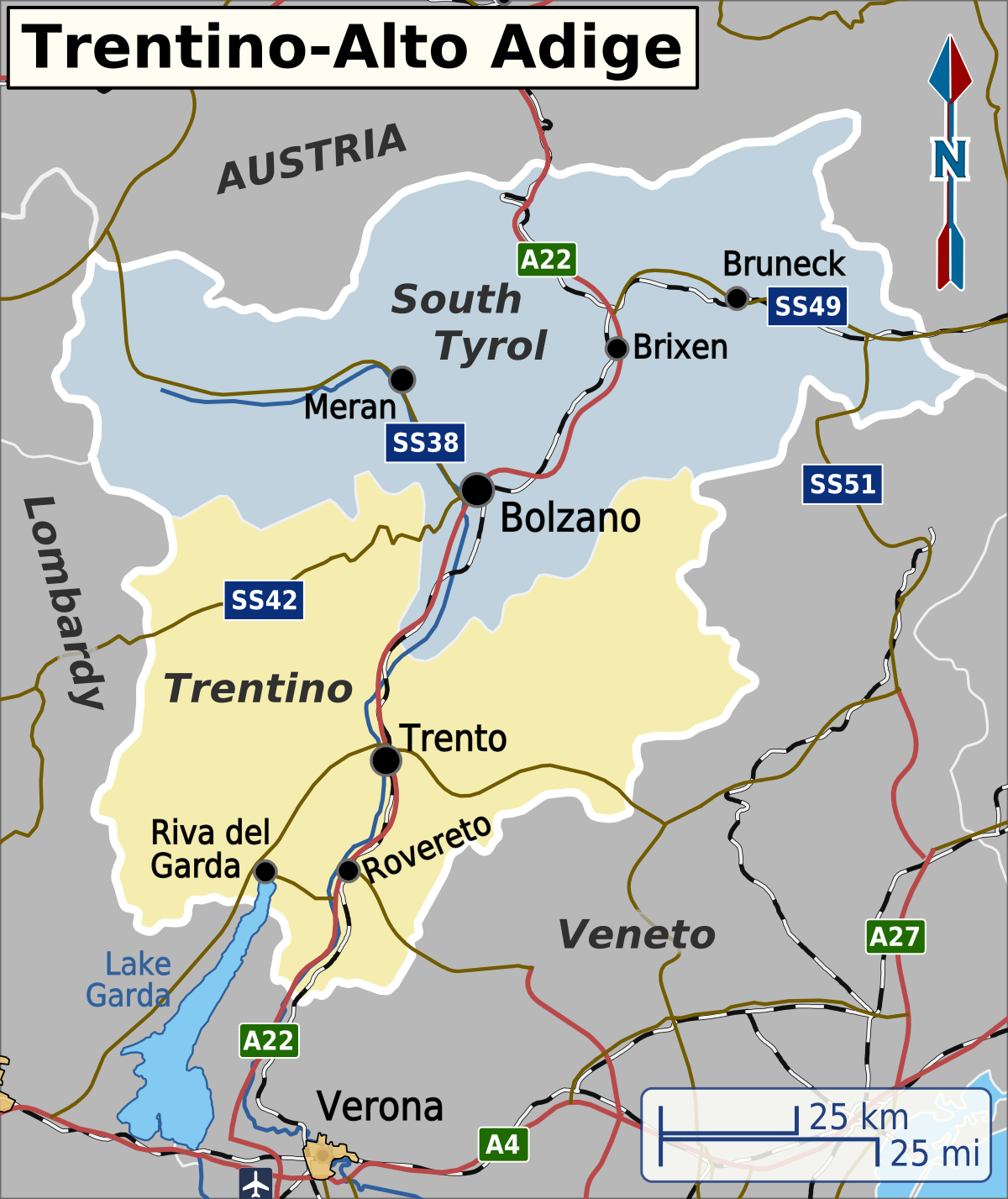
English: Map of Trentino-Alto Adige used in English Wikivoyage, including the travel regions, major cities and transportation routes. Red roads denote an Autostrada, brown roads are all other types of roads. Map projection is Mercator. Approximate scale is 1:1,600,000. |
| Date | |
| Source | Own work, based on data from Natural Earth and map tiles from Openstreetmap.org. |
| Author | Shaundd |
| Other versions | File:Trentino-Alto Adige travel regions.svg - multilingual base SVG |
Licensing
[edit]
I, the copyright holder of this work, hereby publish it under the following license:
This file is licensed under the Creative Commons Attribution-Share Alike 4.0 International license.
- You are free:
- to share – to copy, distribute and transmit the work
- to remix – to adapt the work
- Under the following conditions:
- attribution – You must give appropriate credit, provide a link to the license, and indicate if changes were made. You may do so in any reasonable manner, but not in any way that suggests the licensor endorses you or your use.
- share alike – If you remix, transform, or build upon the material, you must distribute your contributions under the same or compatible license as the original.
File history
Click on a date/time to view the file as it appeared at that time.
| Date/Time | Thumbnail | Dimensions | User | Comment | |
|---|---|---|---|---|---|
| current | 12:36, 26 December 2015 | | 1,200 × 1,427 (445 KB) | Lkcl it (talk | contribs) | reverted edits by LINO CORRADI |
| 11:37, 26 December 2015 |  | 504 × 599 (209 KB) | LINO CORRADI (talk | contribs) | Ho inserito i nomi delle città e della regione Alto Adige in lingua italiana per Wikivoyage. | |
| 07:18, 24 December 2014 |  | 1,200 × 1,427 (445 KB) | Shaundd (talk | contribs) | User created page with UploadWizard |
You cannot overwrite this file.
File usage on Commons
There are no pages that use this file.
File usage on other wikis
The following other wikis use this file:
- Usage on el.wikivoyage.org
- Usage on en.wikivoyage.org
- Usage on it.wikivoyage.org