File:Trebon SMO5 1980.jpg
Jump to navigation
Jump to search
Size of this preview: 800 × 400 pixels. Other resolutions: 320 × 160 pixels | 640 × 320 pixels | 1,024 × 512 pixels | 1,280 × 640 pixels | 4,000 × 2,000 pixels.
Original file (4,000 × 2,000 pixels, file size: 3.92 MB, MIME type: image/jpeg)
Captions
Captions
Add a one-line explanation of what this file represents
Summary
[edit]
| Description |
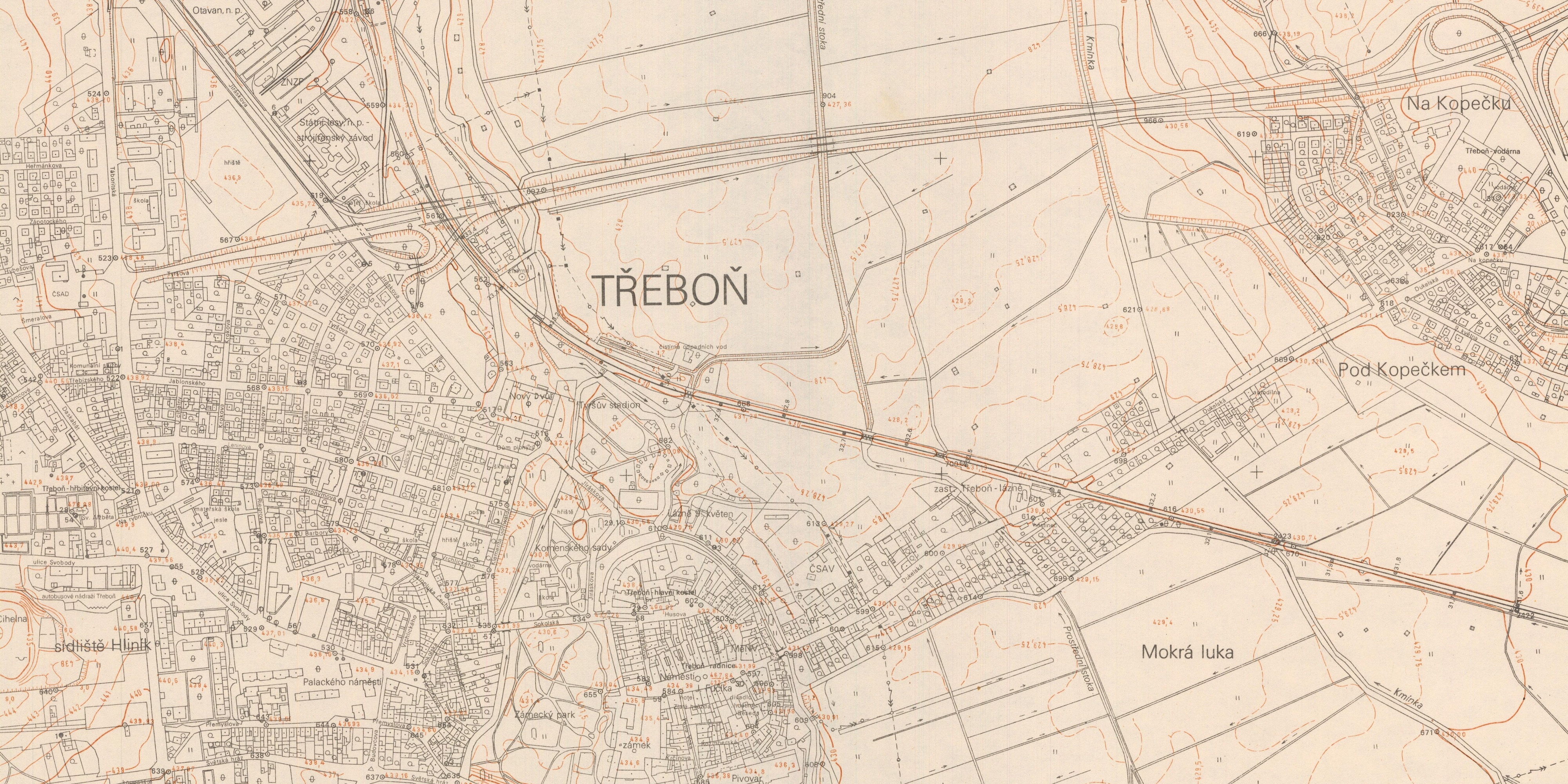
Čeština: Třeboň, Sátní mapa odvozená 1:5 000, výřez z mapového listu Třeboň 3-2. Český úřad geodetický a katastrální, 1980. |
| Date | |
| Source | Ústřední archiv zeměměřictví a katastru |
| Author | Anonymous |
| Camera location | | View this and other nearby images on: OpenStreetMap |
|---|

|
This file was created on the basis of data provided by the Central Archives of Surveying and Land Register (State Administration of Land Surveying and Cadastre).
|

|
This file was obtained as part of the WikiMěsto Třeboň project.
|
Licensing
[edit]
According to the Czech Copyright Act, this work is in the public domain.
(Law No. 121/2000, Article 3, Section a) “Protection pursuant to this Act shall not apply to
|
 |
File history
Click on a date/time to view the file as it appeared at that time.
| Date/Time | Thumbnail | Dimensions | User | Comment | |
|---|---|---|---|---|---|
| current | 16:40, 16 October 2021 | | 4,000 × 2,000 (3.92 MB) | Gampe (talk | contribs) | Uploaded a work by {{Anonymous}} from [https://ags.cuzk.cz/archiv/ Ústřední archiv zeměměřictví a katastru] with UploadWizard |
You cannot overwrite this file.
File usage on Commons
There are no pages that use this file.