File:TrawsCymru buses in Brecon Interchange (geograph 6009565).jpg
Jump to navigation
Jump to search

Size of this preview: 749 × 600 pixels. Other resolutions: 300 × 240 pixels | 600 × 480 pixels | 959 × 768 pixels | 1,024 × 820 pixels.
Original file (1,024 × 820 pixels, file size: 151 KB, MIME type: image/jpeg)
Captions
Captions
Add a one-line explanation of what this file represents
Summary
[edit].jpg&action=edit§ion=1)
| Description |
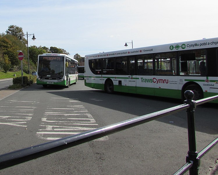
English: TrawsCymru buses in Brecon Interchange. Fleet number in view on the left is 25107. The route on the coach on the right is in Welsh (Caerdydd - Y Drenewydd) which is Cardiff to Newtown in English. TrawsCymru longer distance bus services are an important part of the integrated public transport network in Wales. Funded by the Welsh Government, the buses provide vital public transport for many communities across Wales. They also give visitors an accessible, affordable and environmentally friendly option for exploring the scenic beauty of Wales. |
| Date | |
| Source | From geograph.org.uk |
| Author | Jaggery |
| Permission (Reusing this file) |
Creative Commons Attribution Share-alike license 2.0 |
| Attribution (required by the license) | Jaggery / TrawsCymru buses in Brecon Interchange / |
| Camera location | | View this and other nearby images on: OpenStreetMap |
|---|
.jpg¶ms=051.946909_N_-003.386641_E_globe:Earth_type:camera_source:geograph-osgb36(SO04792851)_heading:112.00&language=en)
| Object location | | View this and other nearby images on: OpenStreetMap |
|---|
.jpg¶ms=051.946820_N_-003.386350_E_globe:Earth_class:object_type:object_source:geograph-osgb36(SO04812850)_heading:112.00&language=en)
Licensing
[edit].jpg&action=edit§ion=2)

|
This image was taken from the Geograph project collection. See this photograph's page on the Geograph website for the photographer's contact details. The copyright on this image is owned by Jaggery and is licensed for reuse under the Creative Commons Attribution-ShareAlike 2.0 license.
|
This file is licensed under the Creative Commons Attribution-Share Alike 2.0 Generic license.
Attribution: Jaggery
- You are free:
- to share – to copy, distribute and transmit the work
- to remix – to adapt the work
- Under the following conditions:
- attribution – You must give appropriate credit, provide a link to the license, and indicate if changes were made. You may do so in any reasonable manner, but not in any way that suggests the licensor endorses you or your use.
- share alike – If you remix, transform, or build upon the material, you must distribute your contributions under the same or compatible license as the original.
File history
Click on a date/time to view the file as it appeared at that time.
| Date/Time | Thumbnail | Dimensions | User | Comment | |
|---|---|---|---|---|---|
| current | 17:04, 31 December 2018 | | 1,024 × 820 (151 KB) | Salen9 (talk | contribs) | Transferred from geograph.co.uk using [https://tools.wmflabs.org/geograph2commons/ geograph2commons] |
You cannot overwrite this file.
File usage on Commons
There are no pages that use this file.
.jpg&oldid=706901275)