File:Transkaspische Eisenbahn 1888.png
Jump to navigation
Jump to search
Size of this preview: 800 × 404 pixels. Other resolutions: 320 × 161 pixels | 640 × 323 pixels | 1,471 × 742 pixels.
Original file (1,471 × 742 pixels, file size: 220 KB, MIME type: image/png)
Captions
Captions
Add a one-line explanation of what this file represents
| Description |
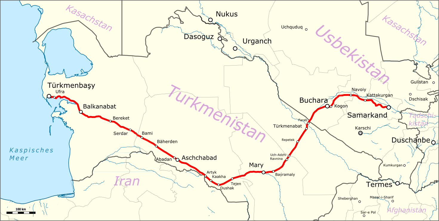
English: Map of the Trans-Caspian railway in the state of 1888 with the boundaries of 2015 Deutsch: Karte der Hauptstrecke der Transkaspische Eisenbahn (Zustand 1888 mit Landesgrenzen von 2015) |
| Date | |
| Source |
|
| Author | |
| Permission (Reusing this file) |
Map data (c) OpenStreetMap (and) contributors, CC-BY-SA |
| Other versions |
|

This file is licensed under the Creative Commons Attribution-Share Alike 3.0 Unported license.
- You are free:
- to share – to copy, distribute and transmit the work
- to remix – to adapt the work
- Under the following conditions:
- attribution – You must give appropriate credit, provide a link to the license, and indicate if changes were made. You may do so in any reasonable manner, but not in any way that suggests the licensor endorses you or your use.
- share alike – If you remix, transform, or build upon the material, you must distribute your contributions under the same or compatible license as the original.
| This work is licensed under the Open Database License (summary). |
File history
Click on a date/time to view the file as it appeared at that time.
| Date/Time | Thumbnail | Dimensions | User | Comment | |
|---|---|---|---|---|---|
| current | 11:22, 5 September 2015 | | 1,471 × 742 (220 KB) | Kopiersperre (talk | contribs) | optipng |
| 23:16, 4 September 2015 |  | 1,471 × 742 (336 KB) | Pechristener (talk | contribs) | {{Information |Description ={{en|1=Map of the Trans-Caspian railway in the state of 1888 with the boundaries of 2015}}{{de|1=Karte der Hauptstrecke der Transkaspische Eisenbahn (Zustand... |
You cannot overwrite this file.
File usage on Commons
The following 3 pages use this file:
File usage on other wikis
The following other wikis use this file:
- Usage on de.wikipedia.org