File:TransOceania.png
Jump to navigation
Jump to search

Size of this preview: 800 × 503 pixels. Other resolutions: 320 × 201 pixels | 640 × 402 pixels | 1,024 × 644 pixels | 1,276 × 802 pixels.
Original file (1,276 × 802 pixels, file size: 46 KB, MIME type: image/png)
Captions
Captions
Add a one-line explanation of what this file represents
Summary
[edit]
| Description | |
| Date | Uploaded 23:53, 5 March 2005 (UTC) |
| Source | w:File:TransOceania.PNG (file now deleted). Image based on file from Amiglobe, which states "The data used in Amiglobe... are all public domain. Thus, maps and any document produced with Amiglobe 2006 can be use freely and without royalties." [1] |
| Author | User:Alinor |
| Other versions | File:TransOceania.PNG |
Licensing
[edit]
| This file is licensed under the Creative Commons Attribution-Share Alike 3.0 Unported license. Subject to disclaimers. | ||
| ||
| This licensing tag was added to this file as part of the GFDL licensing update. |

|
Permission is granted to copy, distribute and/or modify this document under the terms of the GNU Free Documentation License, Version 1.2 or any later version published by the Free Software Foundation; with no Invariant Sections, no Front-Cover Texts, and no Back-Cover Texts. A copy of the license is included in the section entitled GNU Free Documentation License. Subject to disclaimers. |
File history
Click on a date/time to view the file as it appeared at that time.
| Date/Time | Thumbnail | Dimensions | User | Comment | |
|---|---|---|---|---|---|
| current | 12:35, 18 September 2011 | | 1,276 × 802 (46 KB) | Maphobbyist (talk | contribs) | Retouch |
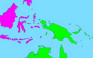
| 12:15, 18 September 2011 |  | 1,276 × 802 (46 KB) | Maphobbyist (talk | contribs) | Map depicting continents according to plate tectonics. The Eastern Sunda Islands and the Moluccas are also part of the Asian tectonic plate. | |
| 12:41, 14 June 2006 |  | 1,276 × 802 (47 KB) | Mac9 (talk | contribs) | Category:Maps of Oceania Category:Maps of Asia |
You cannot overwrite this file.
File usage on Commons
There are no pages that use this file.
File usage on other wikis
The following other wikis use this file: