File:Trafalgar 1200hr-az.png
Jump to navigation
Jump to search
Size of this preview: 635 × 600 pixels. Other resolutions: 254 × 240 pixels | 508 × 480 pixels | 900 × 850 pixels.
Original file (900 × 850 pixels, file size: 102 KB, MIME type: image/png)
Captions
Captions
Add a one-line explanation of what this file represents
Summary
[edit]
| Description |
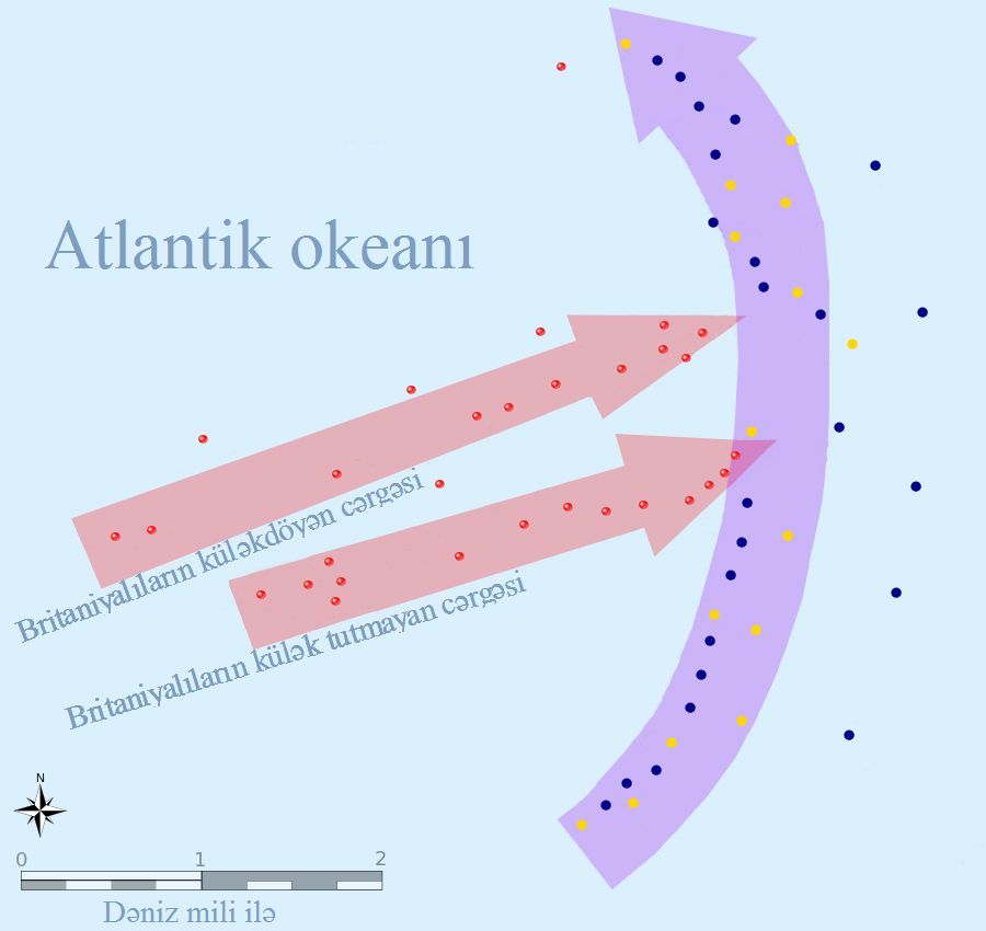
Azərbaycanca: Trafalgar döyüşünün gedişi: Saat 12:00, Trafalqar burnundan 10 dəniz mili şimal şərqdə, Brinaiyalıların küləkdöyən və külək tutmayan iki cərgəsi. Fransa və İspaniya müttəfiqlərinin müdafiə xətti. “Əlahəzrət Royal Soverion” Müttəfiqlərin ön cəbhə xəttini yararkən. North üst və Cape Trafalgar şimal 10 mil. English: This map of the Battle of Trafalgar shows the approximate position of the two fleets at 1200 hours during the battle as the Royal Sovereign was breaking into the Franco-Spanish line. North is to the top, and Cape Trafalgar is 10 miles to the northeast. |
| Date | |
| Source |
|
| Author | Pinpin, Heriberto Arrribas Abato |
Licensing
[edit]
This file is licensed under the Creative Commons Attribution-Share Alike 3.0 Unported license.
- You are free:
- to share – to copy, distribute and transmit the work
- to remix – to adapt the work
- Under the following conditions:
- attribution – You must give appropriate credit, provide a link to the license, and indicate if changes were made. You may do so in any reasonable manner, but not in any way that suggests the licensor endorses you or your use.
- share alike – If you remix, transform, or build upon the material, you must distribute your contributions under the same or compatible license as the original.
File history
Click on a date/time to view the file as it appeared at that time.
| Date/Time | Thumbnail | Dimensions | User | Comment | |
|---|---|---|---|---|---|
| current | 17:05, 23 February 2014 | | 900 × 850 (102 KB) | Tubus (talk | contribs) | User created page with UploadWizard |
You cannot overwrite this file.
File usage on Commons
There are no pages that use this file.
File usage on other wikis
The following other wikis use this file:
- Usage on az.wikipedia.org
- Usage on he.wikipedia.org