File:Tracks south of Hampton Loade - geograph.org.uk - 1552837.jpg
Jump to navigation
Jump to search
No higher resolution available.
Tracks_south_of_Hampton_Loade_-_geograph.org.uk_-_1552837.jpg (640 × 480 pixels, file size: 276 KB, MIME type: image/jpeg)
Captions
Captions
Add a one-line explanation of what this file represents
Summary
[edit]
| Description |
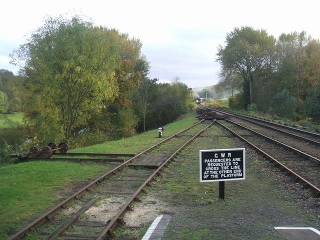
English: Tracks south of Hampton Loade. Track repairs to the points south of the station restrict the station to a single operating platform. The new A1 Pacific 'Tornado' appears around the curve from the direction of Highley.1552785
The railway follows the River Severn as far as Bewdley. |
| Date | |
| Source | From geograph.org.uk |
| Author | John M |
| Attribution (required by the license) | John M / Tracks south of Hampton Loade / |
| Camera location | | View this and other nearby images on: OpenStreetMap |
|---|
_heading:180.00&language=en)
| Object location | | View this and other nearby images on: OpenStreetMap |
|---|
_heading:180.00&language=en)
Licensing
[edit]

|
This image was taken from the Geograph project collection. See this photograph's page on the Geograph website for the photographer's contact details. The copyright on this image is owned by John M and is licensed for reuse under the Creative Commons Attribution-ShareAlike 2.0 license.
|
This file is licensed under the Creative Commons Attribution-Share Alike 2.0 Generic license.
Attribution: John M
- You are free:
- to share – to copy, distribute and transmit the work
- to remix – to adapt the work
- Under the following conditions:
- attribution – You must give appropriate credit, provide a link to the license, and indicate if changes were made. You may do so in any reasonable manner, but not in any way that suggests the licensor endorses you or your use.
- share alike – If you remix, transform, or build upon the material, you must distribute your contributions under the same or compatible license as the original.
File history
Click on a date/time to view the file as it appeared at that time.
| Date/Time | Thumbnail | Dimensions | User | Comment | |
|---|---|---|---|---|---|
| current | 14:54, 3 March 2011 | | 640 × 480 (276 KB) | GeographBot (talk | contribs) | == {{int:filedesc}} == {{Information |description={{en|1=Tracks south of Hampton Loade Track repairs to the points south of the station restrict the station to a single operating platform. The new A1 Pacific 'Tornado' appears around the curve from the dir |
You cannot overwrite this file.
File usage on Commons
There are no pages that use this file.