File:TrK52-Zons.jpg
Jump to navigation
Jump to search
Size of this preview: 582 × 600 pixels. Other resolutions: 233 × 240 pixels | 466 × 480 pixels | 745 × 768 pixels | 994 × 1,024 pixels | 1,987 × 2,048 pixels | 3,853 × 3,971 pixels.
Original file (3,853 × 3,971 pixels, file size: 12.83 MB, MIME type: image/jpeg)
Captions
Captions
Add a one-line explanation of what this file represents
| Description |
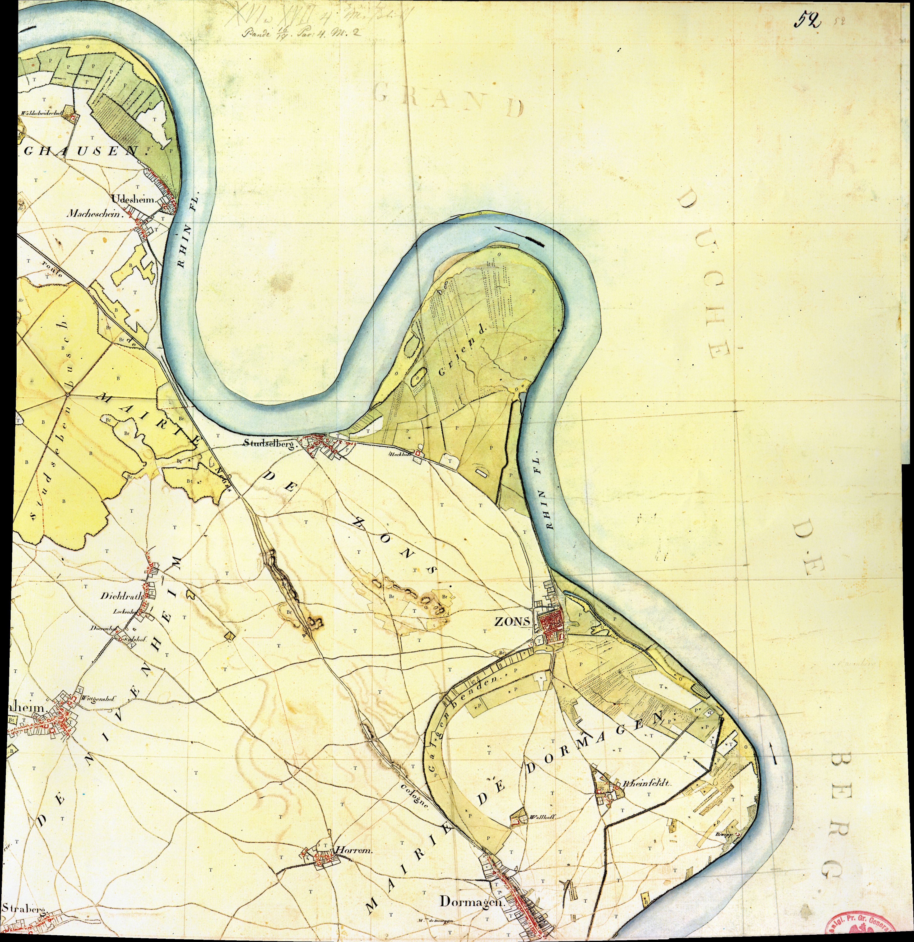
Kartenaufnahme der Rheinlande durch Tranchot und von Müffling 1803-1820Blatt 52 - Zons |
||||
| Date | |||||
| Source | s.o. | ||||
| Author |
Capitaine Ing.-Geograph 2.Klasse Raffy This panoramic image was created with Autostitch (stitched images may differ from reality). |
||||
| Permission (Reusing this file) |
|
||||
Zu den weitere Kartenausschnitten:
| TrK52-Zons_A1.jpg / C2.jpg | |
|---|---|
A1 (oben links) |
A2 (oben rechts) |
B1 (mitte links) |
B2 (mitte rechts) |
C1 (unten links) |
C2 (unten rechts) |
File history
Click on a date/time to view the file as it appeared at that time.
| Date/Time | Thumbnail | Dimensions | User | Comment | |
|---|---|---|---|---|---|
| current | 06:33, 25 September 2008 | | 3,853 × 3,971 (12.83 MB) | Marku1988 (talk | contribs) | {{Information |Description=Kartenaufnahme der Rheinlande durch Tranchot und von Müffling 1803-1820<br>'''Blatt 52 - Zons''' |Source=s.o. |Date=1807 |Author=Capitaine Ing.-Geograph 2.Klasse Raffy<br/>) ''(Scan & Repro)'' Kateer 18:24, 29 A |
You cannot overwrite this file.
File usage on Commons
The following page uses this file: