File:Township and sectional map of Mobile County, State of Alabama - compiled and drawn from the most reliable and recent data - showing the railroads, public roads, school houses, Old Spanish & other LOC 2011590019.jpg
Jump to navigation
Jump to search

Size of this preview: 433 × 599 pixels. Other resolutions: 173 × 240 pixels | 347 × 480 pixels | 555 × 768 pixels | 740 × 1,024 pixels | 1,481 × 2,048 pixels | 8,211 × 11,357 pixels.
Original file (8,211 × 11,357 pixels, file size: 15.9 MB, MIME type: image/jpeg)
Captions
Captions
Add a one-line explanation of what this file represents
Summary
[edit]| Warning | The original file is very high-resolution. It might not load properly or could cause your browser to freeze when opened at full size. |
|---|
| Description |
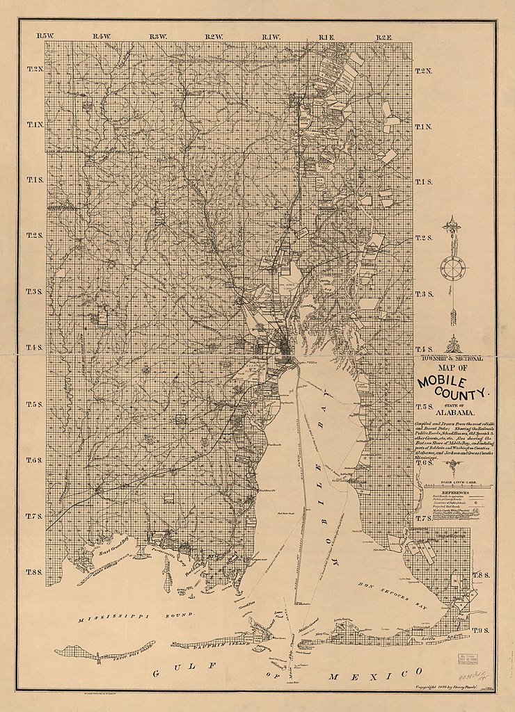
English: Black line print. "Also showing the eastern shore of Mobile Bay, and including parts of Baldwin and Washington counties, Alabama, and Jackson and Green counties, Mississippi. Includes election precincts information. LC Land ownership maps, 5 Available also through the Library of Congress Web site as a raster image. |
||
| Title | Township and sectional map of Mobile County, State of Alabama : compiled and drawn from the most reliable and recent data : showing the railroads, public roads, school houses, Old Spanish & other grants, etc., etc. | ||
| Shelf ID | G3973.M6 1895 .F6 | ||
| Date | |||
| Source | https://www.loc.gov/item/2011590019/ | ||
| Author | Fondé, Henry | ||
| Permission (Reusing this file) |
|
||
| Other versions |
|
||
| Location | United States · Mobile County · Alabama | ||
| Part of | American Memory · Catalog · County Landownership Maps · Geography And Map Division · Cultural Landscapes | ||
| Subject | Cadastral Maps · Mobile County · Election Districts · United States · Maps · Alabama · Landowners · Mobile County (Ala.) |


Licensing
[edit]
|
This is a faithful photographic reproduction of a two-dimensional, public domain work of art. The work of art itself is in the public domain for the following reason:
The official position taken by the Wikimedia Foundation is that "faithful reproductions of two-dimensional public domain works of art are public domain".
This photographic reproduction is therefore also considered to be in the public domain in the United States. In other jurisdictions, re-use of this content may be restricted; see Reuse of PD-Art photographs for details. | ||||
File history
Click on a date/time to view the file as it appeared at that time.
| Date/Time | Thumbnail | Dimensions | User | Comment | |
|---|---|---|---|---|---|
| current | 23:19, 2 August 2018 | | 8,211 × 11,357 (15.9 MB) | Fæ (talk | contribs) | LOC Maps https://www.loc.gov/item/2011590019/ #20134 |
You cannot overwrite this file.
File usage on Commons
The following page uses this file: