File:Towards Patrington on Welwick Road (geograph 5471128).jpg
Jump to navigation
Jump to search
No higher resolution available.
Towards_Patrington_on_Welwick_Road_(geograph_5471128).jpg (640 × 553 pixels, file size: 453 KB, MIME type: image/jpeg)
Captions
Captions
Add a one-line explanation of what this file represents
Summary
[edit].jpg&action=edit§ion=1)
| Description |
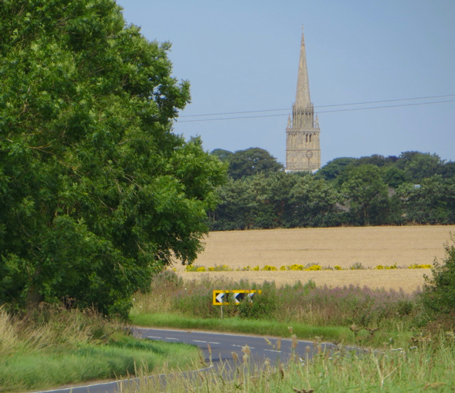
English: Towards Patrington, East Riding of Yorkshire, England. On Welwick Road. Looking west on the B1445; the spire of St Patrick's at Patrington, at 189 feet high, is a prominent landmark in the area. |
| Date | |
| Source | From geograph.org.uk |
| Author | Paul Harrop |
| Permission (Reusing this file) |
Creative Commons Attribution Share-alike license 2.0 |
| Attribution (required by the license) | Paul Harrop / Towards Patrington on Welwick Road / |
| Camera location | | View this and other nearby images on: OpenStreetMap |
|---|
.jpg¶ms=053.676403_N_0000.005191_E_globe:Earth_type:camera_source:geograph-osgb36(TA32552186)_heading:292.00&language=en)
| Object location | | View this and other nearby images on: OpenStreetMap |
|---|
.jpg¶ms=053.676790_N_0000.003540_E_globe:Earth_class:object_type:object_source:geograph-osgb36(TA32442190)_heading:292.00&language=en)
Licensing
[edit].jpg&action=edit§ion=2)

|
This image was taken from the Geograph project collection. See this photograph's page on the Geograph website for the photographer's contact details. The copyright on this image is owned by Paul Harrop and is licensed for reuse under the Creative Commons Attribution-ShareAlike 2.0 license.
|
This file is licensed under the Creative Commons Attribution-Share Alike 2.0 Generic license.
Attribution: Paul Harrop
- You are free:
- to share – to copy, distribute and transmit the work
- to remix – to adapt the work
- Under the following conditions:
- attribution – You must give appropriate credit, provide a link to the license, and indicate if changes were made. You may do so in any reasonable manner, but not in any way that suggests the licensor endorses you or your use.
- share alike – If you remix, transform, or build upon the material, you must distribute your contributions under the same or compatible license as the original.
File history
Click on a date/time to view the file as it appeared at that time.
| Date/Time | Thumbnail | Dimensions | User | Comment | |
|---|---|---|---|---|---|
| current | 19:03, 27 January 2022 | | 640 × 553 (453 KB) | Keith D (talk | contribs) | == {{int:filedesc}} == {{Information |Description={{en|1=Towards Patrington, East Riding of Yorkshire, England.<br />On Welwick Road. Looking west on the B1445; the spire of St Patrick's at Patrington, at 189 feet high, is a prominent landmark in the area.}} |Source=From [https://www.geograph.org.uk/photo/5471128 geograph.org.uk] |Date=2017-07-18 |Author=[https://www.geograph.org.uk/profile/13364 Paul Harrop] |Permission=Creative Commons Att... |
You cannot overwrite this file.
File usage on Commons
There are no pages that use this file.
Metadata
.jpg&oldid=893003324)
Categories:
- Patrington
- Roads in the East Riding of Yorkshire
- B1445 road (England)
- Fields in the East Riding of Yorkshire
- Trees in the East Riding of Yorkshire
- Chevron warning road signs in the East Riding of Yorkshire
- Church spires in the East Riding of Yorkshire
- St Patrick's Church, Patrington
- July 2017 in the East Riding of Yorkshire