File:Tourrettes-sur-Loup Viaduc de Pascaressa (Arche Ouest)(Côté sud).JPG
Jump to navigation
Jump to search
Size of this preview: 800 × 600 pixels. Other resolutions: 320 × 240 pixels | 640 × 480 pixels | 1,024 × 768 pixels | 1,280 × 960 pixels | 2,592 × 1,944 pixels.
Original file (2,592 × 1,944 pixels, file size: 1.42 MB, MIME type: image/jpeg)
Captions
Captions
Add a one-line explanation of what this file represents
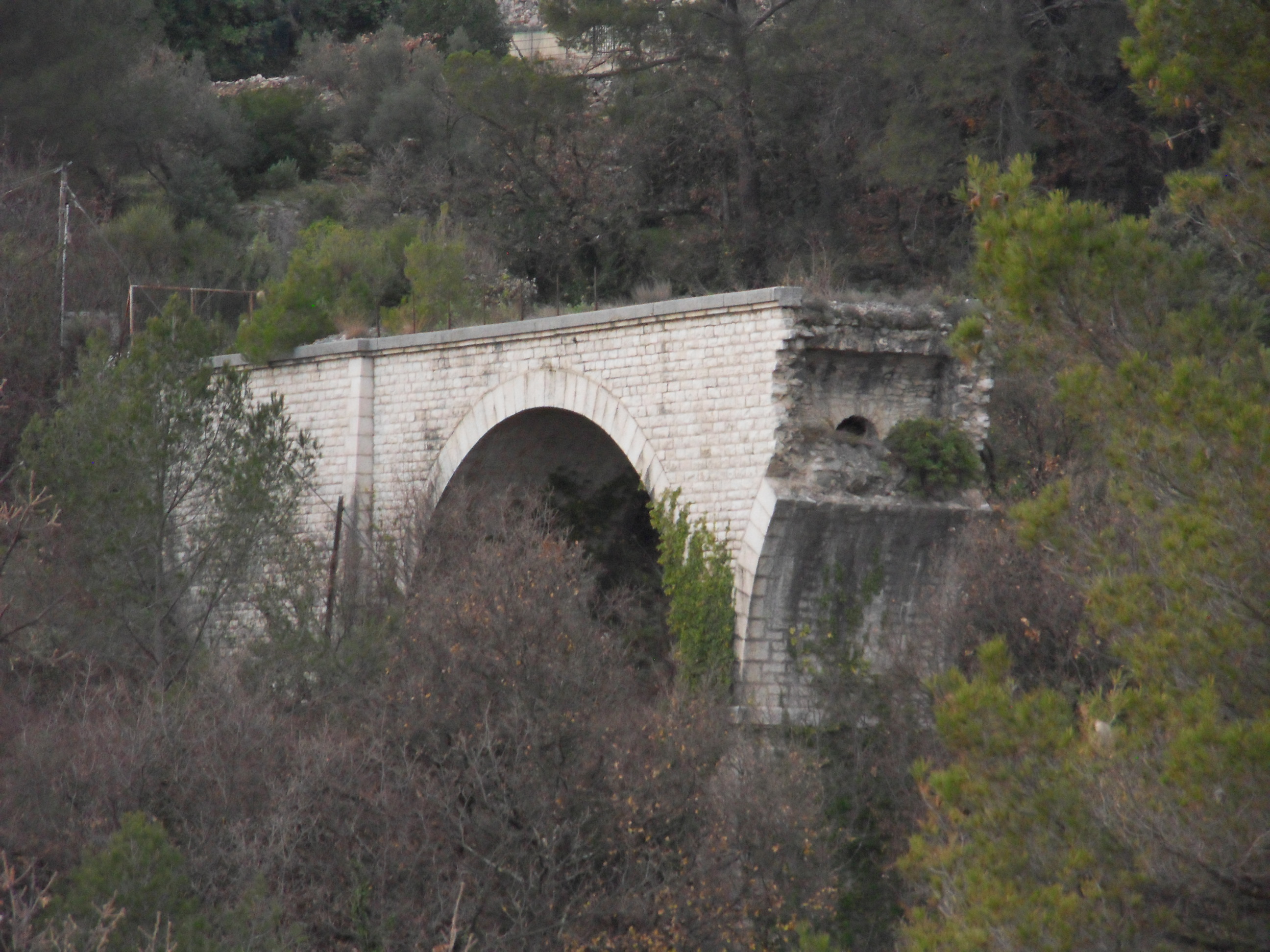
| Description | Ligne Central-Var. Localité de Tourrettes-sur-Loup. Viaduc de Pascaressa (Première arche côté Grasse, côté sud). Détruit par l'armée allemande lors de sa retraite le 24 Août 1944 |
| Date | |
| Source | Own work |
| Author | G CHP |
| Permission (Reusing this file) |
Attribution ShareAlike 2.5 |
| Object location | | View this and other nearby images on: OpenStreetMap |
|---|
(C%C3%B4t%C3%A9_sud).JPG¶ms=043.711378_N_0007.059497_E_globe:Earth_class:object_type:object__&language=en)
This file is licensed under the Creative Commons Attribution-Share Alike 2.5 Generic license.
- You are free:
- to share – to copy, distribute and transmit the work
- to remix – to adapt the work
- Under the following conditions:
- attribution – You must give appropriate credit, provide a link to the license, and indicate if changes were made. You may do so in any reasonable manner, but not in any way that suggests the licensor endorses you or your use.
- share alike – If you remix, transform, or build upon the material, you must distribute your contributions under the same or compatible license as the original.
File history
Click on a date/time to view the file as it appeared at that time.
| Date/Time | Thumbnail | Dimensions | User | Comment | |
|---|---|---|---|---|---|
| current | 14:51, 29 March 2016 | | 2,592 × 1,944 (1.42 MB) | G CHP (talk | contribs) | {{Information |Description= Ligne Central-Var. Localité de Tourrettes-sur-Loup. Viaduc de Pascaressa (Première arche côté Grasse, côté sud). Détruit par l'armée allemande lors de sa retrait... |
You cannot overwrite this file.
File usage on Commons
The following page uses this file:
(Côté_sud).JPG&oldid=813574728)