File:Tottenham Green from the northwest corner.jpg
Original file (4,000 × 3,000 pixels, file size: 3.29 MB, MIME type: image/jpeg)
Captions
Captions
Summary
[edit]
| Description |
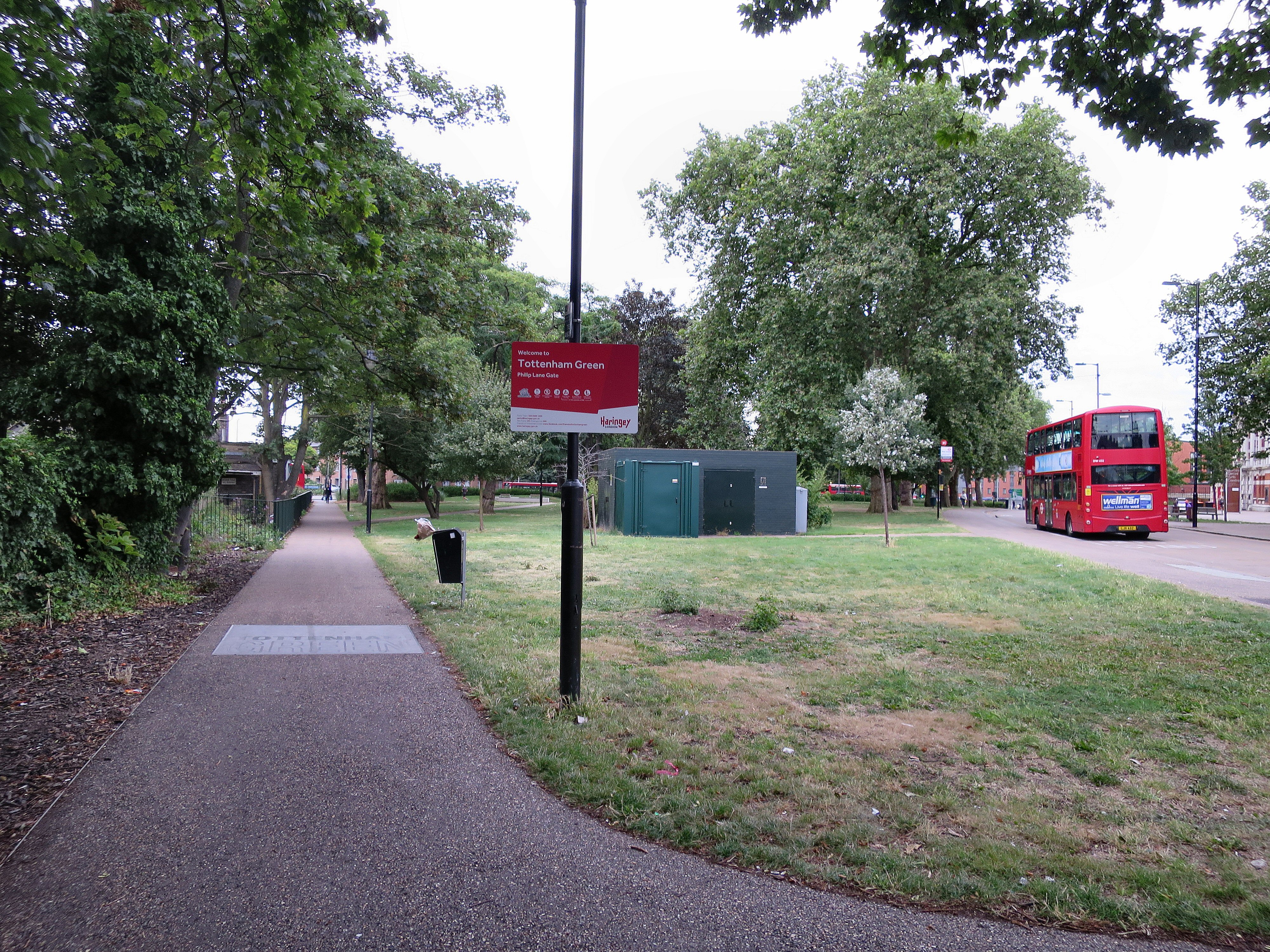
English: The Gate that Ain't
Calling this spot "The Philip Lane Gate" makes no sense. There is no gate in the sense of an entrance or opening. Maybe somebody thought they were dealing with a rather more prestigious park with fences and railings and attractive ornamental wrought ironwork - including some sort of gap or gate. But there are almost no railings on the triangular western part of the Green. Currently (2016) this has no fencing or railings on its western and eastern sides. The land to the north is fenced, as it belongs to Holy Trinity Church. Calling it a gate makes no sense even if it's intended to be a helpful direction finder. Tottenham Green can also be entered from the eastern end of Philip Lane at the junction with High Road Tottenham. So suggesting for instance that people meet at "The Philip Lane Gate" would be confusing. Camouflaging the Electricity Sub-Station The electrical substation on Tottenham Green is inside an ugly brick box. It used to pose problems as the access path road was used to store equipment, and it was at one time abused by some people as an outdoor latrine. Therefore painting it green is sensible. So is the planting which camouflages the brickwork to some extent. Two cheers for this big change for the better. Why not three cheers? Because the best solution would have been removing it altogether. A beautiful public green is not an appropriate place for an electrical substation. Of course, if the Green not properly maintained by Haringey Council and left to become patches of brown mud with a few overpriced stalls at the weekend ..... |
| Date | |
| Source | https://www.flickr.com/photos/53921762@N00/29010021891/ |
| Author | Alan Stanton |
| Camera location | | View this and other nearby images on: OpenStreetMap |
|---|
Licensing
[edit]
- You are free:
- to share – to copy, distribute and transmit the work
- to remix – to adapt the work
- Under the following conditions:
- attribution – You must give appropriate credit, provide a link to the license, and indicate if changes were made. You may do so in any reasonable manner, but not in any way that suggests the licensor endorses you or your use.
- share alike – If you remix, transform, or build upon the material, you must distribute your contributions under the same or compatible license as the original.
| This image was originally posted to Flickr by Alan Stanton at https://flickr.com/photos/53921762@N00/29010021891. It was reviewed on 21 December 2021 by FlickreviewR 2 and was confirmed to be licensed under the terms of the cc-by-sa-2.0. |
File history
Click on a date/time to view the file as it appeared at that time.
| Date/Time | Thumbnail | Dimensions | User | Comment | |
|---|---|---|---|---|---|
| current | 23:25, 21 December 2021 | | 4,000 × 3,000 (3.29 MB) | Oxyman (talk | contribs) | Uploaded a work by Alan Stanton from https://www.flickr.com/photos/53921762@N00/29010021891/ with UploadWizard |
You cannot overwrite this file.
File usage on Commons
There are no pages that use this file.