File:Topographischer Atlas des Koenigreichs Württemberg - Titelblatt (cropped).jpg

Original file (1,008 × 1,175 pixels, file size: 1.14 MB, MIME type: image/jpeg)
Captions
Captions
Summary
[edit].jpg&action=edit§ion=1)
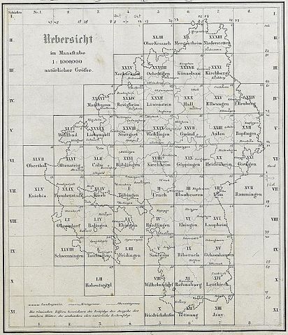
| Description | Topografischer Atlas des Königreichs Württemberg, Titelblatt (Ausschnitt) |
| Date | |
| Source |
Topographischer Atlas des Koenigreichs Württemberg: im Masstabe 1 : 50 000; in 55 Blättern; 1821–1851. Stuttgart, Tübingen, 1851. Scan: Universitätsbibliothek Tübingen, LI 9. |
| Author | Statistisch-Topographisches Bureau des Königreichs Württemberg |
| Other versions | File:Topographischer Atlas des Koenigreichs Württemberg - Titelblatt.jpg |
Licensing
[edit].jpg&action=edit§ion=2)
|
This work is in the public domain in its country of origin and other countries and areas where the copyright term is the author's life plus 70 years or fewer.
| |
| This file has been identified as being free of known restrictions under copyright law, including all related and neighboring rights. | |
| Annotations | This image is annotated: View the annotations at Commons |
.jpg)
File history
Click on a date/time to view the file as it appeared at that time.
| Date/Time | Thumbnail | Dimensions | User | Comment | |
|---|---|---|---|---|---|
| current | 07:04, 31 August 2016 | | 1,008 × 1,175 (1.14 MB) | Torana (talk | contribs) | {{Information |Description=''Topografischer Atlas des Königreichs Württemberg'', Titelblatt (Ausschnitt) |Source=''Topographischer Atlas des Koenigreichs Württemberg: im Masstabe 1 : 50 000; in 55 Blättern; 1821–1851.'' Stuttgart, Tübingen, 1851... |
You cannot overwrite this file.
File usage on Commons
The following page uses this file:
File usage on other wikis
The following other wikis use this file:
- Usage on sv.wikipedia.org
Metadata
.jpg&oldid=806602726)
- Topographischer Atlas des Königreichs Württemberg
- Topographischer Atlas des Koenigreichs Württemberg (Universitätsbibiothek Tübingen)
- Topographischer Atlas des Koenigreichs Württemberg (Universitätsbibiothek Tübingen) by districts of Baden-Württemberg
- Topographischer Atlas des Koenigreichs Württemberg (Universitätsbibiothek Tübingen) maps of Main-Tauber-Kreis