File:Topographische karte grossherzogthum baden 5.png
Jump to navigation
Jump to search
Size of this preview: 601 × 599 pixels. Other resolutions: 241 × 240 pixels | 481 × 480 pixels | 770 × 768 pixels | 1,027 × 1,024 pixels | 2,054 × 2,048 pixels | 3,550 × 3,539 pixels.
Original file (3,550 × 3,539 pixels, file size: 22.61 MB, MIME type: image/png)
Captions
Captions
Add a one-line explanation of what this file represents
Summary
[edit]
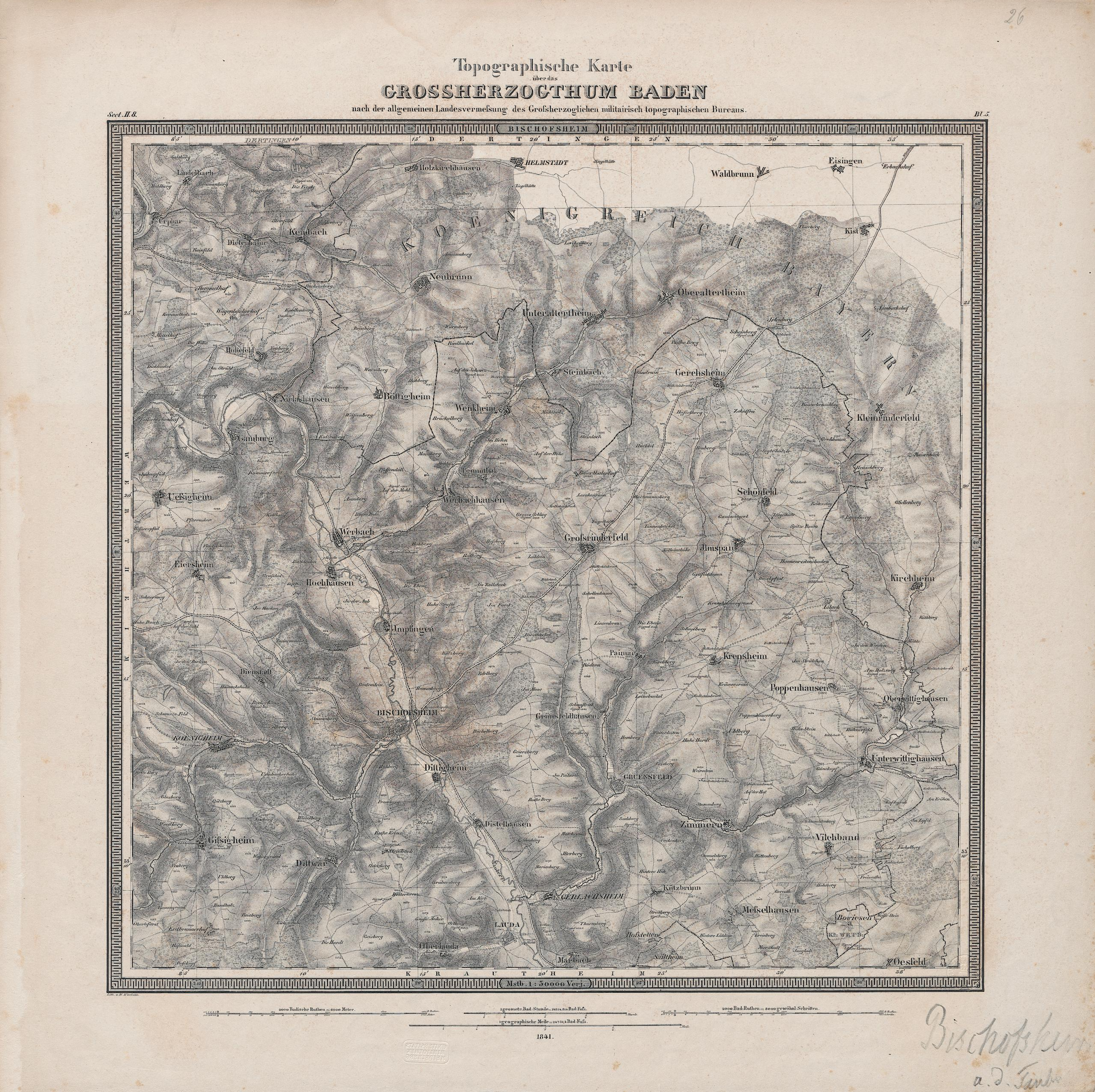
| Description | Topographische Karte über das Grossherzogthum Baden, Blatt Bischofsheim |
| Source | Universitätsbibliothek Heidelberg Ministerium für Wissenschaft, Forschung und Kunst Baden-Württemberg |
| Author | W. Winckens, V. Mayer (Verlag:Militairisch Topographisches Bureau) |
Licensing
[edit]
This file is licensed under the Creative Commons Attribution-Share Alike 3.0 Germany license.
- You are free:
- to share – to copy, distribute and transmit the work
- to remix – to adapt the work
- Under the following conditions:
- attribution – You must give appropriate credit, provide a link to the license, and indicate if changes were made. You may do so in any reasonable manner, but not in any way that suggests the licensor endorses you or your use.
- share alike – If you remix, transform, or build upon the material, you must distribute your contributions under the same or compatible license as the original.

File history
Click on a date/time to view the file as it appeared at that time.
| Date/Time | Thumbnail | Dimensions | User | Comment | |
|---|---|---|---|---|---|
| current | 18:41, 25 December 2017 | | 3,550 × 3,539 (22.61 MB) | Lutzto (talk | contribs) |
You cannot overwrite this file.
File usage on Commons
The following page uses this file: