File:Topographical survey sheets of the borough of the Bronx easterly of the Bronx River (1905) Sheet 11.jpg
Jump to navigation
Jump to search

Size of this preview: 638 × 599 pixels. Other resolutions: 255 × 240 pixels | 511 × 480 pixels | 817 × 768 pixels | 1,090 × 1,024 pixels | 2,180 × 2,048 pixels | 5,575 × 5,238 pixels.
Original file (5,575 × 5,238 pixels, file size: 26.14 MB, MIME type: image/jpeg)
Captions
Captions
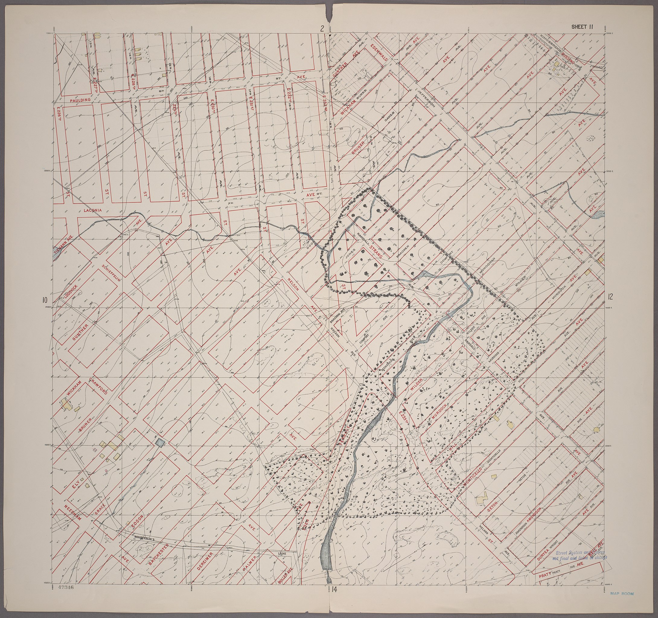
Topographical survey sheets of the borough of the Bronx easterly of the Bronx River [1905]
Summary
[edit]_Sheet_11.jpg&action=edit§ion=1)
| Description |
English: Sheet 11: Grid #12000E - 16000E, #11000N - 15000N. [Includes Murdock Avenue, Wilder Avenue, Rattlesnake Creek, Gunther Avenue, Wickham Avenue, Bruner Avenue,Ely Avenue, Edgewald (Wakefield), Edenwald Avenue, (Seton Falls Park upto Wilder Avenue) and (New York City Subway shops and Yards).] |
| Date | |
| Source |
New York Public Library Digital Collections https://digitalcollections.nypl.org/items/510d47e2-58da-a3d9-e040-e00a18064a99 |
| Author | Unknown author |
Licensing
[edit]_Sheet_11.jpg&action=edit§ion=2)
This work is in the public domain in the United States because it was published (or registered with the U.S. Copyright Office) before January 1, 1929.
Public domain works must be out of copyright in both the United States and in the source country of the work in order to be hosted on the Commons. If the work is not a U.S. work, the file must have an additional copyright tag indicating the copyright status in the source country.
Note: This tag should not be used for sound recordings. |
File history
Click on a date/time to view the file as it appeared at that time.
| Date/Time | Thumbnail | Dimensions | User | Comment | |
|---|---|---|---|---|---|
| current | 01:42, 14 June 2020 | | 5,575 × 5,238 (26.14 MB) | RoySmith (talk | contribs) | Uploaded a work by Unknown from New York Public Library Digital Collections https://digitalcollections.nypl.org/items/510d47e2-58da-a3d9-e040-e00a18064a99 with UploadWizard |
You cannot overwrite this file.
File usage on Commons
There are no pages that use this file.
File usage on other wikis
The following other wikis use this file:
- Usage on en.wikipedia.org
_Sheet_11.jpg&oldid=848132838)