File:Topographic map of the Island of Niihau, Kauai County, Hawaii LOC 2005625309.jpg
Jump to navigation
Jump to search
Size of this preview: 523 × 600 pixels. Other resolutions: 209 × 240 pixels | 418 × 480 pixels | 670 × 768 pixels | 893 × 1,024 pixels | 1,786 × 2,048 pixels | 5,560 × 6,377 pixels.
Original file (5,560 × 6,377 pixels, file size: 4.84 MB, MIME type: image/jpeg)
Captions
Captions
Add a one-line explanation of what this file represents
Summary
[edit]| Description |
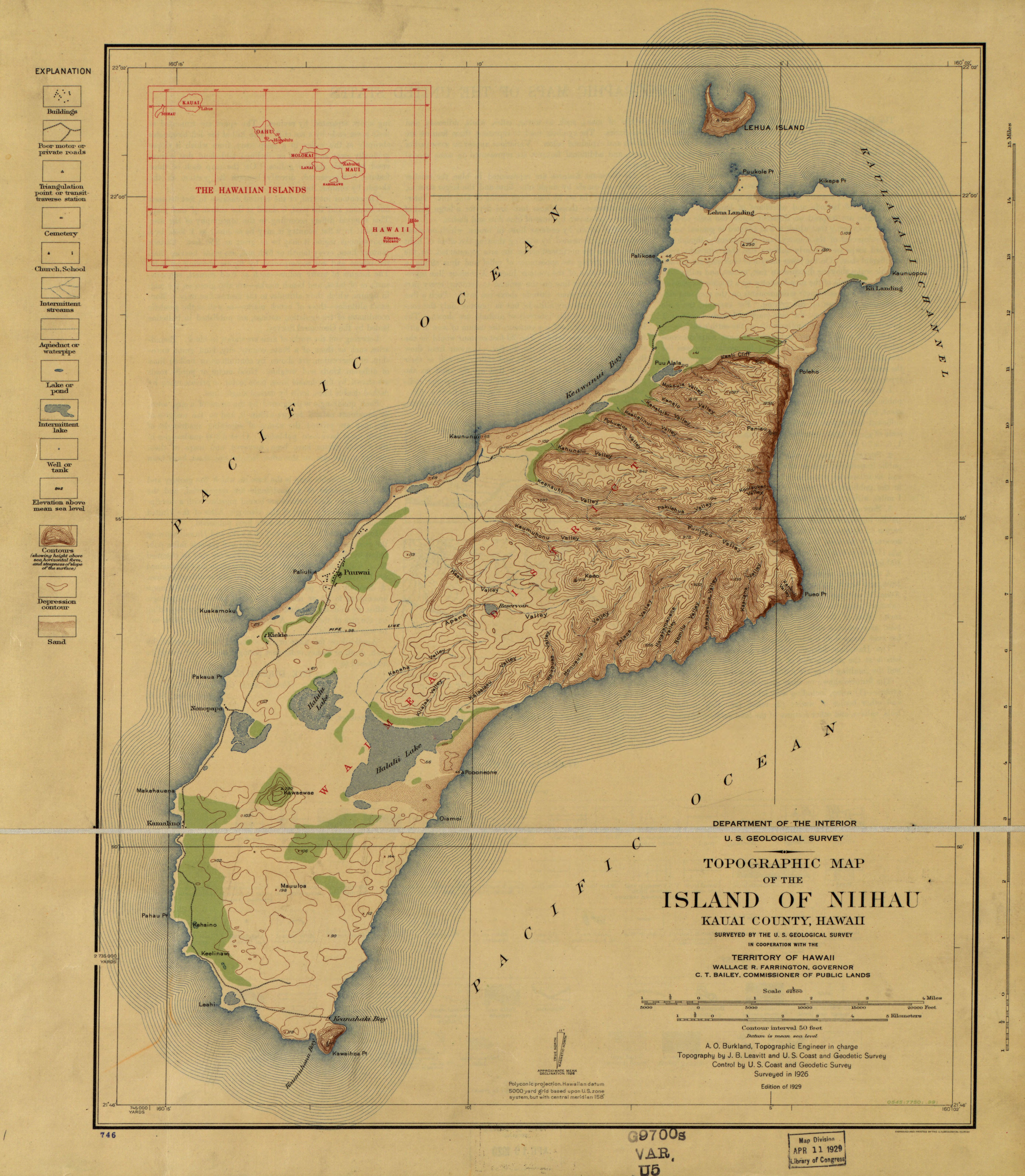
English: Relief shown by contours and spot heights. LC Hawaii, 16 Surveyed in 1926. Datum is mean sea level. Inset: The Hawaiian Islands. Available also through the Library of Congress Web site as a raster image. |
||
| Title | Topographic map of the Island of Niihau, Kauai County, Hawaii | ||
| Shelf ID | G4382.N5 1926 .U5 | ||
| Date | |||
| Source | https://www.loc.gov/item/2005625309/ | ||
| Author | Geological Survey (U.S.) | ||
| Permission (Reusing this file) |
|
||
| Other versions |
|
||
| Location | Niihau · United States · Hawaii | ||
| Part of | American Memory · General Maps · Catalog · Geography And Map Division | ||
| Subject | United States · Niihau (Hawaii) · Niihau · Hawaii · Maps, Topographic |


Licensing
[edit]
|
This is a faithful photographic reproduction of a two-dimensional, public domain work of art. The work of art itself is in the public domain for the following reason:
The official position taken by the Wikimedia Foundation is that "faithful reproductions of two-dimensional public domain works of art are public domain".
This photographic reproduction is therefore also considered to be in the public domain in the United States. In other jurisdictions, re-use of this content may be restricted; see Reuse of PD-Art photographs for details. | ||||
File history
Click on a date/time to view the file as it appeared at that time.
| Date/Time | Thumbnail | Dimensions | User | Comment | |
|---|---|---|---|---|---|
| current | 21:35, 22 May 2018 | | 5,560 × 6,377 (4.84 MB) | Fæ (talk | contribs) | LOC Maps https://www.loc.gov/item/2005625309/ #13459 |
You cannot overwrite this file.
File usage on Commons
The following 2 pages use this file: