File:Topographic map of Tenerife-en.svg
Jump to navigation
Jump to search

Size of this PNG preview of this SVG file: 800 × 592 pixels. Other resolutions: 320 × 237 pixels | 640 × 473 pixels | 1,024 × 757 pixels | 1,280 × 947 pixels | 2,560 × 1,894 pixels | 1,045 × 773 pixels.
Original file (SVG file, nominally 1,045 × 773 pixels, file size: 505 KB)
Captions
Captions
Add a one-line explanation of what this file represents
Summary
[edit]| Description |
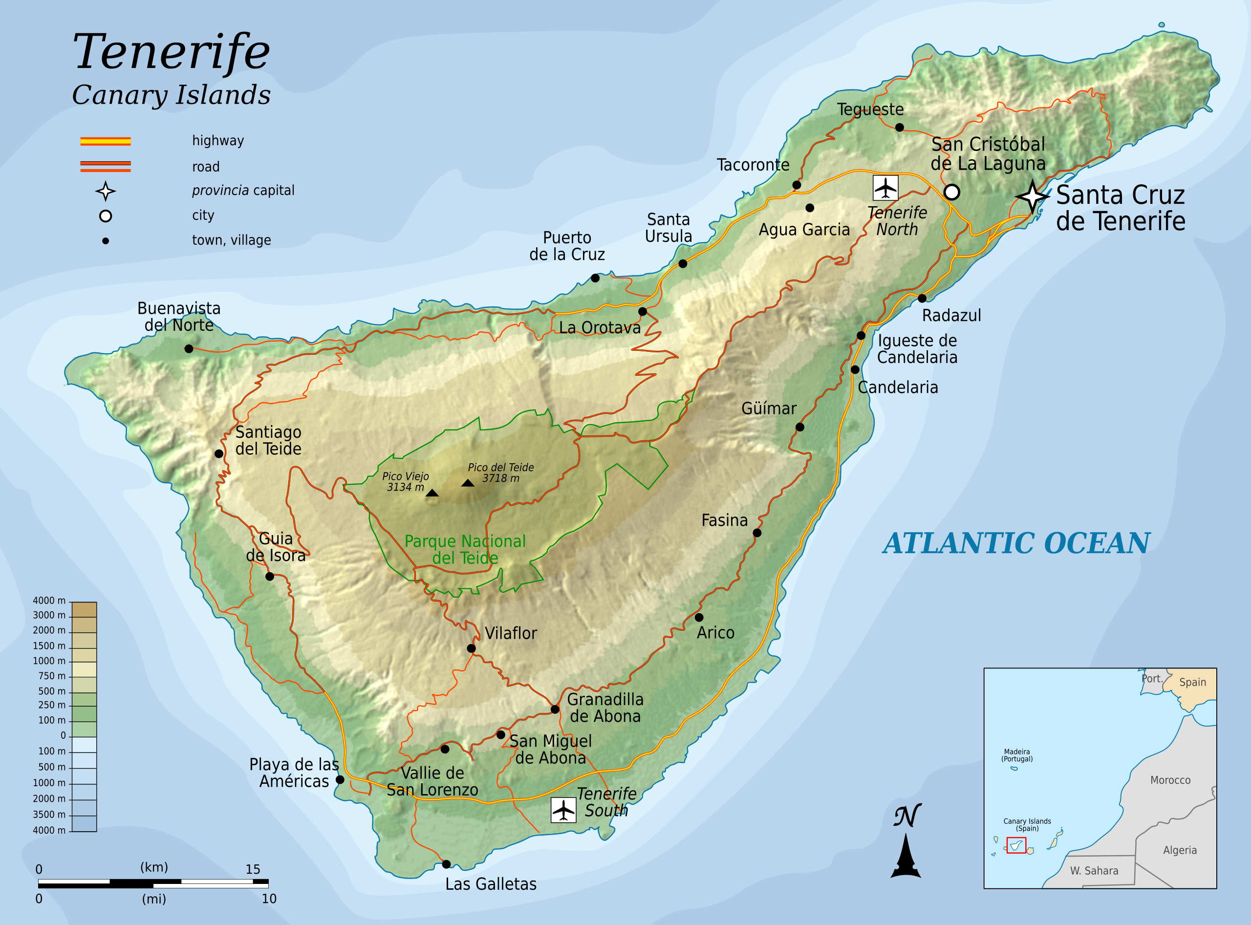
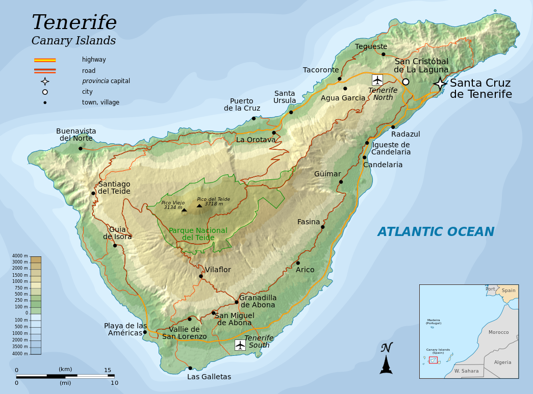
English: Topographic map of Tenerife, an island of the Canary Islands of Spain. |
| Date | |
| Source |
Self-made in Inkscape.
|
| Author | Oona Räisänen (Mysid) |
| Other versions |
|


|
This SVG file contains embedded text that can be translated into your language, using any capable SVG editor, text editor or the SVG Translate tool. For more information see: About translating SVG files. |
This W3C-invalid vector image was created with Inkscape by v .
Licensing
[edit]
I, the copyright holder of this work, hereby publish it under the following licenses:
This file is licensed under the Creative Commons Attribution-Share Alike 3.0 Unported license.
- You are free:
- to share – to copy, distribute and transmit the work
- to remix – to adapt the work
- Under the following conditions:
- attribution – You must give appropriate credit, provide a link to the license, and indicate if changes were made. You may do so in any reasonable manner, but not in any way that suggests the licensor endorses you or your use.
- share alike – If you remix, transform, or build upon the material, you must distribute your contributions under the same or compatible license as the original.

|
Permission is granted to copy, distribute and/or modify this document under the terms of the GNU Free Documentation License, Version 1.2 or any later version published by the Free Software Foundation; with no Invariant Sections, no Front-Cover Texts, and no Back-Cover Texts. A copy of the license is included in the section entitled GNU Free Documentation License. |
You may select the license of your choice.
File history
Click on a date/time to view the file as it appeared at that time.
| Date/Time | Thumbnail | Dimensions | User | Comment | |
|---|---|---|---|---|---|
| current | 06:25, 6 August 2010 | | 1,045 × 773 (505 KB) | Mysid (talk | contribs) | more roads + north reference |
| 21:45, 5 August 2010 |  | 1,045 × 773 (466 KB) | Mysid (talk | contribs) | add northern airport | |
| 20:30, 5 August 2010 |  | 1,045 × 773 (463 KB) | Mysid (talk | contribs) | fonts | |
| 20:26, 5 August 2010 |  | 1,045 × 773 (463 KB) | Mysid (talk | contribs) | {{Information |Description={{en|1=Topographic map of Tenerife, and island of the Canary Islands of Spain.}} |Source=Self-made in Inkscape. |Author=Mysid |Date=2010-08-05 |Permission= |other_versions= }} {{translation possib |
You cannot overwrite this file.
File usage on Commons
The following 2 pages use this file:
File usage on other wikis
The following other wikis use this file:
- Usage on cs.wikipedia.org
- Usage on en.wikipedia.org
- Usage on fi.wikipedia.org
- Usage on fr.wikipedia.org
- Usage on hr.wikipedia.org
- Usage on hu.wikipedia.org
- Usage on ko.wikipedia.org
- Usage on mr.wikipedia.org
- Usage on nl.wikipedia.org
- Usage on pnb.wikipedia.org
- Usage on ru.wikipedia.org
- Usage on sl.wikipedia.org
- Usage on tr.wikipedia.org
- Usage on zh.wikipedia.org