File:Topografischer Netzplan S-Bahn Hamburg.png
Jump to navigation
Jump to search
Size of this preview: 800 × 529 pixels. Other resolutions: 320 × 212 pixels | 640 × 423 pixels | 1,024 × 677 pixels | 1,280 × 847 pixels | 2,509 × 1,660 pixels.
Original file (2,509 × 1,660 pixels, file size: 1.31 MB, MIME type: image/png)
Captions
Captions
Add a one-line explanation of what this file represents
Summary
[edit]
| Description |
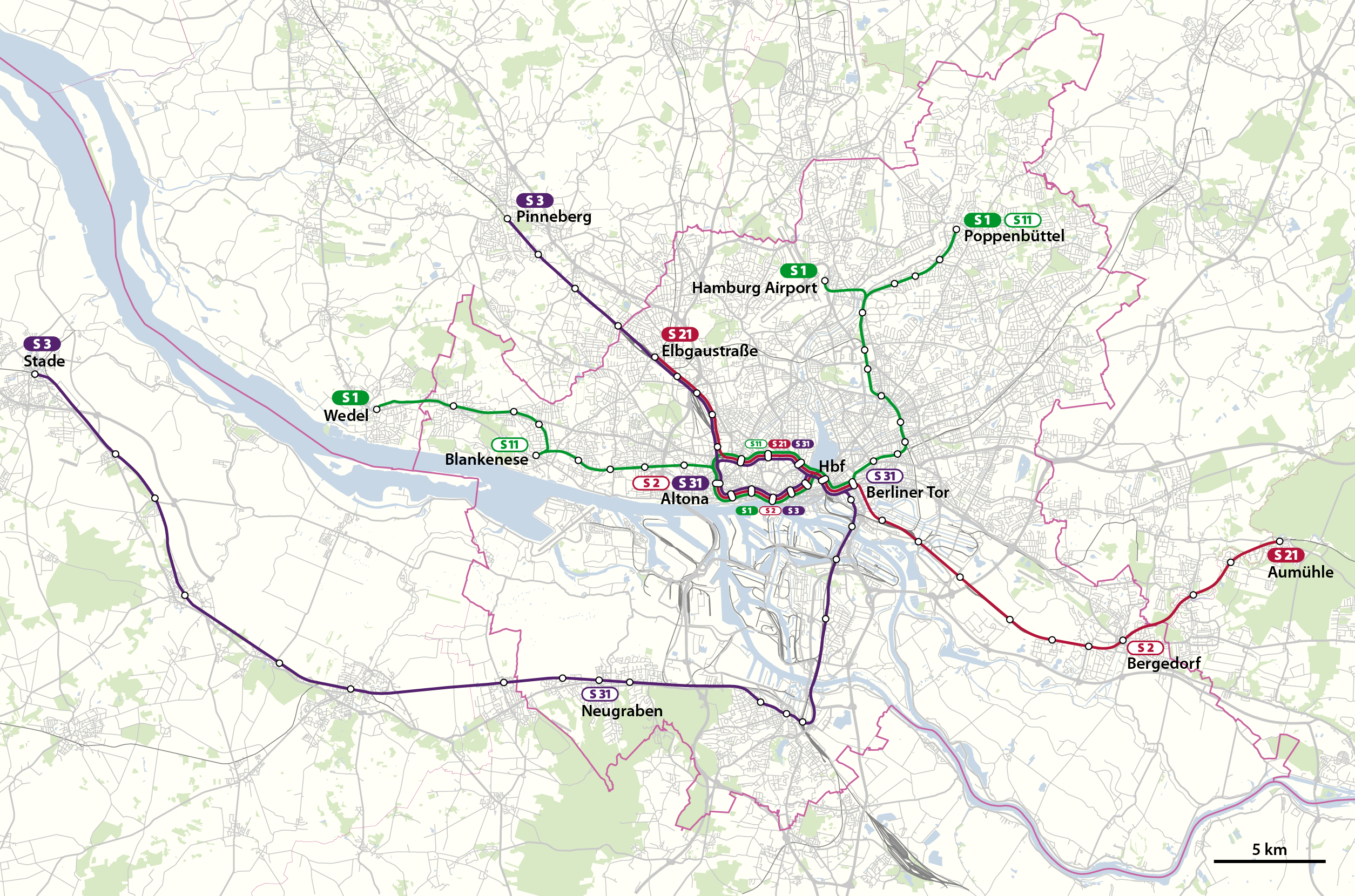
Deutsch: Topographischer Netzplan der S-Bahn Hamburg bis Dezember 2023
English: Topographical network map of the Hamburg S-Bahn until Dec 2023 |
||||||||||||
| Date | |||||||||||||
| Source | Own work, using OpenStreetMap data | ||||||||||||
| Author | NordNordWest | ||||||||||||
| Permission (Reusing this file) |
|

|
This map has been made or improved in the German Kartenwerkstatt (Map Lab). You can propose maps to improve as well.
|
File history
Click on a date/time to view the file as it appeared at that time.
| Date/Time | Thumbnail | Dimensions | User | Comment | |
|---|---|---|---|---|---|
| current | 16:40, 14 December 2019 | | 2,509 × 1,660 (1.31 MB) | NordNordWest (talk | contribs) | upd |
| 18:17, 25 January 2011 |  | 2,509 × 1,660 (1.17 MB) | NordNordWest (talk | contribs) | upd | |
| 16:24, 14 February 2010 |  | 2,509 × 1,660 (1 MB) | NordNordWest (talk | contribs) | c | |
| 17:09, 13 February 2010 |  | 2,509 × 1,660 (1.01 MB) | NordNordWest (talk | contribs) | + | |
| 17:45, 7 February 2010 |  | 2,509 × 1,660 (1 MB) | NordNordWest (talk | contribs) | + | |
| 21:05, 6 February 2010 |  | 1,361 × 900 (456 KB) | NordNordWest (talk | contribs) | == {{int:filedesc}} == {{Information |Description= {{de|Topographischer Netzplan der S-Bahn Hamburg}} {{en|Topographical network map of the Hamburg S-Bahn}} |Source={{Own}}, using OpenStreetMap data |Date=201 |
You cannot overwrite this file.
File usage on Commons
The following 8 pages use this file:
- S-Bahn Hamburg
- User:Chumwa/OgreBot/Potential transport maps/2019 December 11-20
- User:Chumwa/OgreBot/Public transport information/2019 December 11-20
- User:Chumwa/OgreBot/Transport Maps/2019 December 11-20
- User:Clic/Nahverkehr in Deutschland/2019 December 11-20
- User:NordNordWest/Gallery/Maps
- User:Nordlicht8/Rail Germany/2019 December 11-20
- Category:S-Bahn Hamburg
File usage on other wikis
The following other wikis use this file:
- Usage on de.wikipedia.org
- Usage on hu.wikipedia.org
- Usage on nl.wikipedia.org
- Usage on www.wikidata.org