File:Topo karta generalstab GM.jpg
Jump to navigation
Jump to search

Size of this preview: 698 × 600 pixels. Other resolutions: 280 × 240 pixels | 559 × 480 pixels | 894 × 768 pixels | 1,192 × 1,024 pixels | 2,385 × 2,048 pixels | 5,223 × 4,486 pixels.
Original file (5,223 × 4,486 pixels, file size: 4.51 MB, MIME type: image/jpeg)
Captions
Captions
Add a one-line explanation of what this file represents
Summary
[edit]
| Description |
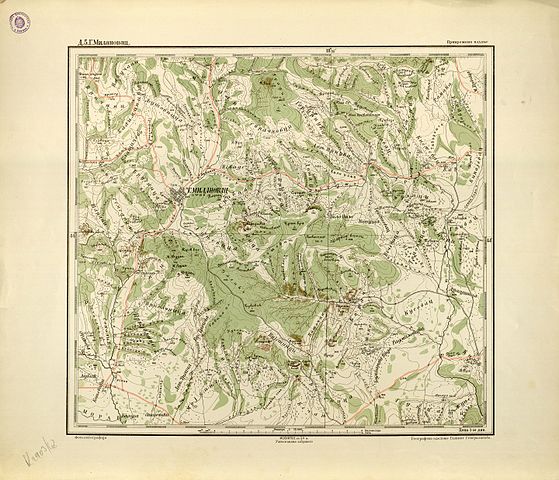
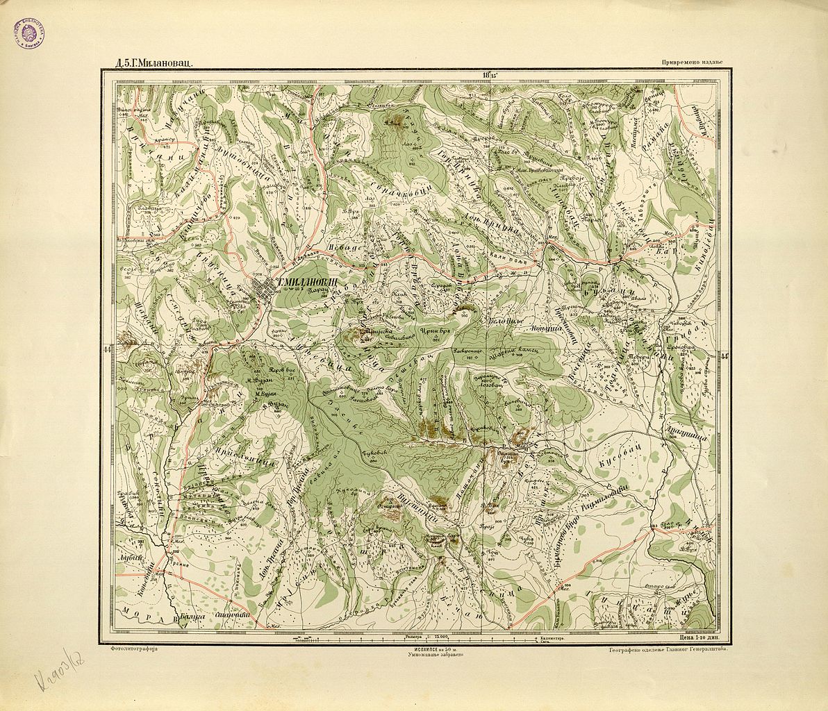
Српски / srpski: Дигитална копија Ђенералштабне карте Србије. Карта је штампана у Београду 1894. године, у 94 секције, са топографским кључем и у размери 1:75.000. То је прва специјална војна карта Србије која је штампана у земљи. Лист Д.5.Горњи Милановац. |
| Date | 3 June 2014 (original upload date) |
| Source | Transferred from sr.wikipedia to Commons. |
| Author | The original uploader was Ranko at Serbian Wikipedia. |
Licensing
[edit]
This work published in Serbia is in the public domain because its copyright expired pursuant to the Yugoslav Copyright Act of 1978 which provided for copyright term of the life of the author plus 50 years, respectively 25 years for photograph or a work of applied art. This applies to works already in the public domain on or before December 29, 2004 when a new copyright act became valid.
The work meets one of the following criteria:
A source should be included so that the status can be verified. Note that other works enter the public domain 70 years after the author's death or 70 years after publication if the work was published anonymously. If this is the case please use {{PD-old-70}}.
|
 |
|
This work is in the public domain in its country of origin and other countries and areas where the copyright term is the author's life plus 100 years or fewer. | |
| This file has been identified as being free of known restrictions under copyright law, including all related and neighboring rights. | |
Original upload log
[edit]
The original description page was here. All following user names refer to sr.wikipedia.
| Date/Time | Dimensions | User | Comment |
|---|---|---|---|
| 2014-06-03 09:18 | 5223×4486× (4729629 bytes) | Ranko | Дигитална копија Ђенералштабне карте Србије. Карта је штампана у Београду 1894. године, у 94 секције, са топографским кључем и у размери 1:75.000.… |
File history
Click on a date/time to view the file as it appeared at that time.
| Date/Time | Thumbnail | Dimensions | User | Comment | |
|---|---|---|---|---|---|
| current | 13:30, 21 January 2017 | | 5,223 × 4,486 (4.51 MB) | Ранко Николић (talk | contribs) | == {{int:filedesc}} == {{Information |Description={{sr|Дигитална копија Ђенералштабне карте Србије. Карта је штампана у Београду 1894. године, у 94 секције, са топогр... |
You cannot overwrite this file.
File usage on Commons
There are no pages that use this file.
File usage on other wikis
The following other wikis use this file:
- Usage on sr.wikipedia.org