File:Topo PL+LV.png
Jump to navigation
Jump to search

Size of this preview: 613 × 600 pixels. Other resolutions: 245 × 240 pixels | 491 × 480 pixels | 785 × 768 pixels | 1,047 × 1,024 pixels | 2,557 × 2,502 pixels.
Original file (2,557 × 2,502 pixels, file size: 918 KB, MIME type: image/png)
Captions
Captions
Add a one-line explanation of what this file represents
Summary
[edit]
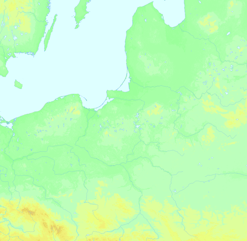
| Description | Topographic background map of most parts of Poland and Lettonia |
| Date | |
| Source | https://maps-for-free.com/ |
| Author | Ulamm (talk) |
| Other versions | Borders will perhaps be added, later. |
Licensing
[edit]
I, the copyright holder of this work, hereby publish it under the following licenses:

|
Permission is granted to copy, distribute and/or modify this document under the terms of the GNU Free Documentation License, Version 1.2 or any later version published by the Free Software Foundation; with no Invariant Sections, no Front-Cover Texts, and no Back-Cover Texts. A copy of the license is included in the section entitled GNU Free Documentation License. |
This file is licensed under the Creative Commons Attribution-Share Alike 4.0 International, 3.0 Unported, 2.5 Generic, 2.0 Generic and 1.0 Generic license.
- You are free:
- to share – to copy, distribute and transmit the work
- to remix – to adapt the work
- Under the following conditions:
- attribution – You must give appropriate credit, provide a link to the license, and indicate if changes were made. You may do so in any reasonable manner, but not in any way that suggests the licensor endorses you or your use.
- share alike – If you remix, transform, or build upon the material, you must distribute your contributions under the same or compatible license as the original.
You may select the license of your choice.
File history
Click on a date/time to view the file as it appeared at that time.
| Date/Time | Thumbnail | Dimensions | User | Comment | |
|---|---|---|---|---|---|
| current | 08:36, 10 September 2020 | | 2,557 × 2,502 (918 KB) | Ulamm (talk | contribs) | level colours harmonized |
| 09:36, 25 August 2020 |  | 2,557 × 2,511 (2.1 MB) | Ulamm (talk | contribs) | elevation colours improved | |
| 14:31, 24 August 2020 |  | 2,557 × 2,511 (2.69 MB) | Ulamm (talk | contribs) | {{Information |Description=Topographic background map of most parts of Poland and Lettonia |Source=https://maps-for-free.com/ |Date=2020-08-24 |Author=~~~ |Permission= |other_versions=Borders will perhaps be added, later. }} Category:Topographic maps of Poland Category:Maps by Ulamm |
You cannot overwrite this file.
File usage on Commons
There are no pages that use this file.
File usage on other wikis
The following other wikis use this file:
- Usage on de.wikipedia.org
- Vorlage:Positionskarte PL+LV
- Benutzer:Ulamm/Verteil LV
- Vorlage:Positionskarte PL NO
- Benutzer:Ulamm/Verteil PL NO
- Vorlage:Positionskarte PL+PR
- Benutzer:Ulamm/Verteil PR
- Vorlage:Positionskarte LIT+BELA
- Benutzer:Ulamm/Verteil LIT+BELA
- Vorlage:Positionskarte PL NW
- Benutzer:Ulamm/Verteil PL NW
- Vorlage:Positionskarte PL SW
- Benutzer:Ulamm/Verteil PL SW
- Vorlage:Positionskarte PL SO
- Benutzer:Ulamm/Verteil PL SO
- Vorlage:Positionskarte PL+UA
- Benutzer:Ulamm/Verteil UA
- Vorlage:Positionskarte PL+CZ
- Benutzer:Ulamm/Verteil CZ2
- Vorlage:Positionskarte PL+GOT
- Benutzer:Ulamm/Verteil SVE-GOT