File:Top station Munnar.jpg
From Wikimedia Commons, the free media repository
Jump to navigation
Jump to search
![File:Top station Munnar.jpg](https://upload.wikimedia.org/wikipedia/commons/thumb/9/92/Top_station_Munnar.jpg/800px-Top_station_Munnar.jpg?20160604141938)
Size of this preview: 800 × 450 pixels. Other resolutions: 320 × 180 pixels | 640 × 360 pixels | 1,024 × 576 pixels | 1,280 × 720 pixels | 2,560 × 1,440 pixels | 4,160 × 2,340 pixels.
Original file (4,160 × 2,340 pixels, file size: 1.7 MB, MIME type: image/jpeg)
File information
Structured data
Captions
Captions
Add a one-line explanation of what this file represents
Summary
[edit]DescriptionTop station Munnar.jpg |
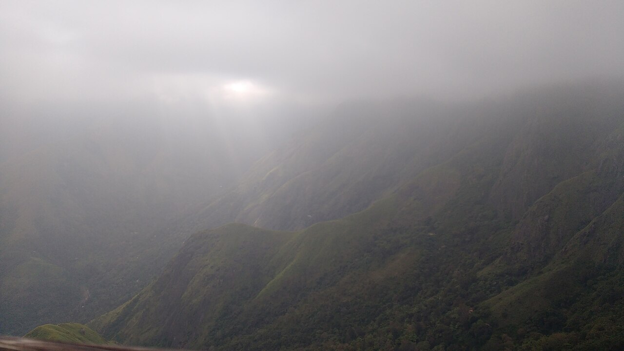
English: It is part of Theni District in the state of Tamil Nadu. Top Station is notable as the historic transshippment location for Kannan Devan tea delivered up here from Munnar and Madupatty by railway and then down by ropeway to Kottagudi. This area is popular for the rare Neelakurinji flowers |
Date | |
Source | Own work |
Author | Manoj M Shenoy |
Licensing
[edit]I, the copyright holder of this work, hereby publish it under the following license:
![w:en:Creative Commons](https://upload.wikimedia.org/wikipedia/commons/thumb/7/79/CC_some_rights_reserved.svg/90px-CC_some_rights_reserved.svg.png)
![attribution](https://upload.wikimedia.org/wikipedia/commons/thumb/1/11/Cc-by_new_white.svg/24px-Cc-by_new_white.svg.png)
![share alike](https://upload.wikimedia.org/wikipedia/commons/thumb/d/df/Cc-sa_white.svg/24px-Cc-sa_white.svg.png)
This file is licensed under the Creative Commons Attribution-Share Alike 4.0 International license.
- You are free:
- to share – to copy, distribute and transmit the work
- to remix – to adapt the work
- Under the following conditions:
- attribution – You must give appropriate credit, provide a link to the license, and indicate if changes were made. You may do so in any reasonable manner, but not in any way that suggests the licensor endorses you or your use.
- share alike – If you remix, transform, or build upon the material, you must distribute your contributions under the same or compatible license as the original.
File history
Click on a date/time to view the file as it appeared at that time.
Date/Time | Thumbnail | Dimensions | User | Comment | |
---|---|---|---|---|---|
current | 14:19, 4 June 2016 | ![]() | 4,160 × 2,340 (1.7 MB) | Manoj shenoy1992 (talk | contribs) | User created page with UploadWizard |
You cannot overwrite this file.
File usage on Commons
There are no pages that use this file.
Metadata
This file contains additional information such as Exif metadata which may have been added by the digital camera, scanner, or software program used to create or digitize it. If the file has been modified from its original state, some details such as the timestamp may not fully reflect those of the original file. The timestamp is only as accurate as the clock in the camera, and it may be completely wrong.
Camera manufacturer | Motorola |
---|---|
Camera model | MotoG3 |
Exposure time | 211/100,000 sec (0.00211) |
F-number | f/2 |
ISO speed rating | 50 |
Date and time of data generation | 15:52, 26 December 2015 |
Lens focal length | 3.64 mm |
Horizontal resolution | 72 dpi |
Vertical resolution | 72 dpi |
File change date and time | 15:52, 26 December 2015 |
Y and C positioning | Centered |
Exposure Program | Normal program |
Exif version | 2.2 |
Date and time of digitizing | 15:52, 26 December 2015 |
Meaning of each component |
|
APEX shutter speed | 8.88 |
APEX aperture | 2 |
APEX brightness | −1 |
APEX exposure bias | 0 |
Maximum land aperture | 2 APEX (f/2) |
Metering mode | Center weighted average |
Flash | Flash did not fire, compulsory flash suppression |
DateTime subseconds | 733191 |
DateTimeOriginal subseconds | 733191 |
DateTimeDigitized subseconds | 733191 |
Supported Flashpix version | 1 |
Color space | sRGB |
Scene type | A directly photographed image |
Custom image processing | Normal process |
Exposure mode | Auto exposure |
White balance | Auto white balance |
Digital zoom ratio | 1 |
Contrast | Normal |
Saturation | Normal |
Sharpness | Soft |
Geodetic survey data used | WGS-84 |
GPS tag version | 2.2.0.0 |
Hidden categories: