File:Tonahutu Creek Trail.jpg
Jump to navigation
Jump to search

Size of this preview: 800 × 600 pixels. Other resolutions: 320 × 240 pixels | 640 × 480 pixels | 1,024 × 768 pixels | 1,280 × 960 pixels | 2,560 × 1,920 pixels | 3,648 × 2,736 pixels.
Original file (3,648 × 2,736 pixels, file size: 1.98 MB, MIME type: image/jpeg)
Captions
Captions
Add a one-line explanation of what this file represents
|
This is an image of a place or building that is listed on the National Register of Historic Places in the United States of America. Its reference number is 8000130. |
| Camera location | | View this and other nearby images on: OpenStreetMap |
|---|
| Description |
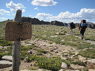
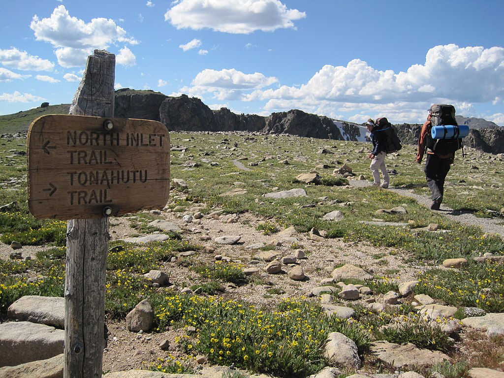
English: Looking along the Tonahutu Creek Trail at its split from the North Inlet Trail in the Larimer County portion of Rocky Mountain National Park. Located southwest of Estes Park in the U.S. state of Colorado, the trail was built in 1918 and is listed on the National Register of Historic Places. |
| Date | |
| Source | Flickr |
| Author | Eric Schmuttenmaer |
| Permission (Reusing this file) |
This file is licensed under the Creative Commons Attribution-Share Alike 2.0 Generic license.
|
| This image was originally posted to Flickr by akeg at https://www.flickr.com/photos/88583398@N00/3737306642. It was reviewed on 15 December 2010 by FlickreviewR and was confirmed to be licensed under the terms of the cc-by-sa-2.0. |
File history
Click on a date/time to view the file as it appeared at that time.
| Date/Time | Thumbnail | Dimensions | User | Comment | |
|---|---|---|---|---|---|
| current | 04:12, 15 December 2010 | | 3,648 × 2,736 (1.98 MB) | Nyttend (talk | contribs) | {{Location|40|18|33.6|N|105|41|42|W}} {{Information |Description={{en|Looking along the {{w|Tonahutu Creek Trail}} at its split from the {{w|North Inlet Trail}} in the {{w|Larimer County, Colorado|Larimer County}} portion of {{w|Rocky Mountain National Pa |
You cannot overwrite this file.
File usage on Commons
The following 2 pages use this file:
File usage on other wikis
The following other wikis use this file:
- Usage on en.wikipedia.org
- Usage on fr.wikipedia.org
- Usage on www.wikidata.org