File:Tomas nov 5 2010.jpg
Jump to navigation
Jump to search

Size of this preview: 800 × 600 pixels. Other resolutions: 320 × 240 pixels | 640 × 480 pixels | 1,024 × 768 pixels | 1,280 × 960 pixels | 2,000 × 1,500 pixels.
Original file (2,000 × 1,500 pixels, file size: 725 KB, MIME type: image/jpeg)
Captions
Captions
Add a one-line explanation of what this file represents
Summary
[edit]
| Description |
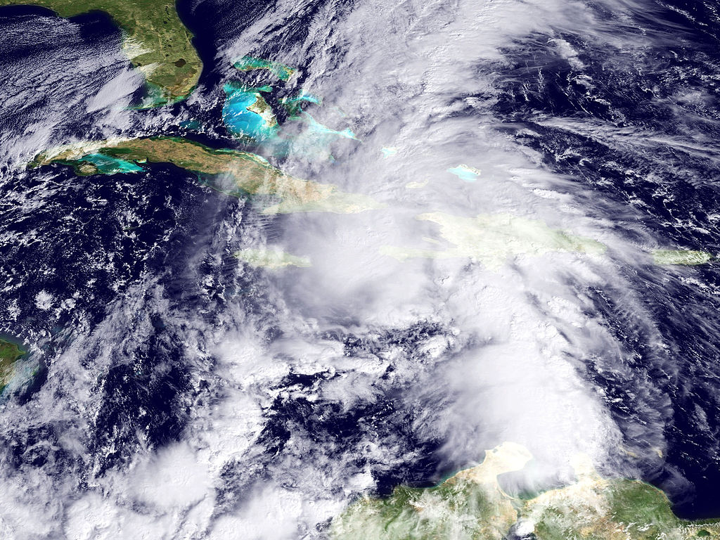
English: GOES-East satellite imagery shows Hurricane Tomas as its center of circulation moves between Haiti and Cuba. With wind speeds of 85 mph, Tomas is a moderate Category 1 storm. It is expected to cross over the Bahamas early Saturday and then move out into the Atlantic but stay far offshore of the mainland U.S., potentially impacting Bermuda. |
| Date | |
| Source | http://www.nnvl.noaa.gov/MediaDetail.php?MediaID=576&MediaTypeID=1 |
| Author | NOAA |
Licensing
[edit]
This image is in the public domain because it contains materials that originally came from the U.S. National Oceanic and Atmospheric Administration, taken or made as part of an employee's official duties.
|
File history
Click on a date/time to view the file as it appeared at that time.
| Date/Time | Thumbnail | Dimensions | User | Comment | |
|---|---|---|---|---|---|
| current | 03:10, 6 November 2010 | | 2,000 × 1,500 (725 KB) | Supportstorm (talk | contribs) | {{Information |Description={{en|1=GOES-East satellite imagery shows Hurricane Tomas as its center of circulation moves between Haiti and Cuba. With wind speeds of 85 mph, Tomas is a moderate Category 1 storm. It is expected to cross over the Bahamas early |
You cannot overwrite this file.
File usage on Commons
There are no pages that use this file.