File:Tolchester folio Maryland Plate II.jpg
Jump to navigation
Jump to search
Size of this preview: 800 × 465 pixels. Other resolutions: 320 × 186 pixels | 640 × 372 pixels | 1,024 × 595 pixels | 1,280 × 744 pixels | 2,084 × 1,211 pixels.
Original file (2,084 × 1,211 pixels, file size: 1.11 MB, MIME type: image/jpeg)
Captions
Captions
Add a one-line explanation of what this file represents
Summary
[edit]
| Description |
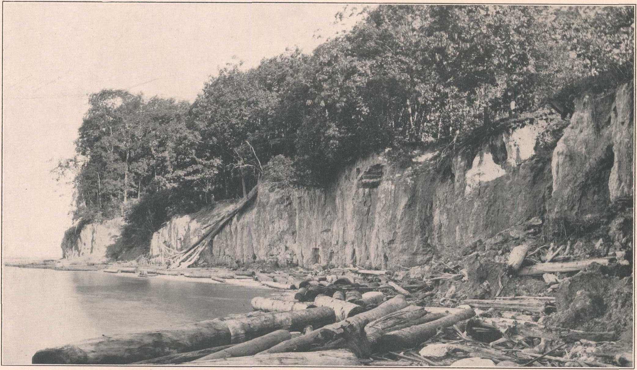
English: Plate II from Tolchester Folio, Maryland, which has the following caption:
The text of the publication states:
|
| Date | |
| Source | Tolchester folio, Maryland, Geologic Atlas of the United States, by B. L. Miller , E. B. Mathews, A. B. Bibbins, and H. P. Little, 2017 |
| Author | USGS |
| Other versions |
 |
Licensing
[edit]
This image is in the public domain in the United States because it only contains materials that originally came from the United States Geological Survey, an agency of the United States Department of the Interior. For more information, see the official USGS copyright policy.
|
File history
Click on a date/time to view the file as it appeared at that time.
| Date/Time | Thumbnail | Dimensions | User | Comment | |
|---|---|---|---|---|---|
| current | 12:59, 7 February 2023 | | 2,084 × 1,211 (1.11 MB) | Jstuby (talk | contribs) | Uploaded a work by USGS from [https://pubs.er.usgs.gov/publication/gf204 Tolchester folio, Maryland], Geologic Atlas of the United States, by B. L. Miller , E. B. Mathews, A. B. Bibbins, and H. P. Little, 2017 with UploadWizard |
You cannot overwrite this file.
File usage on Commons
The following page uses this file:
File usage on other wikis
The following other wikis use this file:
- Usage on en.wikipedia.org