File:Tobe Wiley House site.jpg
Jump to navigation
Jump to search

Size of this preview: 800 × 532 pixels. Other resolutions: 320 × 213 pixels | 640 × 426 pixels | 1,024 × 681 pixels | 1,280 × 851 pixels | 2,560 × 1,702 pixels | 6,016 × 4,000 pixels.
Original file (6,016 × 4,000 pixels, file size: 6.35 MB, MIME type: image/jpeg)
Captions
Captions
Add a one-line explanation of what this file represents
|
This is an image of a place or building that is listed on the National Register of Historic Places in the United States of America. Its reference number is 88003161. |
| Camera location | | View this and other nearby images on: OpenStreetMap |
|---|
| Description |
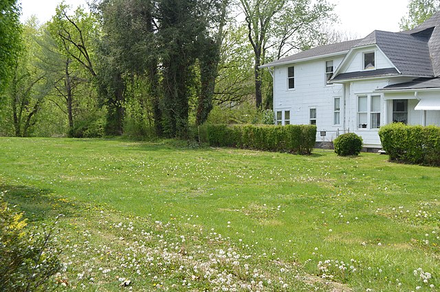
English: Site of the Tobe Wiley House, located just southeast of the junction of Euclid Avenue (Kentucky Route 40) with Main Street in Paintsville, Kentucky, United States. Although listed on the National Register of Historic Places in 1989, it has been destroyed. Visible in the background is the Allie Webb House, also Register-listed. |
||
| Date | Taken on 21 April 2014 | ||
| Source | Own work | ||
| Author | Nyttend | ||
| Permission (Reusing this file) |
|
File history
Click on a date/time to view the file as it appeared at that time.
| Date/Time | Thumbnail | Dimensions | User | Comment | |
|---|---|---|---|---|---|
| current | 13:26, 5 May 2014 | | 6,016 × 4,000 (6.35 MB) | Nyttend (talk | contribs) | {{NRHP|88003161}} {{Location|37|48|52|N|82|48|7.5|W}} {{Information |Description={{en|Site of the {{w|Tobe Wiley House}}, located just southeast of the junction of Euclid Avenue ({{w|Kentucky Route 40}}) with Main Street in {{w|Paintsville, Kentucky|Pa... |
You cannot overwrite this file.
File usage on Commons
There are no pages that use this file.
File usage on other wikis
The following other wikis use this file:
- Usage on en.wikipedia.org