File:Točník úhlová diskordance.png
Jump to navigation
Jump to search
No higher resolution available.
Točník_úhlová_diskordance.png (600 × 450 pixels, file size: 814 KB, MIME type: image/png)
Captions
Captions
Add a one-line explanation of what this file represents
Summary
[edit]
| Description |
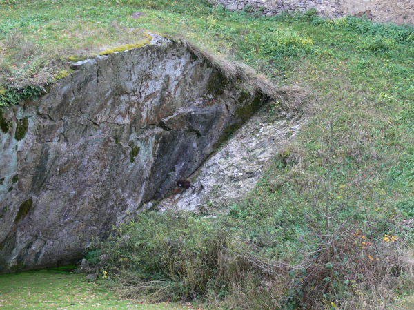
Čeština: Úhlová diskordance mezi usazeninami svrchního proterozoika a spodního ordoviku u jezírka pod hradem Točníkem.
English: Angular unconcormity between Proterozoic and Ordovician sediments under the Točník Castle, CZ. |
| Date | |
| Source | Own work |
| Author | Lamprus |
| Camera location | | View this and other nearby images on: OpenStreetMap |
|---|
Licensing
[edit]
| I, the copyright holder of this work, release this work into the public domain. This applies worldwide. In some countries this may not be legally possible; if so: I grant anyone the right to use this work for any purpose, without any conditions, unless such conditions are required by law. |
File history
Click on a date/time to view the file as it appeared at that time.
| Date/Time | Thumbnail | Dimensions | User | Comment | |
|---|---|---|---|---|---|
| current | 22:44, 9 December 2010 | | 600 × 450 (814 KB) | Lamprus (talk | contribs) | {{Information |Description={{cs|1=Úhlová diskordance mezi usazeninami svrchního proterozoika a spodního ordoviku u jezírka pod hradem Točníkem.}} {{en|1=Angular unconcofmity between Proterozoic and Ordovician sediments under the Točník Castle, CZ |
You cannot overwrite this file.
File usage on Commons
There are no pages that use this file.
File usage on other wikis
The following other wikis use this file:
- Usage on cs.wikipedia.org