File:Timiŝoaro, suda fervoja stacio, 1.jpeg
![File:Timiŝoaro, suda fervoja stacio, 1.jpeg](https://upload.wikimedia.org/wikipedia/commons/thumb/4/40/Timi%C5%9Doaro%2C_suda_fervoja_stacio%2C_1.jpeg/800px-Timi%C5%9Doaro%2C_suda_fervoja_stacio%2C_1.jpeg?20180325195546)
Original file (2,800 × 1,400 pixels, file size: 811 KB, MIME type: image/jpeg)
Captions
Captions
Summary
[edit]DescriptionTimiŝoaro, suda fervoja stacio, 1.jpeg |
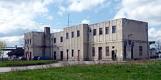
Deutsch: Temeswar (RO), Südbahnhof.
Esperanto: Timiŝoaro (RO), suda fervoja stacio.
Română: Timișoara, stație Timișoara Sud. |
|||
Date | ||||
Source | Self-photographed | |||
Author | Renardo la vulpo | |||
Permission (Reusing this file) |
I, the copyright holder of this work, hereby publish it under the following license:
|
Camera location | 45° 43′ 00″ N, 21° 12′ 11.5″ E ![]() ![]() | View this and other nearby images on: OpenStreetMap | ![]() |
---|
File history
Click on a date/time to view the file as it appeared at that time.
Date/Time | Thumbnail | Dimensions | User | Comment | |
---|---|---|---|---|---|
current | 19:55, 25 March 2018 | ![]() | 2,800 × 1,400 (811 KB) | Renardo la vulpo (talk | contribs) | {{Information |description={{de|1=Temeswar (RO), Südbahnhof.}} {{eo|1=Timiŝoaro (RO), suda fervoja stacio.}} {{ro|1=Timișoara, stație Timișoara Sud.}} |source= {{self-photographed}} |date= 2015-04-03 |author= {{U|Renardo la vulpo}} |permission= {{self|cc-zero}} |other versions= }} {{Location|45|43|0|N|21|12|11.5|E|heading:S}} Category:Train stations in Timișoara |
You cannot overwrite this file.
File usage on Commons
The following 2 pages use this file:
File usage on other wikis
The following other wikis use this file:
- Usage on en.wikipedia.org
- Usage on fr.wikipedia.org
- Usage on hu.wikipedia.org
- Usage on ro.wikipedia.org
- Usage on www.wikidata.org
Metadata
This file contains additional information such as Exif metadata which may have been added by the digital camera, scanner, or software program used to create or digitize it. If the file has been modified from its original state, some details such as the timestamp may not fully reflect those of the original file. The timestamp is only as accurate as the clock in the camera, and it may be completely wrong.
Camera manufacturer | Panasonic |
---|---|
Camera model | DMC-TZ41 |
Exposure time | 1/1,600 sec (0.000625) |
F-number | f/5.6 |
ISO speed rating | 400 |
Date and time of data generation | 09:02, 3 April 2015 |
Lens focal length | 6.9 mm |
Latitude | 45° 43′ 0.07″ N |
Longitude | 21° 12′ 11.45″ E |
Altitude | 0 meters above sea level |
Orientation | Normal |
Horizontal resolution | 180 dpi |
Vertical resolution | 180 dpi |
Software used | GIMP 2.8.20 |
File change date and time | 21:46, 25 March 2018 |
Y and C positioning | Co-sited |
Exposure Program | Normal program |
Exif version | 2.3 |
Date and time of digitizing | 09:02, 3 April 2015 |
Meaning of each component |
|
Image compression mode | 2 |
APEX exposure bias | 0 |
Maximum land aperture | 3.890625 APEX (f/3.85) |
Metering mode | Center weighted average |
Light source | Unknown |
Flash | Flash did not fire, compulsory flash suppression |
Supported Flashpix version | 1 |
Color space | sRGB |
Sensing method | One-chip color area sensor |
File source | Digital still camera |
Scene type | A directly photographed image |
Custom image processing | Normal process |
Exposure mode | Auto exposure |
White balance | Auto white balance |
Digital zoom ratio | 0 |
Focal length in 35 mm film | 39 mm |
Scene capture type | Standard |
Scene control | High gain up |
Contrast | Normal |
Saturation | Normal |
Sharpness | Normal |
GPS time (atomic clock) | 08:02 |
Receiver status | Measurement in progress |
Measurement mode | 2-dimensional measurement |
Measurement precision | Fair (1.5) |
Reference for direction of image | Magnetic direction |
Direction of image | 202.5 |
Geodetic survey data used | WGS-84 |
Name of GPS area | --- |
GPS date | 3 April 2015 |
GPS tag version | 0.0.3.2 |
Image width | 3,264 px |
Image height | 2,448 px |
Name of GPS processing method | 14 bytes undefined data |