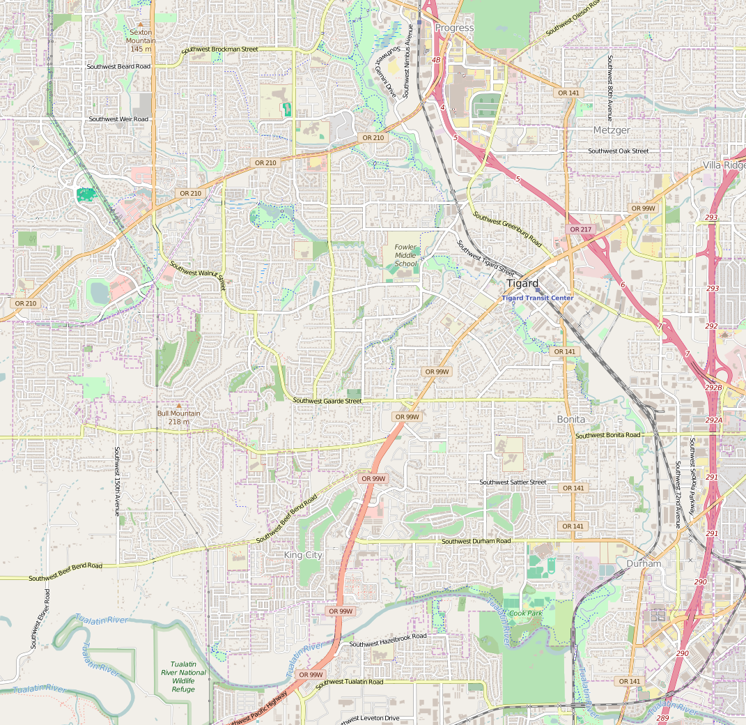
File:Tigard OR - OpenStreetMap.png
Jump to navigation
Jump to search
Size of this preview: 617 × 599 pixels. Other resolutions: 247 × 240 pixels | 494 × 480 pixels | 791 × 768 pixels | 1,071 × 1,040 pixels.
Original file (1,071 × 1,040 pixels, file size: 1.3 MB, MIME type: image/png)
Captions
Captions
Add a one-line explanation of what this file represents
| Description |
Map of Tigard Oregon. This map of Tigard_OR was created from OpenStreetMap project data, collected by the community. This map may be incomplete, and may contain errors. Don't rely solely on it for navigation. |
|||||||||
| Date | ||||||||||
| Source | You may find a page on the OpenStreetMap wiki page for Tigard_OR | |||||||||
| Creator |
OpenStreetMap contributors OpenStreetMap contributors |
|||||||||
| Permission (Reusing this file) |
OpenStreetMap data is available under the Open Database License (details). Map tiles are licensed under the Creative Commons Attribution-ShareAlike 2.0 license (CC-BY-SA 2.0).
This file is licensed under the Creative Commons Attribution-Share Alike 2.0 Generic license.
|
|||||||||
| Geotemporal data | ||||||||||
| Bounding box |
|
|||||||||
| Georeferencing | If inappropriate please set warp_status = skip to hide. | |||||||||
File history
Click on a date/time to view the file as it appeared at that time.
| Date/Time | Thumbnail | Dimensions | User | Comment | |
|---|---|---|---|---|---|
| current | 22:59, 14 April 2016 | | 1,071 × 1,040 (1.3 MB) | Tagishsimon (talk | contribs) | {{OpenStreetMap | name = Tigard_OR | location = Tigard_OR | description = Map of Tigard Oregon. | top = 45.4599 | bottom = 45.3854 | left = -122.8484 | right = -122.7391 | date = 2016-0... |
You cannot overwrite this file.
File usage on Commons
There are no pages that use this file.
File usage on other wikis
The following other wikis use this file:
- Usage on ar.wikipedia.org
- Usage on en.wikipedia.org
- Usage on si.wikipedia.org