File:Tide over 4 m.png
Jump to navigation
Jump to search
Size of this preview: 800 × 370 pixels. Other resolutions: 320 × 148 pixels | 640 × 296 pixels | 1,357 × 628 pixels.
Original file (1,357 × 628 pixels, file size: 64 KB, MIME type: image/png)
Captions
Captions
Add a one-line explanation of what this file represents

|
This map image could be re-created using vector graphics as an SVG file. This has several advantages; see Commons:Media for cleanup for more information. If an SVG form of this image is available, please upload it and afterwards replace this template with
{{vector version available|new image name}}.
It is recommended to name the SVG file “Tide over 4 m.svg”—then the template Vector version available (or Vva) does not need the new image name parameter. |
Summary
[edit]
| Description |
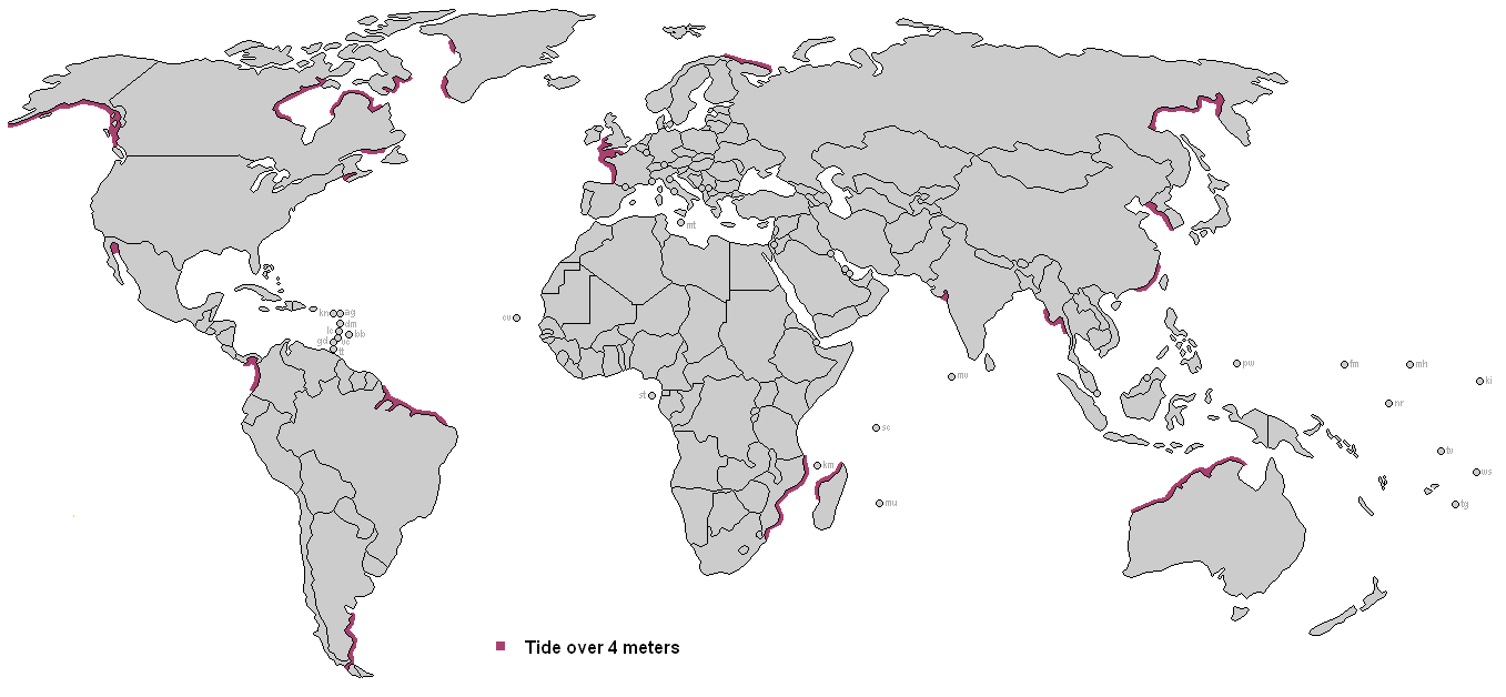
English: Map showing places in the world where is tide of more than 4 meters
Čeština: Mapa znázornující místa na světe kde je příliv větší jak 4 metry.
Deutsch: Weltkarte: Küsten mit einem Tidenhub über 4 Meter. |
| Source | Own work |
| Author | Kolomaznik |
Licensing
[edit]
I, the copyright holder of this work, hereby publish it under the following licenses:

|
Permission is granted to copy, distribute and/or modify this document under the terms of the GNU Free Documentation License, Version 1.2 or any later version published by the Free Software Foundation; with no Invariant Sections, no Front-Cover Texts, and no Back-Cover Texts. A copy of the license is included in the section entitled GNU Free Documentation License. |
This file is licensed under the Creative Commons Attribution 3.0 Unported license.
- You are free:
- to share – to copy, distribute and transmit the work
- to remix – to adapt the work
- Under the following conditions:
- attribution – You must give appropriate credit, provide a link to the license, and indicate if changes were made. You may do so in any reasonable manner, but not in any way that suggests the licensor endorses you or your use.
You may select the license of your choice.
File history
Click on a date/time to view the file as it appeared at that time.
| Date/Time | Thumbnail | Dimensions | User | Comment | |
|---|---|---|---|---|---|
| current | 16:35, 23 April 2011 | | 1,357 × 628 (64 KB) | Kolomaznik (talk | contribs) | {{Information |Description ={{en|1=Map showing places in the world where is tide of more than 4 meters}} {{cs|1=Mapa znázornující místa na světe kde je příliv větší jak 4 metry.}} |Source ={{own}} |Author =[[User:Kolomaznik|Ko |
You cannot overwrite this file.
File usage on Commons
The following page uses this file:
File usage on other wikis
The following other wikis use this file:
- Usage on ca.wikipedia.org
- Usage on cs.wikipedia.org
- Usage on de.wikipedia.org
- Usage on he.wikipedia.org
- Usage on www.wikidata.org
- Usage on zh.wikipedia.org