File:Thunau am Kamp - Kirche.JPG
Jump to navigation
Jump to search

Size of this preview: 800 × 523 pixels. Other resolutions: 320 × 209 pixels | 640 × 418 pixels | 1,024 × 669 pixels | 1,280 × 836 pixels | 2,560 × 1,672 pixels | 4,600 × 3,005 pixels.
Original file (4,600 × 3,005 pixels, file size: 10.44 MB, MIME type: image/jpeg)
Captions
Captions
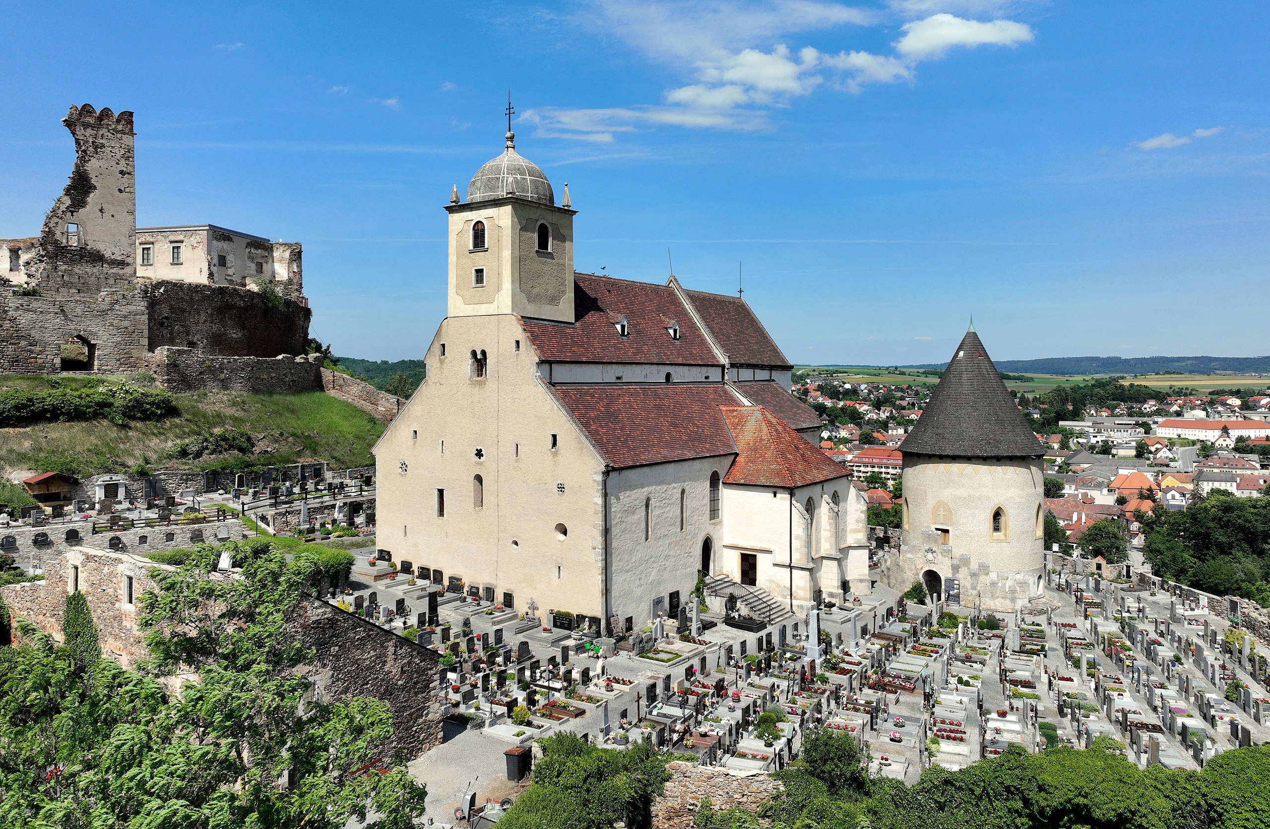
South view of the former parish church of Thunau am Kamp, Lower Austria.
Summary
[edit]
| Description |
Deutsch: Südsüdwestansicht der ehemaligen röm.-kath. Pfarrkirche hl. Gertrud in Thunau am Kamp, ein Ortsteil der niederösterreichischen Marktgemeinde Gars am Kamp.
Mit dem Bau der Kirche am südöstlichen Abhang des Burgberges begann der Babenberger Markgraf Leopold II. (1050–1095). In drei Bauphasen entstand durch Erweiterungen aus der spätromanischen dreischiffigen Basilika bis ins 14 Jahrhundert eine Kirche von 35 m Länge, einer Breite von 17 m und einer Höhe von 12 m mit drei Chören: [1]. Ende des 17. Jahrhunderts erhöhte man den Turm und schloss ihn mit einer markanten Steinkuppel ab. Die Kirche ist von einem Friedhof umgeben. Der Karner südöstlich der Kirche, ein Rundbau mit Halbkreisapsis, stammt aus der romanische Zeit und ist seit 1876 die Begräbnisstätte der Familie Croy. English: South view of the former parish church of Thunau am Kamp, Lower Austria.
|
| Date | |
| Source | Own work |
| Author | C.Stadler/Bwag |
| Permission (Reusing this file) |
Deutsch: Hallo, du darfst meine Fotos kostenlos nutzen, aber nenne mich bitte als Fotograf, beispielsweise „Foto: C.Stadler/Bwag“ oder © C.Stadler/Bwag; CC-BY-SA-4.0. Auf mehr Angaben bestehe ich nicht - im Gegensatz zu manch anderen, die die Vorgaben der unten angeführten Lizenzierung auf Punkt und Beistrich einfordern. English: Feel free to use my photos, but please mention me as the author like © C.Stadler/Bwag or © C.Stadler/Bwag; CC-BY-SA-4.0 (that's good enough) and if you want send me a message: bwag@gmx.net. |
| Object location | | View this and other nearby images on: OpenStreetMap |
|---|
| Camera location | | View this and other nearby images on: OpenStreetMap |
|---|
Licensing
[edit]
I, the copyright holder of this work, hereby publish it under the following license:
This file is licensed under the Creative Commons Attribution-Share Alike 4.0 International license.
- You are free:
- to share – to copy, distribute and transmit the work
- to remix – to adapt the work
- Under the following conditions:
- attribution – You must give appropriate credit, provide a link to the license, and indicate if changes were made. You may do so in any reasonable manner, but not in any way that suggests the licensor endorses you or your use.
- share alike – If you remix, transform, or build upon the material, you must distribute your contributions under the same or compatible license as the original.
File history
Click on a date/time to view the file as it appeared at that time.
| Date/Time | Thumbnail | Dimensions | User | Comment | |
|---|---|---|---|---|---|
| current | 04:59, 7 June 2022 | | 4,600 × 3,005 (10.44 MB) | Bwag (talk | contribs) | b |
| 21:03, 6 June 2022 |  | 4,600 × 3,005 (9.76 MB) | Bwag (talk | contribs) | == {{int:filedesc}} == {{Information |Description= {{de|1= Südsüdwestansicht der ehemaligen röm.-kath. Pfarrkirche ''hl. Gertrud'' in Thunau am Kamp, ein Ortsteil der niederösterreichischen Marktgemeinde Gars am Kamp.<br/>Mit dem Bau der Kirche am südöstlichen Abhang des Burgberges begann der Babenberger Marktgraf Leopold II. In drei Bauphasen entstand durch Erweiterungen aus der spätromanischen dreischiffigen Basilika bis ins 14 Jahrhundert eine Kirche von 35 m Länge, einer Breite von 17 m... |
You cannot overwrite this file.
File usage on Commons
The following page uses this file:
File usage on other wikis
The following other wikis use this file:
- Usage on cs.wikipedia.org
- Usage on de.wikipedia.org
- Usage on en.wikipedia.org
- Usage on www.wikidata.org