File:Throop, the pond - geograph.org.uk - 1240027.jpg
Jump to navigation
Jump to search
No higher resolution available.
Throop,_the_pond_-_geograph.org.uk_-_1240027.jpg (640 × 480 pixels, file size: 86 KB, MIME type: image/jpeg)
Captions
Captions
Add a one-line explanation of what this file represents
Summary
[edit]
| Description |
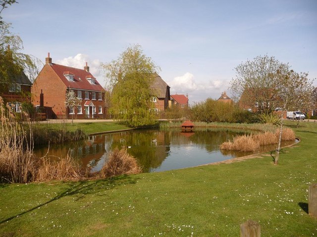
English: Throop: the pond Throop is one of the very last villagey enclaves in Bournemouth, most of the rest of it having been swallowed up by relentless development over the last hundred years.
It is therefore almost ironic that this typical rural scene should be such a recent creation: These houses, and the road and pond which they surround, were built only at the very end of the 20th century, and therefore the area retains its villagey feel. |
| Date | |
| Source | From geograph.org.uk |
| Author | Chris Downer |
| Attribution (required by the license) | Chris Downer / Throop: the pond / |
| Camera location | | View this and other nearby images on: OpenStreetMap |
|---|
_heading:22.00&language=en)
| Object location | | View this and other nearby images on: OpenStreetMap |
|---|
_heading:22.00&language=en)
Licensing
[edit]

|
This image was taken from the Geograph project collection. See this photograph's page on the Geograph website for the photographer's contact details. The copyright on this image is owned by Chris Downer and is licensed for reuse under the Creative Commons Attribution-ShareAlike 2.0 license.
|
This file is licensed under the Creative Commons Attribution-Share Alike 2.0 Generic license.
Attribution: Chris Downer
- You are free:
- to share – to copy, distribute and transmit the work
- to remix – to adapt the work
- Under the following conditions:
- attribution – You must give appropriate credit, provide a link to the license, and indicate if changes were made. You may do so in any reasonable manner, but not in any way that suggests the licensor endorses you or your use.
- share alike – If you remix, transform, or build upon the material, you must distribute your contributions under the same or compatible license as the original.
File history
Click on a date/time to view the file as it appeared at that time.
| Date/Time | Thumbnail | Dimensions | User | Comment | |
|---|---|---|---|---|---|
| current | 18:04, 26 February 2011 | | 640 × 480 (86 KB) | GeographBot (talk | contribs) | == {{int:filedesc}} == {{Information |description={{en|1=Throop: the pond Throop is one of the very last villagey enclaves in Bournemouth, most of the rest of it having been swallowed up by relentless development over the last hundred years. It is ther |
You cannot overwrite this file.
File usage on Commons
There are no pages that use this file.
File usage on other wikis
The following other wikis use this file:
- Usage on pl.wikipedia.org