File:Three 1909-06-29 weather map.png
Jump to navigation
Jump to search

Size of this preview: 654 × 600 pixels. Other resolutions: 262 × 240 pixels | 524 × 480 pixels | 838 × 768 pixels | 1,117 × 1,024 pixels | 2,041 × 1,871 pixels.
Original file (2,041 × 1,871 pixels, file size: 5.78 MB, MIME type: image/png)
Captions
Captions
Add a one-line explanation of what this file represents
Summary
| Description | ||||
| Date | ||||
| Source | NOAA Central Library Data Imaging Project | |||
| Author | NOAA Central Library, Silver Spring, Maryland | |||
| Permission (Reusing this file) |
|
File history
Click on a date/time to view the file as it appeared at that time.
| Date/Time | Thumbnail | Dimensions | User | Comment | |
|---|---|---|---|---|---|
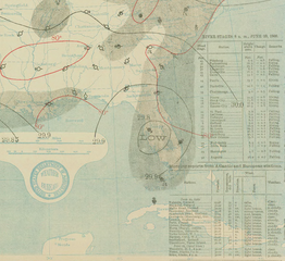
| current | 00:23, 24 May 2010 | | 2,041 × 1,871 (5.78 MB) | Cyclonebiskit (talk | contribs) | {{Information |Description={{en|1=A June 29, 1909 weather map of a storm.}} |Source=http://docs.lib.noaa.gov/rescue/dwm/1909/19090629.djvu |Author=[http://docs.lib.noaa.gov/rescue/dwm/data_rescue_daily_weather_maps.html NOAA Central Library Data Imaging P |
You cannot overwrite this file.
File usage on Commons
The following page uses this file:
- File:June 29, 1909 Tropical Storm Three Weather Map.png (file redirect)
File usage on other wikis
The following other wikis use this file:
- Usage on en.wikipedia.org
- Usage on pt.wikipedia.org
- Usage on zh.wikipedia.org