File:Thomas Bresson - Entree-principale (by).jpg
Jump to navigation
Jump to search

Size of this preview: 800 × 531 pixels. Other resolutions: 320 × 212 pixels | 640 × 425 pixels | 1,024 × 680 pixels | 1,280 × 849 pixels | 1,998 × 1,326 pixels.
Original file (1,998 × 1,326 pixels, file size: 4.07 MB, MIME type: image/jpeg)
Captions
Captions
Add a one-line explanation of what this file represents
Summary
[edit]| Description |
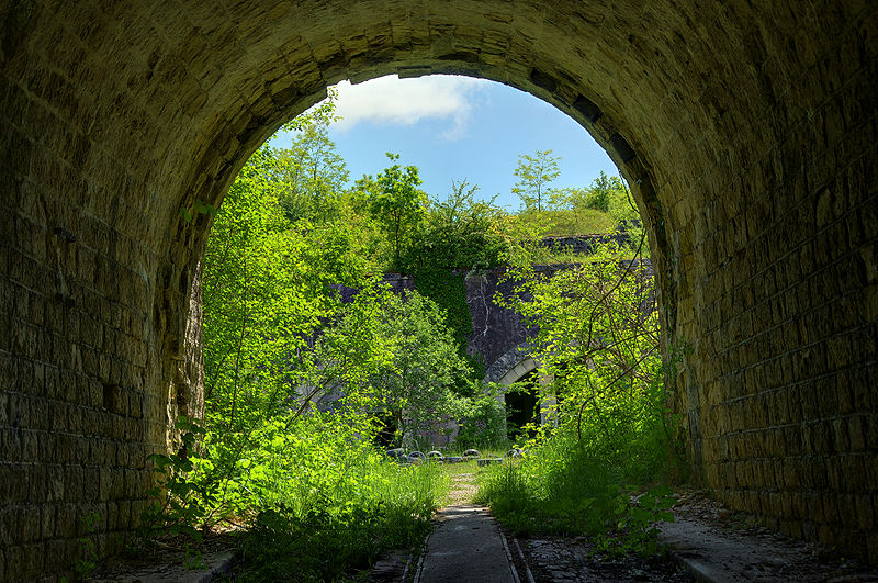
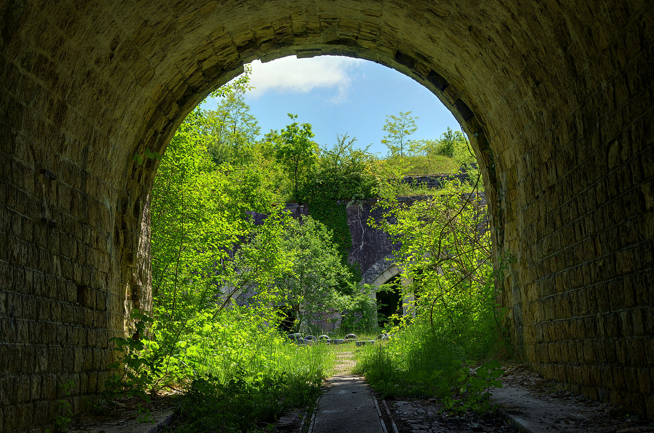
Français : Entrée principale débouchant sur la cour intérieure.Fort du Bois d'Oye (HDR)
English: Bois d'Oye fortifications (HDR). |
||||||||||||||||||||||
| Date | |||||||||||||||||||||||
| Source | Fort du Bois d'Oye | ||||||||||||||||||||||
| Author |
Thomas Bresson from Belfort, France
|
||||||||||||||||||||||

.jpg&action=edit§ion=1)
| Camera location | | View this and other nearby images on: OpenStreetMap |
|---|
.jpg¶ms=047.574502_N_0006.843286_E_globe:Earth_type:camera__&language=en)
Licensing
[edit].jpg&action=edit§ion=2)
This file is licensed under the Creative Commons Attribution 2.0 Generic license.
- You are free:
- to share – to copy, distribute and transmit the work
- to remix – to adapt the work
- Under the following conditions:
- attribution – You must give appropriate credit, provide a link to the license, and indicate if changes were made. You may do so in any reasonable manner, but not in any way that suggests the licensor endorses you or your use.
| This image was originally posted to Flickr by ComputerHotline at https://www.flickr.com/photos/36519414@N00/3543001846. It was reviewed on 18 May 2009 by FlickreviewR and was confirmed to be licensed under the terms of the cc-by-2.0. |
This image has been assessed using the Quality image guidelines and is considered a Quality image.
|
File history
Click on a date/time to view the file as it appeared at that time.
| Date/Time | Thumbnail | Dimensions | User | Comment | |
|---|---|---|---|---|---|
| current | 18:12, 18 May 2009 | | 1,998 × 1,326 (4.07 MB) | ComputerHotline (talk | contribs) | {{Information |Description= Entrée principale débouchant sur la cour intérieure. Bois d'Oye fortifications (HDR). |Source=[http://www.flickr.com/photos/36519414@N00/3543001846/ Fort du Bois d'Oye] |Date=2009-05-18 12:22 |Author=[http://www.flickr.com/ |
You cannot overwrite this file.
File usage on Commons
The following 8 pages use this file:
- User:ComputerHotline/Archive 1
- User:ComputerHotline/examples (3)
- User:EuseBot/test/candidate list
- Commons:Featured picture candidates/File:Thomas Bresson - Entree-principale (by).jpg
- Commons:Featured picture candidates/Log/May 2009
- Commons:Quality images/Subject/Places/Mixed/Archive2
- Commons:Quality images candidates/Archives May 2008
- Commons:Quality images candidates/Archives May 2009
.jpg)
File usage on other wikis
The following other wikis use this file:
- Usage on fr.wikipedia.org
.jpg&oldid=929266579)