File:The view from Scrabo (1) - geograph.org.uk - 1295419.jpg
Jump to navigation
Jump to search
No higher resolution available.
The_view_from_Scrabo_(1)_-_geograph.org.uk_-_1295419.jpg (640 × 388 pixels, file size: 88 KB, MIME type: image/jpeg)
Captions
Captions
Add a one-line explanation of what this file represents
Summary
[edit]_-_geograph.org.uk_-_1295419.jpg&action=edit§ion=1)
| Description |
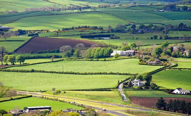
English: The view from Scrabo (1). Scrabo Tower, perched on the top of Scrabo Hill 775719, is the vantage point for excellent views over both the town and surrounding countryside. This is the view to the north west, towards Ballyrogan and Ballycullen townlands with the road to Belfast 317326 running along the bottom. Continue to 1295485. |
| Date | |
| Source | From geograph.org.uk |
| Author | Albert Bridge |
| Attribution (required by the license) | Albert Bridge / The view from Scrabo (1) / |
_-_geograph.org.uk_-_775719.jpg)
_-_geograph.org.uk_-_317326.jpg)
_-_geograph.org.uk_-_1295485.jpg)
| Camera location | | View this and other nearby images on: OpenStreetMap |
|---|
_-_geograph.org.uk_-_1295419.jpg¶ms=054.580640_N_-005.714900_E_globe:Earth_type:camera_source:geograph-irishgrid(J47797266)_heading:315.00&language=en)
| Object location | | View this and other nearby images on: OpenStreetMap |
|---|
_-_geograph.org.uk_-_1295419.jpg¶ms=054.596710_N_-005.733000_E_globe:Earth_class:object_type:object_source:geograph-irishgrid(J46567441)_heading:315.00&language=en)
Licensing
[edit]_-_geograph.org.uk_-_1295419.jpg&action=edit§ion=2)

|
This image was taken from the Geograph project collection. See this photograph's page on the Geograph website for the photographer's contact details. The copyright on this image is owned by Albert Bridge and is licensed for reuse under the Creative Commons Attribution-ShareAlike 2.0 license.
|
This file is licensed under the Creative Commons Attribution-Share Alike 2.0 Generic license.
Attribution: Albert Bridge
- You are free:
- to share – to copy, distribute and transmit the work
- to remix – to adapt the work
- Under the following conditions:
- attribution – You must give appropriate credit, provide a link to the license, and indicate if changes were made. You may do so in any reasonable manner, but not in any way that suggests the licensor endorses you or your use.
- share alike – If you remix, transform, or build upon the material, you must distribute your contributions under the same or compatible license as the original.
File history
Click on a date/time to view the file as it appeared at that time.
| Date/Time | Thumbnail | Dimensions | User | Comment | |
|---|---|---|---|---|---|
| current | 11:14, 27 February 2011 | | 640 × 388 (88 KB) | GeographBot (talk | contribs) | == {{int:filedesc}} == {{Information |description={{en|1=The view from Scrabo (1) Scrabo Tower, perched on the top of Scrabo Hill 775719, is the vantage point for excellent views over both the town and surrounding countryside. This is the view to the |
You cannot overwrite this file.
File usage on Commons
There are no pages that use this file.
_-_geograph.org.uk_-_1295419.jpg&oldid=716256387)