File:The ruin of St Mary's church - view past the tower - geograph.org.uk - 1284088.jpg
Jump to navigation
Jump to search
Size of this preview: 470 × 599 pixels. Other resolutions: 188 × 240 pixels | 502 × 640 pixels.
Original file (502 × 640 pixels, file size: 142 KB, MIME type: image/jpeg)
Captions
Captions
Add a one-line explanation of what this file represents
Summary
[edit]
| Description |
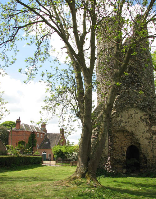
English: The ruin of St Mary's church - view past the tower What appears to be the Hall can be seen at left. The ruined round-towered St Mary's church stands across the road from St Andrew's > https://www.geograph.org.uk/photo/1284035. St Mary's fell into disuse around 1700 and only the ruined tower and the north and east walls remain. http://www.norfolkchurches.co.uk/kirbybedon/kirbybedonruin.htm. |
| Date | |
| Source | From geograph.org.uk |
| Author | Evelyn Simak |
| Attribution (required by the license) | Evelyn Simak / The ruin of St Mary's church - view past the tower / |
| Camera location | | View this and other nearby images on: OpenStreetMap |
|---|
_heading:270.00&language=en)
| Object location | | View this and other nearby images on: OpenStreetMap |
|---|
_heading:270.00&language=en)
Licensing
[edit]

|
This image was taken from the Geograph project collection. See this photograph's page on the Geograph website for the photographer's contact details. The copyright on this image is owned by Evelyn Simak and is licensed for reuse under the Creative Commons Attribution-ShareAlike 2.0 license.
|
This file is licensed under the Creative Commons Attribution-Share Alike 2.0 Generic license.
Attribution: Evelyn Simak
- You are free:
- to share – to copy, distribute and transmit the work
- to remix – to adapt the work
- Under the following conditions:
- attribution – You must give appropriate credit, provide a link to the license, and indicate if changes were made. You may do so in any reasonable manner, but not in any way that suggests the licensor endorses you or your use.
- share alike – If you remix, transform, or build upon the material, you must distribute your contributions under the same or compatible license as the original.
File history
Click on a date/time to view the file as it appeared at that time.
| Date/Time | Thumbnail | Dimensions | User | Comment | |
|---|---|---|---|---|---|
| current | 07:31, 27 February 2011 | | 502 × 640 (142 KB) | GeographBot (talk | contribs) | == {{int:filedesc}} == {{Information |description={{en|1=The ruin of St Mary's church - view past the tower What appears to be the Hall can be seen at left. The ruined round-towered St Mary's church stands across the road from St Andrew's > http://www.geo |
You cannot overwrite this file.
File usage on Commons
There are no pages that use this file.