File:The remains of Upper Bank Station, Swansea (geograph 2738407).jpg
Jump to navigation
Jump to search
Size of this preview: 750 × 600 pixels. Other resolutions: 300 × 240 pixels | 600 × 480 pixels | 960 × 768 pixels | 1,280 × 1,024 pixels.
Original file (1,280 × 1,024 pixels, file size: 420 KB, MIME type: image/jpeg)
Captions
Captions
Add a one-line explanation of what this file represents
Summary
[edit].jpg&action=edit§ion=1)
| Description |
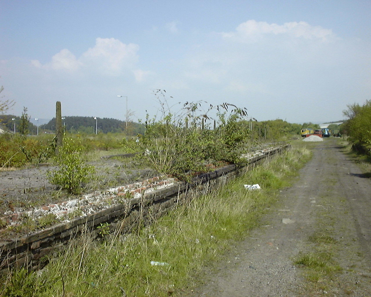
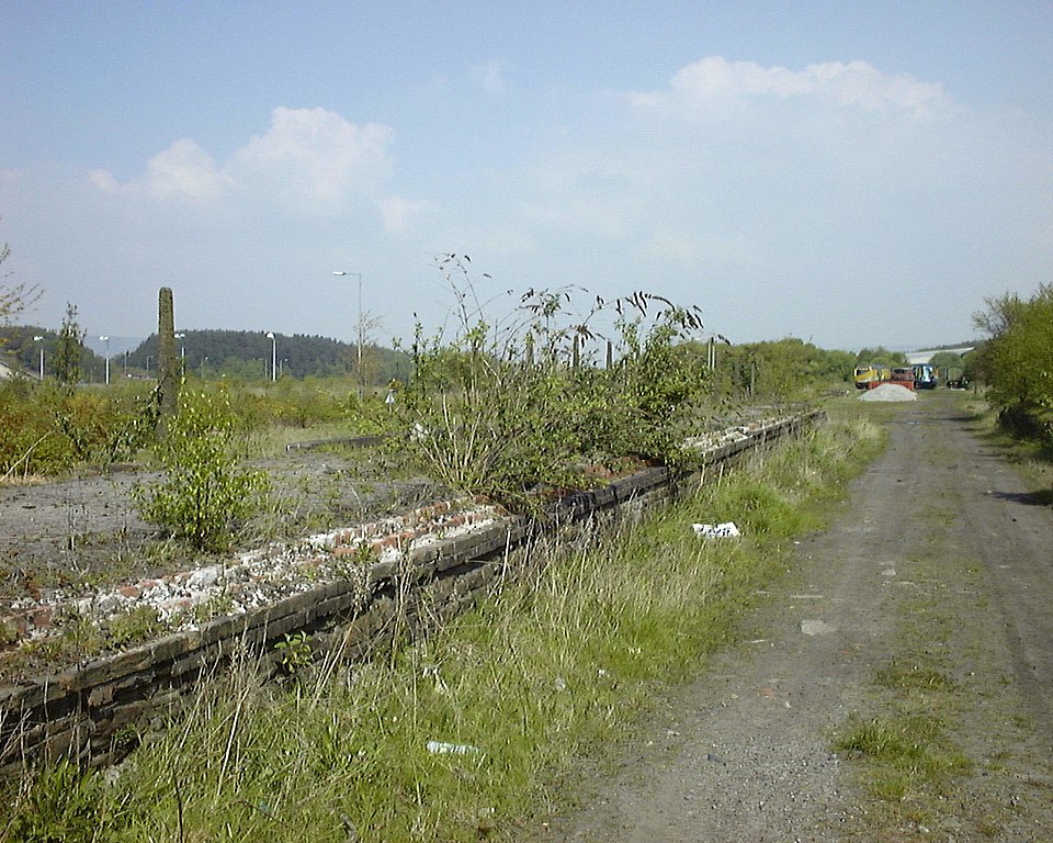
English: The remains of Upper Bank Station, Swansea In this 1998 view, the decaying remains of Upper Bank Station can be seen. Upper Bank was opened in 1871 as part of the Swansea Vale Railway's route to Morriston. It eventually reached Brynamman. The whole line was taken over by the Midland Railway in 1876 and additional through routes were added as a result. Passenger services ceased in 1950 and complete closure took place in the 1960s. By 1985 the only railway here was the section preserved by the SVR Society. In 2007, Swansea Council decided to redevelop the area and by 2010 the preserved railway was itself history, although the society itself lives on. |
| Date | |
| Source | From geograph.org.uk |
| Author | vectorkraft |
| Permission (Reusing this file) |
Creative Commons Attribution Share-alike license 2.0 |
| Attribution (required by the license) | vectorkraft / The remains of Upper Bank Station, Swansea / |
| Camera location | | View this and other nearby images on: OpenStreetMap |
|---|
.jpg¶ms=051.640221_N_-003.927015_E_globe:Earth_type:camera_source:geograph-osgb36(SS66759525)_heading:45.00&language=en)
| Object location | | View this and other nearby images on: OpenStreetMap |
|---|
.jpg¶ms=051.640320_N_-003.926730_E_globe:Earth_class:object_type:object_source:geograph-osgb36(SS66779526)_heading:45.00&language=en)
Licensing
[edit].jpg&action=edit§ion=2)

|
This image was taken from the Geograph project collection. See this photograph's page on the Geograph website for the photographer's contact details. The copyright on this image is owned by vectorkraft and is licensed for reuse under the Creative Commons Attribution-ShareAlike 2.0 license.
|
This file is licensed under the Creative Commons Attribution-Share Alike 2.0 Generic license.
Attribution: vectorkraft
- You are free:
- to share – to copy, distribute and transmit the work
- to remix – to adapt the work
- Under the following conditions:
- attribution – You must give appropriate credit, provide a link to the license, and indicate if changes were made. You may do so in any reasonable manner, but not in any way that suggests the licensor endorses you or your use.
- share alike – If you remix, transform, or build upon the material, you must distribute your contributions under the same or compatible license as the original.
File history
Click on a date/time to view the file as it appeared at that time.
| Date/Time | Thumbnail | Dimensions | User | Comment | |
|---|---|---|---|---|---|
| current | 18:47, 9 January 2021 | | 1,280 × 1,024 (420 KB) | Lamberhurst (talk | contribs) | Transferred from geograph.co.uk using [https://tools.wmflabs.org/geograph2commons/ geograph2commons] |
You cannot overwrite this file.
File usage on Commons
The following page uses this file:
File usage on other wikis
The following other wikis use this file:
- Usage on en.wikipedia.org
.jpg&oldid=912674961)