File:The end of Vicarage Lane - geograph.org.uk - 1262465.jpg
Jump to navigation
Jump to search
No higher resolution available.
The_end_of_Vicarage_Lane_-_geograph.org.uk_-_1262465.jpg (640 × 480 pixels, file size: 145 KB, MIME type: image/jpeg)
Captions
Captions
Add a one-line explanation of what this file represents
Summary
[edit]
| Description |
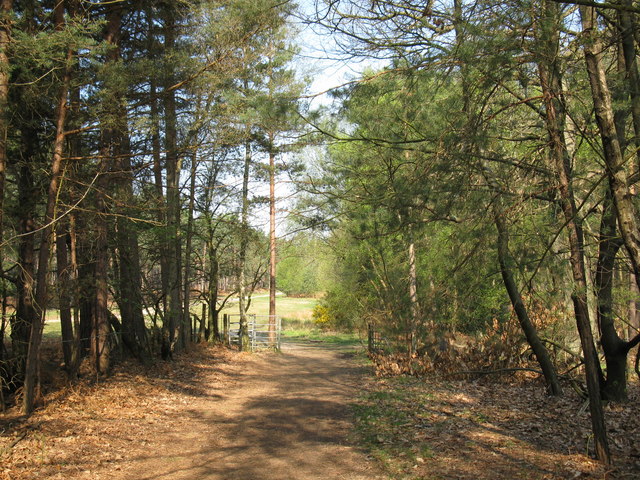
English: The end of Vicarage Lane Shown on the 1:25000 map as a public footpath which ends at this gate. After the gate is Crown Estate land to which access on foot is permitted. The forest attracts many visitors from across the region each year, it in fact forms one forest with Bagshot/Windlesham/Camberley Heaths or Woods in Surrey which were traditionally demarcated but now few divides exist between the counties. |
| Date | |
| Source | From geograph.org.uk |
| Author | don cload |
| Attribution (required by the license) | don cload / The end of Vicarage Lane / |
| Camera location | | View this and other nearby images on: OpenStreetMap |
|---|
_heading:292.00&language=en)
| Object location | | View this and other nearby images on: OpenStreetMap |
|---|
_heading:292.00&language=en)
Licensing
[edit]

|
This image was taken from the Geograph project collection. See this photograph's page on the Geograph website for the photographer's contact details. The copyright on this image is owned by don cload and is licensed for reuse under the Creative Commons Attribution-ShareAlike 2.0 license.
|
This file is licensed under the Creative Commons Attribution-Share Alike 2.0 Generic license.
Attribution: don cload
- You are free:
- to share – to copy, distribute and transmit the work
- to remix – to adapt the work
- Under the following conditions:
- attribution – You must give appropriate credit, provide a link to the license, and indicate if changes were made. You may do so in any reasonable manner, but not in any way that suggests the licensor endorses you or your use.
- share alike – If you remix, transform, or build upon the material, you must distribute your contributions under the same or compatible license as the original.
File history
Click on a date/time to view the file as it appeared at that time.
| Date/Time | Thumbnail | Dimensions | User | Comment | |
|---|---|---|---|---|---|
| current | 00:46, 27 February 2011 | | 640 × 480 (145 KB) | GeographBot (talk | contribs) | == {{int:filedesc}} == {{Information |description={{en|1=The end of Vicarage Lane Shown on the 1:25000 map as a public footpath which ends at this gate. After the gate is Crown Estate land to which access on foot is permitted.}} |date=2009-04-20 |source=F |
You cannot overwrite this file.
File usage on Commons
There are no pages that use this file.