File:The division of Europe by cardinal directions.Center of Europe near Vilnius. Caucasus border.png
Jump to navigation
Jump to search

Size of this preview: 573 × 599 pixels. Other resolutions: 230 × 240 pixels | 459 × 480 pixels | 735 × 768 pixels | 979 × 1,024 pixels | 2,200 × 2,300 pixels.
Original file (2,200 × 2,300 pixels, file size: 253 KB, MIME type: image/png)
Captions
Captions
Add a one-line explanation of what this file represents
Summary
[edit]
| Description |
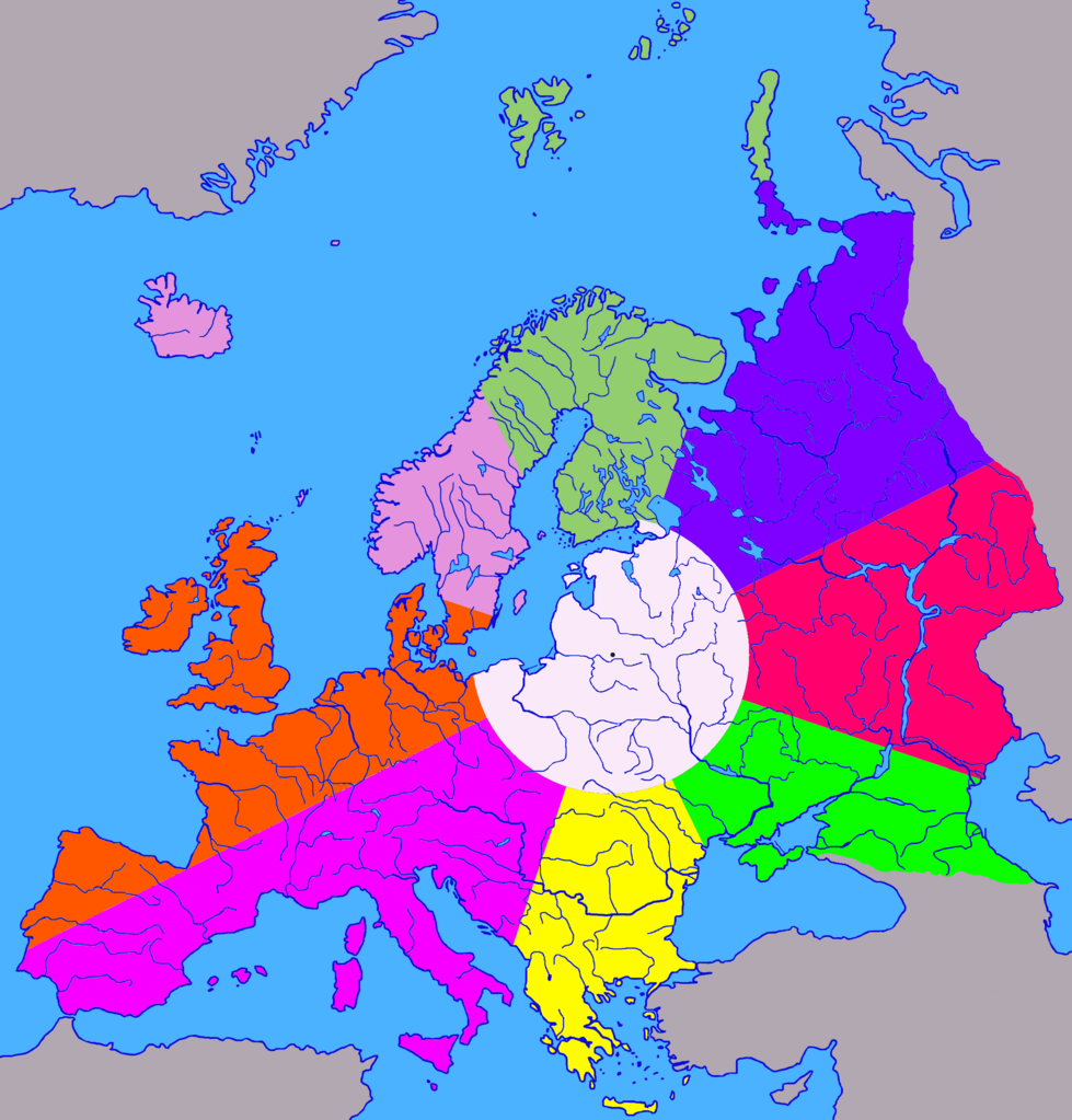
English: The division of Europe from the geographical center (near Vilnius) into 8 cardinal directions and the central part. The land area of the central part is 1/9 of the area of Europe, radius 680 km.
Русский: Деление Европы из географического центра возле Вильнюса на 8 сторон света и центральную часть. Площадь центральной части по суше составляет 1/9 от площади Европы, радиус 680 км. |
| Date | |
| Source | Own work |
| Author | Germash19 |
| Other versions |
 |
Licensing
[edit]
This file is licensed under the Creative Commons Attribution-Share Alike 4.0 International license.
- You are free:
- to share – to copy, distribute and transmit the work
- to remix – to adapt the work
- Under the following conditions:
- attribution – You must give appropriate credit, provide a link to the license, and indicate if changes were made. You may do so in any reasonable manner, but not in any way that suggests the licensor endorses you or your use.
- share alike – If you remix, transform, or build upon the material, you must distribute your contributions under the same or compatible license as the original.
| Annotations | This image is annotated: View the annotations at Commons |
File history
Click on a date/time to view the file as it appeared at that time.
| Date/Time | Thumbnail | Dimensions | User | Comment | |
|---|---|---|---|---|---|
| current | 18:05, 7 August 2023 | | 2,200 × 2,300 (253 KB) | Germash19 (talk | contribs) | == {{int:filedesc}} == {{Information |Description={{en|1=The division of Europe from the geographical center (near Vilnius) into 8 cardinal directions and the central part. The land area of the central part is 1/9 of the area of Europe, radius 680 km.}} {{ru|1=Деление Европы из географического центра возле Вильнюса на 8 сторон света и центральную часть. Площадь центральной части по суше составляет 1/9 от площади Европы, радиус 680 км.}} |Source={{own}} |Date=2023 |Author=Germash19 |Permission... |
You cannot overwrite this file.
File usage on Commons
The following page uses this file:
File usage on other wikis
The following other wikis use this file:
- Usage on en.wikipedia.org